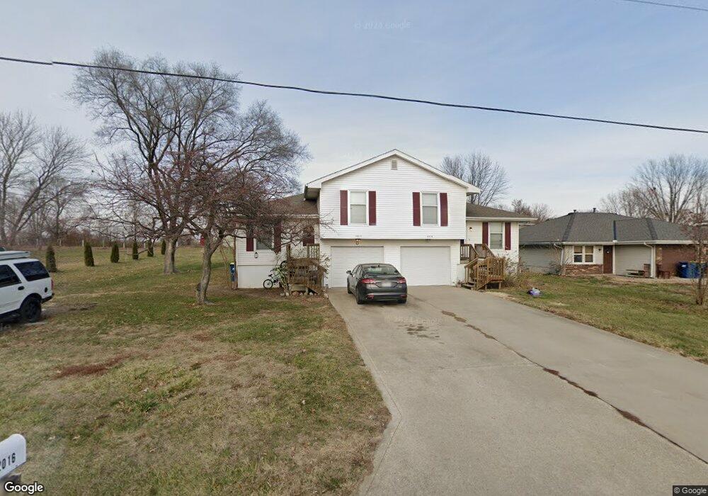
2018 Wornall Rd Excelsior Springs, MO 64024
Estimated Value: $294,000 - $343,000
4
Beds
4
Baths
1,856
Sq Ft
$170/Sq Ft
Est. Value
About This Home
This home is located at 2018 Wornall Rd, Excelsior Springs, MO 64024 and is currently estimated at $315,023, approximately $169 per square foot. 2018 Wornall Rd is a home located in Clay County with nearby schools including Excelsior Springs High School.
Ownership History
Date
Name
Owned For
Owner Type
Purchase Details
Closed on
May 27, 2020
Sold by
Homebuilders Pension Fund Llc
Bought by
Investment Resources Llc
Current Estimated Value
Purchase Details
Closed on
Jun 9, 2000
Sold by
Palmer Mark E and Palmer Pamela J
Bought by
Homebuilders Pension Fund
Home Financials for this Owner
Home Financials are based on the most recent Mortgage that was taken out on this home.
Original Mortgage
$85,600
Interest Rate
9.5%
Create a Home Valuation Report for This Property
The Home Valuation Report is an in-depth analysis detailing your home's value as well as a comparison with similar homes in the area
Home Values in the Area
Average Home Value in this Area
Purchase History
| Date | Buyer | Sale Price | Title Company |
|---|---|---|---|
| Investment Resources Llc | -- | Stewart | |
| Homebuilders Pension Fund | -- | First American Title Ins Co |
Source: Public Records
Mortgage History
| Date | Status | Borrower | Loan Amount |
|---|---|---|---|
| Previous Owner | Homebuilders Pension Fund | $85,600 |
Source: Public Records
Tax History Compared to Growth
Tax History
| Year | Tax Paid | Tax Assessment Tax Assessment Total Assessment is a certain percentage of the fair market value that is determined by local assessors to be the total taxable value of land and additions on the property. | Land | Improvement |
|---|---|---|---|---|
| 2025 | $2,156 | $35,320 | -- | -- |
| 2024 | $2,156 | $30,740 | -- | -- |
| 2023 | $2,142 | $30,740 | $0 | $0 |
| 2022 | $1,887 | $26,640 | $0 | $0 |
| 2021 | $1,895 | $26,638 | $3,800 | $22,838 |
| 2020 | $2,252 | $30,780 | $0 | $0 |
| 2019 | $2,250 | $51,840 | $5,760 | $46,080 |
| 2018 | $1,757 | $23,960 | $0 | $0 |
| 2017 | $1,714 | $23,960 | $3,420 | $20,540 |
| 2016 | $1,714 | $23,960 | $3,420 | $20,540 |
| 2015 | $1,730 | $23,960 | $3,420 | $20,540 |
| 2014 | $1,696 | $23,280 | $3,420 | $19,860 |
Source: Public Records
Map
Nearby Homes
- 2017 Karlton Way
- 609 Kimberly Dr
- 2116 Bradford Place
- 617 Lodwick Ln
- 2081 Rock Bridge Pkwy
- 206 Crest Dr
- 240 Rock Bridge Pkwy
- 220 Rock Bridge Pkwy
- 106 Sunset Ln
- 2021 Riverstone Dr
- Lot 2 Wornall Rd
- 2017 Wornall Rd
- 125 Crown Hill Rd
- 25421 Marel Rd
- 2210 Piedmont Place
- 2305 Arbor Ln
- 1318 Kristie Cir
- 112 Delores St
- 2407 Merlot Place
- 1104 Frontier St
- 2014 Wornall Rd
- 2012 Wornall Rd
- 2015 Karlton Way
- 2013 Karlton Way
- 2010 Wornall Rd
- 419 Leslie Ln
- 2011 Karlton Way
- 2100 Wornall Rd
- 2008 Wornall Rd
- 2014 Karlton Way
- 2006 Wornall Rd
- 2012 Karlton Way
- 417 Leslie Ln
- 2007 Karlton Way
- 2010 Karlton Way
- 420 Leslie Ln
- 2004 Wornall Rd
- 2008 Karlton Way
- 2005 Karlton Way
- 602 Kountry Ln