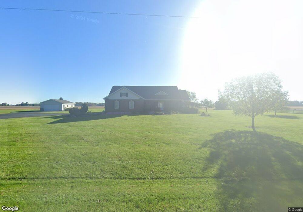
20182 Bowsher Rd Wapakoneta, OH 45895
Estimated Value: $402,618 - $612,000
4
Beds
3
Baths
2,252
Sq Ft
$213/Sq Ft
Est. Value
About This Home
This home is located at 20182 Bowsher Rd, Wapakoneta, OH 45895 and is currently estimated at $478,655, approximately $212 per square foot. 20182 Bowsher Rd is a home located in Auglaize County with nearby schools including Wapakoneta Elementary School, Wapakoneta High School, and Wapakoneta Middle School.
Ownership History
Date
Name
Owned For
Owner Type
Purchase Details
Closed on
Oct 1, 2014
Sold by
Duval Ronald E and Duval Beth A
Bought by
Duval Beth A and Beth A Duval Trust
Current Estimated Value
Purchase Details
Closed on
Sep 4, 2014
Sold by
Steinbrunner Kathryn M
Bought by
Duval Ronald E and Duval Beth A
Purchase Details
Closed on
Nov 30, 2009
Sold by
Merricle Jonathon J and Merricle Angela K
Bought by
Steinbrunner David A and Steinbrunner Kathryn M
Home Financials for this Owner
Home Financials are based on the most recent Mortgage that was taken out on this home.
Original Mortgage
$178,400
Interest Rate
4.95%
Mortgage Type
Purchase Money Mortgage
Purchase Details
Closed on
Oct 10, 2000
Sold by
Springer Thomas R
Bought by
Merricle Jonathon J
Create a Home Valuation Report for This Property
The Home Valuation Report is an in-depth analysis detailing your home's value as well as a comparison with similar homes in the area
Home Values in the Area
Average Home Value in this Area
Purchase History
| Date | Buyer | Sale Price | Title Company |
|---|---|---|---|
| Duval Beth A | -- | None Available | |
| Duval Ronald E | $225,000 | None Available | |
| Steinbrunner David A | $223,000 | Attorney | |
| Merricle Jonathon J | $17,000 | -- |
Source: Public Records
Mortgage History
| Date | Status | Borrower | Loan Amount |
|---|---|---|---|
| Previous Owner | Steinbrunner David A | $178,400 |
Source: Public Records
Tax History Compared to Growth
Tax History
| Year | Tax Paid | Tax Assessment Tax Assessment Total Assessment is a certain percentage of the fair market value that is determined by local assessors to be the total taxable value of land and additions on the property. | Land | Improvement |
|---|---|---|---|---|
| 2024 | $5,340 | $110,120 | $10,190 | $99,930 |
| 2023 | $3,523 | $110,120 | $10,190 | $99,930 |
| 2022 | $3,183 | $91,950 | $9,260 | $82,690 |
| 2021 | $3,163 | $91,950 | $9,260 | $82,690 |
| 2020 | $3,129 | $91,953 | $9,265 | $82,688 |
| 2019 | $2,739 | $77,774 | $7,788 | $69,986 |
| 2018 | $2,749 | $77,774 | $7,788 | $69,986 |
| 2017 | $2,738 | $77,774 | $7,788 | $69,986 |
| 2016 | $2,411 | $68,961 | $7,417 | $61,544 |
| 2015 | $2,317 | $66,354 | $7,417 | $58,937 |
| 2014 | $2,352 | $66,354 | $7,417 | $58,937 |
| 2013 | $2,401 | $66,354 | $7,417 | $58,937 |
Source: Public Records
Map
Nearby Homes
- 22284 Ohio 198
- 7470 Fort Amanda Rd
- 17054 State Route 198
- 3650 Redbud Ln
- 3523 Woodhaven Ln
- 1020 Timber Trail
- 3495 Woodhaven Ln
- 4268 Blue Spruce Ln
- 3680 Yoakam Rd
- 1028 Stonegate Ct
- 17683 Ohio 117
- 920 Primrose Dr
- 4475 Wintergreen Dr
- 924 Poppy Dr
- 3648 Hiawatha Trail
- 3039 Lakeshore Dr
- 4039 Magnolia
- 601 Warren St
- 906 Aster Dr
- 4075 Yellowood St
- 20238 Bowsher Rd
- 20114 Bowsher Rd
- 20207 Bowsher Rd
- 10951 Monroe Rd
- 20032 Bowsher Rd
- 20356 Bowsher Rd
- 10897 Monroe Rd
- 10948 Monroe Rd
- 20068 Ohio 198
- 10855 Monroe Rd
- 20130 State Route 198
- 10860 Monroe Rd
- 20512 Bowsher Rd
- 20147 State Route 198
- 10806 Monroe Rd
- 19854 State Route 198
- 19769 State Route 198
- 11513 Monroe Rd
- 10531 Monroe Rd
- 19614 State Route 198