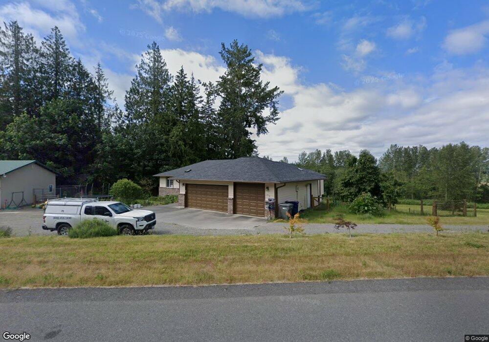
20184 Sinnes Rd Mount Vernon, WA 98274
Estimated Value: $917,467 - $1,604,000
4
Beds
4
Baths
3,714
Sq Ft
$314/Sq Ft
Est. Value
About This Home
This home is located at 20184 Sinnes Rd, Mount Vernon, WA 98274 and is currently estimated at $1,165,117, approximately $313 per square foot. 20184 Sinnes Rd is a home located in Skagit County with nearby schools including Conway School.
Ownership History
Date
Name
Owned For
Owner Type
Purchase Details
Closed on
Jun 26, 2023
Sold by
Malaki Lope D
Bought by
Fox Diane M
Current Estimated Value
Home Financials for this Owner
Home Financials are based on the most recent Mortgage that was taken out on this home.
Original Mortgage
$452,000
Outstanding Balance
$440,307
Interest Rate
6.35%
Mortgage Type
New Conventional
Estimated Equity
$724,810
Create a Home Valuation Report for This Property
The Home Valuation Report is an in-depth analysis detailing your home's value as well as a comparison with similar homes in the area
Home Values in the Area
Average Home Value in this Area
Purchase History
| Date | Buyer | Sale Price | Title Company |
|---|---|---|---|
| Fox Diane M | $775,000 | Guardian Northwest Title |
Source: Public Records
Mortgage History
| Date | Status | Borrower | Loan Amount |
|---|---|---|---|
| Open | Fox Diane M | $452,000 |
Source: Public Records
Tax History Compared to Growth
Tax History
| Year | Tax Paid | Tax Assessment Tax Assessment Total Assessment is a certain percentage of the fair market value that is determined by local assessors to be the total taxable value of land and additions on the property. | Land | Improvement |
|---|---|---|---|---|
| 2024 | $8,454 | $1,022,100 | $326,400 | $695,700 |
| 2023 | $8,454 | $942,400 | $305,000 | $637,400 |
| 2022 | $7,553 | $983,200 | $322,000 | $661,200 |
| 2021 | $7,475 | $767,300 | $248,300 | $519,000 |
| 2020 | $6,950 | $701,800 | $0 | $0 |
| 2019 | $5,925 | $650,600 | $0 | $0 |
| 2018 | $6,700 | $562,800 | $0 | $0 |
| 2017 | $5,995 | $537,000 | $0 | $0 |
| 2016 | $5,781 | $483,600 | $147,500 | $336,100 |
| 2015 | $5,167 | $451,400 | $137,700 | $313,700 |
| 2013 | $5,297 | $373,100 | $0 | $0 |
Source: Public Records
Map
Nearby Homes
- 20616 Bulson Rd
- 20519 Benson Ridge Ln
- 20434 Benson Ridge
- 20555 Benson Ridge
- 19687 Trophy Ln
- 22414 Bulson Rd
- 22539 Fieldstone Ln
- 0 XX 00
- 18340 Osprey Ct
- 18345 Osprey Ct
- 0 Milltown Crossing Rd Unit NWM2358059
- 0 Cedardale Rd Unit 11749606
- 23158 Bonnieview Rd
- 17406 Fir Island Rd
- 17609 S Skyridge Dr
- 21314 Starbird Rd
- 23330 State Route 534
- 0 Anderson Rd
- 2312 Crosby Dr
- 19719 Dry Slough Rd
- 20525 Sinnes Rd
- 20625 Sinnes Rd
- 20439 Spring Hill Ln
- 20401 Spring Hill Ln
- 20444 Spring Hill Ln
- 20152 Sinnes Rd
- 20562 Sinnes Rd
- 20127 Okerlund Dr
- 20119 Okerlund Dr
- 20165 Okerlund Dr
- 20400 Spring Hill Ln
- 20451 Heather Ln
- 20164 Okerlund Dr
- 20429 Sinnes Rd
- 20057 Okerlund Dr
- 20060 Okerlund Dr
- 20429 Heather Ln
- 20428 Heather Ln
- 20450 Heather Ln
- 20168 Okerlund Dr