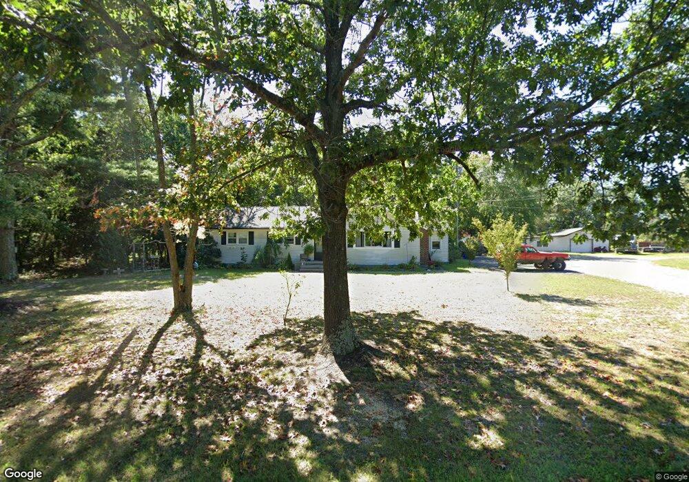
2019 Airport Rd Hammonton, NJ 08037
Estimated Value: $268,280 - $329,000
--
Bed
--
Bath
1,436
Sq Ft
$206/Sq Ft
Est. Value
About This Home
This home is located at 2019 Airport Rd, Hammonton, NJ 08037 and is currently estimated at $295,427, approximately $205 per square foot. 2019 Airport Rd is a home located in Atlantic County with nearby schools including Mullica Township Primary School, Mullica Township Elementary & Middle School, and Cedar Creek High School.
Ownership History
Date
Name
Owned For
Owner Type
Purchase Details
Closed on
Apr 17, 2017
Sold by
Burke William David and Burke Frank Louis
Bought by
Keubler Kristin A
Current Estimated Value
Home Financials for this Owner
Home Financials are based on the most recent Mortgage that was taken out on this home.
Original Mortgage
$133,333
Outstanding Balance
$110,953
Interest Rate
4.21%
Mortgage Type
New Conventional
Estimated Equity
$184,474
Purchase Details
Closed on
Oct 12, 1983
Bought by
Wood Richard and Wood Louise E
Create a Home Valuation Report for This Property
The Home Valuation Report is an in-depth analysis detailing your home's value as well as a comparison with similar homes in the area
Home Values in the Area
Average Home Value in this Area
Purchase History
| Date | Buyer | Sale Price | Title Company |
|---|---|---|---|
| Keubler Kristin A | $132,000 | Lands Title Corp | |
| Wood Richard | $58,000 | -- |
Source: Public Records
Mortgage History
| Date | Status | Borrower | Loan Amount |
|---|---|---|---|
| Open | Keubler Kristin A | $133,333 |
Source: Public Records
Tax History Compared to Growth
Tax History
| Year | Tax Paid | Tax Assessment Tax Assessment Total Assessment is a certain percentage of the fair market value that is determined by local assessors to be the total taxable value of land and additions on the property. | Land | Improvement |
|---|---|---|---|---|
| 2025 | $4,526 | $125,800 | $25,500 | $100,300 |
| 2024 | $4,526 | $125,800 | $25,500 | $100,300 |
| 2023 | $4,291 | $125,800 | $25,500 | $100,300 |
| 2022 | $4,291 | $125,800 | $25,500 | $100,300 |
| 2021 | $4,121 | $125,800 | $25,500 | $100,300 |
| 2020 | $4,014 | $125,800 | $25,500 | $100,300 |
| 2019 | $3,934 | $125,800 | $25,500 | $100,300 |
| 2018 | $4,031 | $85,800 | $20,200 | $65,600 |
| 2017 | $4,027 | $85,800 | $20,200 | $65,600 |
| 2016 | $3,290 | $85,800 | $20,200 | $65,600 |
| 2015 | $3,101 | $85,800 | $20,200 | $65,600 |
| 2014 | $3,060 | $85,800 | $20,200 | $65,600 |
Source: Public Records
Map
Nearby Homes
- 54 Centennial Dr
- 194 Yorktown Blvd Unit 194
- 36 Dogwood Ln
- 615 S White Horse Pike
- 557 S White Horse Pike
- 415 S White Horse Pike
- 3142 Moss Mill Rd
- 201 7th St
- 200 Lakeview Dr
- 750 Moss Mill Rd
- 56 Samuel Dr
- 124 Batchelor Ln
- 0 9th St Unit NJAC2019908
- Block: 3033 Lot: 13 14 15 16 17&18
- 4119 Nesco Rd
- 31 N Liberty St
- 3030 S 1st Rd
- 44 Harborwood Dr Unit CO44
- 960 S Grand St
- 369 S 3rd St
- 2011 Airport Rd
- 2027 Airport Rd
- 2024 Airport Rd
- 2010 Columbia Rd
- 2010 Airport Rd
- 599 Columbia Rd
- 3024 Nesco Rd
- 3020 Nesco Rd
- 3022 Nesco Rd
- 901 Pleasant Mills Rd
- 3053 Nesco Rd
- 3061 Nesco Rd
- 3016 Nesco Rd
- 3009 Nesco Rd
- 3013 Nesco Rd
- 3001 Nesco Rd
- 890 Pleasant Mills Rd
- 3112 Nesco Rd
- 886 Pleasant Mills Rd
- 884-886 Pleasant Mills Rd