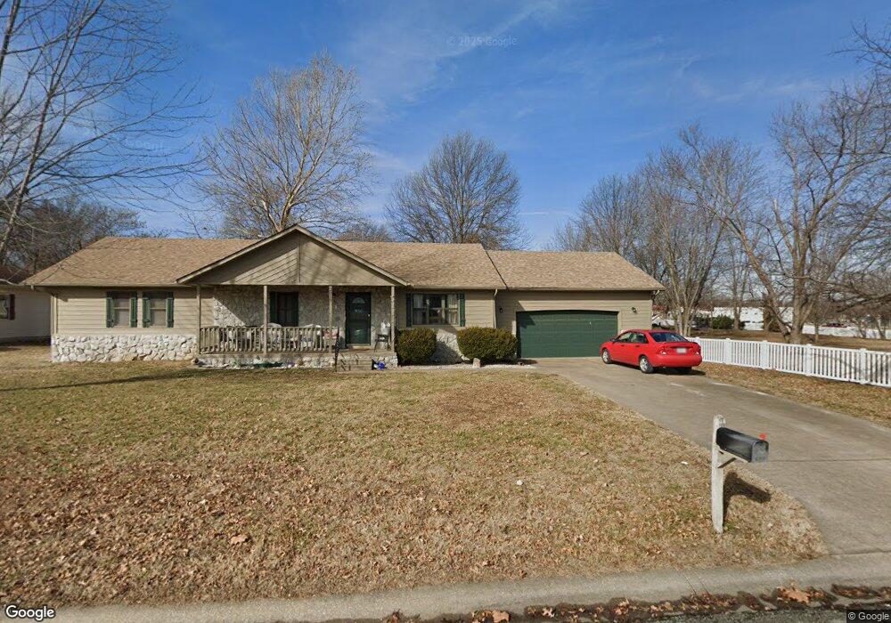
2019 Alison St Carthage, MO 64836
Estimated Value: $229,880 - $275,000
3
Beds
2
Baths
1,512
Sq Ft
$165/Sq Ft
Est. Value
About This Home
This home is located at 2019 Alison St, Carthage, MO 64836 and is currently estimated at $249,220, approximately $164 per square foot. 2019 Alison St is a home located in Jasper County with nearby schools including Carthage High School, St. Ann's Catholic School, and Victory Academy.
Ownership History
Date
Name
Owned For
Owner Type
Purchase Details
Closed on
May 10, 2017
Sold by
Turner Jerry L and Turner Donna
Bought by
Gall Jeffrey and Gall Elizabeth
Current Estimated Value
Home Financials for this Owner
Home Financials are based on the most recent Mortgage that was taken out on this home.
Original Mortgage
$114,750
Outstanding Balance
$95,148
Interest Rate
4.08%
Mortgage Type
New Conventional
Estimated Equity
$154,072
Purchase Details
Closed on
Dec 30, 2014
Sold by
Wilkinson Jeff and Wilkinson Karen
Bought by
Turner Terry Ross and Turner Jerry Lee
Purchase Details
Closed on
Aug 8, 2005
Sold by
Jones Samuel L and Jones Connie L
Bought by
Turner Peggy D
Create a Home Valuation Report for This Property
The Home Valuation Report is an in-depth analysis detailing your home's value as well as a comparison with similar homes in the area
Home Values in the Area
Average Home Value in this Area
Purchase History
| Date | Buyer | Sale Price | Title Company |
|---|---|---|---|
| Gall Jeffrey | -- | None Available | |
| Turner Terry Ross | -- | None Available | |
| Turner Peggy D | -- | -- |
Source: Public Records
Mortgage History
| Date | Status | Borrower | Loan Amount |
|---|---|---|---|
| Open | Gall Jeffrey | $114,750 |
Source: Public Records
Tax History
| Year | Tax Paid | Tax Assessment Tax Assessment Total Assessment is a certain percentage of the fair market value that is determined by local assessors to be the total taxable value of land and additions on the property. | Land | Improvement |
|---|---|---|---|---|
| 2025 | $1,255 | $26,140 | $4,170 | $21,970 |
| 2024 | $1,255 | $24,380 | $4,170 | $20,210 |
| 2023 | $1,255 | $24,380 | $4,170 | $20,210 |
| 2022 | $1,277 | $24,890 | $4,170 | $20,720 |
| 2021 | $1,263 | $24,890 | $4,170 | $20,720 |
| 2020 | $1,220 | $23,050 | $4,170 | $18,880 |
| 2019 | $1,223 | $23,050 | $4,170 | $18,880 |
| 2018 | $1,110 | $20,980 | $0 | $0 |
| 2017 | $1,113 | $20,980 | $0 | $0 |
| 2016 | $1,168 | $22,090 | $0 | $0 |
Source: Public Records
Map
Nearby Homes
- 2032 Alison St
- 2110 Pearl St
- 1910 Buena Vista Ave
- 1814 Buena Vista Ave
- 1431 Quail Place
- 905 Durward Hall Dr
- 1328 Hafner Ct
- 1726 Buena Vista Ave
- 1922 Southwood Ln
- 1131 Belle Air Place
- 1647 Glenwood Place
- 909 Durward Hall Dr
- 1910 Wynwood Dr
- 1012 Euclid Blvd
- 2166 Noah's Ark Ln
- 2515 S River St
- TBD Lexie Ln
- 1328 Sunrise Dr
- 2206 Benjamin Dr
- 702 E Centennial Ave
- 2027 Alison St
- 2010 Katherine St
- 2018 Katherine St
- 2103 Alison St
- 2024 Katherine St
- 2004 Katherine St
- 2032 Katherine St
- 2111 Alison St
- 2106 Alison St
- 2119 Alison St
- 2107 Laura St
- 2112 Alison St
- 2100 Carrie St
- 2101 Laura St
- 2115 Laura St
- 2122 Alison St
- 2127 Alison St
- 2112 Carrie St
- 1220 E Fairview Ave
- 2121 Laura St
Your Personal Tour Guide
Ask me questions while you tour the home.