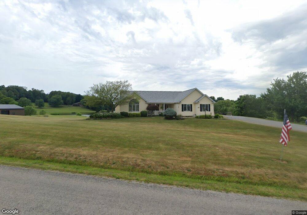
2019 Belfort Ave Louisville, OH 44641
Estimated Value: $365,000 - $489,465
3
Beds
3
Baths
2,408
Sq Ft
$173/Sq Ft
Est. Value
About This Home
This home is located at 2019 Belfort Ave, Louisville, OH 44641 and is currently estimated at $416,366, approximately $172 per square foot. 2019 Belfort Ave is a home located in Stark County with nearby schools including East Canton Elementary School, East Canton Middle School, and East Canton High School.
Ownership History
Date
Name
Owned For
Owner Type
Purchase Details
Closed on
Sep 26, 2023
Sold by
Kandel Clark E and Kandel Linda W
Bought by
Clark E Kandel Jr And Linda W Kandel Irrevoca and Kandel
Current Estimated Value
Purchase Details
Closed on
Sep 5, 2000
Sold by
Kandel Gene R and The Gene R Kandel Trust
Bought by
Kandel Clark E and Kandel Linda W
Create a Home Valuation Report for This Property
The Home Valuation Report is an in-depth analysis detailing your home's value as well as a comparison with similar homes in the area
Home Values in the Area
Average Home Value in this Area
Purchase History
| Date | Buyer | Sale Price | Title Company |
|---|---|---|---|
| Clark E Kandel Jr And Linda W Kandel Irrevoca | -- | None Listed On Document | |
| Kandel Clark E | -- | -- |
Source: Public Records
Tax History Compared to Growth
Tax History
| Year | Tax Paid | Tax Assessment Tax Assessment Total Assessment is a certain percentage of the fair market value that is determined by local assessors to be the total taxable value of land and additions on the property. | Land | Improvement |
|---|---|---|---|---|
| 2025 | -- | $165,840 | $26,010 | $139,830 |
| 2024 | -- | $165,840 | $26,010 | $139,830 |
| 2023 | $3,694 | $107,320 | $17,330 | $89,990 |
| 2022 | $3,626 | $107,320 | $17,330 | $89,990 |
| 2021 | $3,638 | $107,320 | $17,330 | $89,990 |
| 2020 | $3,545 | $96,180 | $15,820 | $80,360 |
| 2019 | $3,478 | $96,190 | $15,830 | $80,360 |
| 2018 | $3,444 | $96,190 | $15,830 | $80,360 |
| 2017 | $3,317 | $85,870 | $15,410 | $70,460 |
| 2016 | $3,257 | $84,050 | $15,410 | $68,640 |
| 2015 | $3,286 | $84,050 | $15,410 | $68,640 |
| 2014 | $1,043 | $72,280 | $13,200 | $59,080 |
| 2013 | $1,526 | $72,280 | $13,200 | $59,080 |
Source: Public Records
Map
Nearby Homes
- 1990 Belfort Ave
- 8225 Georgetown St
- 2425 Miday Ave NE
- 3390 Meese Rd NE
- 908 Sand Lot Cir
- 6969 Georgetown St NE
- 7547 Lincoln St SE
- 2110 Edmar St
- 1702 View Pointe Ave
- 1639 Horizon Dr
- 0 Lincoln St SE Unit 5157308
- 0 Lincoln St SE Unit 5157344
- 0 Lincoln St SE Unit 5157290
- 2030 Woodland Park Ave SE
- 6416 15th St NE
- 1715 High St
- 1812 E Broad St
- 641 S Nickelplate St
- 0 Neimans Ave SE Unit 5149957
- 520 S Silver St
- 1935 Belfort Ave
- 2141 Belfort Ave
- 1863 Belfort Ave
- 2153 Belfort Ave
- 2047 Belfort Ave
- 2161 Belfort Ave
- 2194 Belfort Ave
- 1837 Belfort Ave
- 2233 Belfort Ave
- 1849 Belfort Ave
- 2249 Belfort Ave
- 1775 Belfort Ave
- 2281 Belfort Ave
- 8591 Lisbon St NE
- 1734 Belfort Ave
- 2303 Belfort Ave
- 8591 Lisbon St
- 8697 Lisbon St
- 2325 Belfort Ave NE
- 1749 Belfort Ave