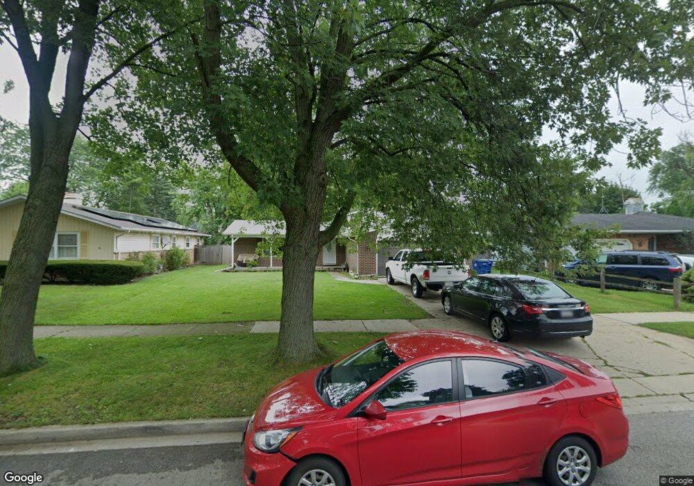
2019 Chestnut St Waukegan, IL 60087
Marquette Highlands NeighborhoodEstimated Value: $272,000 - $298,320
4
Beds
3
Baths
1,246
Sq Ft
$227/Sq Ft
Est. Value
About This Home
This home is located at 2019 Chestnut St, Waukegan, IL 60087 and is currently estimated at $283,080, approximately $227 per square foot. 2019 Chestnut St is a home located in Lake County with nearby schools including Greenwood Elementary School, Edith M Smith Middle School, and Waukegan High School.
Ownership History
Date
Name
Owned For
Owner Type
Purchase Details
Closed on
Jul 23, 1999
Sold by
Declaration Vasofsky Ronald J and Declaration Ronald J Vasofsky
Bought by
Mchugh Gary M and Mchugh Anabelle
Current Estimated Value
Home Financials for this Owner
Home Financials are based on the most recent Mortgage that was taken out on this home.
Original Mortgage
$150,950
Outstanding Balance
$42,717
Interest Rate
7.69%
Mortgage Type
VA
Estimated Equity
$240,363
Purchase Details
Closed on
Jul 14, 1997
Sold by
Vasofsky Ronald J
Bought by
Declaration Vasofsky Ronald J and Declaration Ronald J Vasofsky
Create a Home Valuation Report for This Property
The Home Valuation Report is an in-depth analysis detailing your home's value as well as a comparison with similar homes in the area
Home Values in the Area
Average Home Value in this Area
Purchase History
| Date | Buyer | Sale Price | Title Company |
|---|---|---|---|
| Mchugh Gary M | $148,000 | First American Title | |
| Declaration Vasofsky Ronald J | -- | -- |
Source: Public Records
Mortgage History
| Date | Status | Borrower | Loan Amount |
|---|---|---|---|
| Open | Mchugh Gary M | $150,950 |
Source: Public Records
Tax History Compared to Growth
Tax History
| Year | Tax Paid | Tax Assessment Tax Assessment Total Assessment is a certain percentage of the fair market value that is determined by local assessors to be the total taxable value of land and additions on the property. | Land | Improvement |
|---|---|---|---|---|
| 2024 | $6,214 | $81,900 | $17,183 | $64,717 |
| 2023 | $6,456 | $73,902 | $15,505 | $58,397 |
| 2022 | $6,456 | $72,042 | $13,420 | $58,622 |
| 2021 | $6,367 | $67,072 | $11,971 | $55,101 |
| 2020 | $6,403 | $62,485 | $11,152 | $51,333 |
| 2019 | $6,391 | $57,257 | $10,219 | $47,038 |
| 2018 | $5,917 | $52,146 | $14,463 | $37,683 |
| 2017 | $5,709 | $46,135 | $12,796 | $33,339 |
| 2016 | $5,268 | $40,089 | $11,119 | $28,970 |
| 2015 | $5,048 | $35,881 | $9,952 | $25,929 |
| 2014 | -- | $30,561 | $8,857 | $21,704 |
| 2012 | $5,467 | $33,110 | $9,596 | $23,514 |
Source: Public Records
Map
Nearby Homes
- 1905 Linden Ave
- 2232 Walnut St
- 616 W Keith Ave
- 1018 W Atlantic Ave
- 301 W Eagle Ct
- 1336 N Ash St
- 1335 Chestnut St
- 2246 Alta Vista Dr
- 2213 Alta Vista Dr
- 0 Traditions Dr
- 1312 N Linden Ave
- 1504 W Glen Flora Ave
- 1105 Woodlawn Cir
- 1110 N Ash St
- 2350 N Lewis Ave
- 2008 Harding Ave
- 1117 Judge Ave
- 2009 Harding Ave
- 2207 Williamsburg Dr
- 1000 Pine St
- 2023 Chestnut St
- 2015 Chestnut St
- 2029 Chestnut St
- 2011 Chestnut St
- 2016 N Poplar St
- 2022 N Poplar St
- 2033 Chestnut St
- 2024 Chestnut St
- 2006 N Poplar St
- 2020 Chestnut St
- 2003 Chestnut St
- 2030 N Poplar St
- 2028 Chestnut St
- 2014 Chestnut St
- 2037 Chestnut St
- 2032 Chestnut St
- 2008 Chestnut St
- 1951 Chestnut St
- 2036 N Poplar St
- 1952 N Poplar St