Estimated Value: $456,000 - $688,000
3
Beds
3
Baths
2,259
Sq Ft
$257/Sq Ft
Est. Value
About This Home
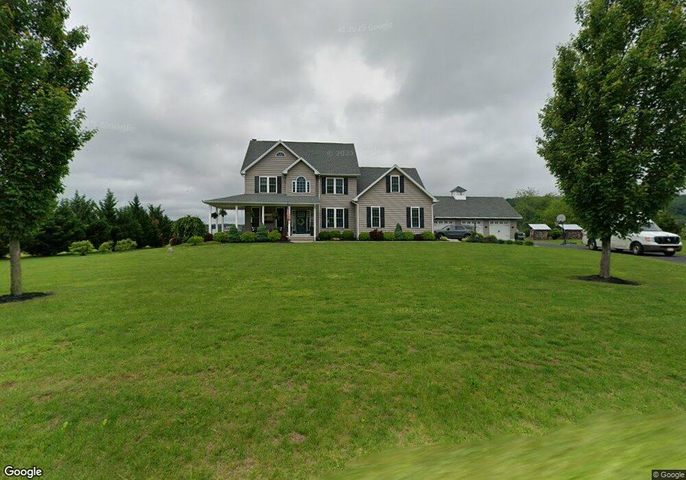
This home is located at 2019 Corning Rd, Palm, PA 18070 and is currently estimated at $581,637, approximately $257 per square foot. 2019 Corning Rd is a home with nearby schools including Upper Perkiomen 4th & 5th Grade Center, Upper Perkiomen Middle School, and Upper Perkiomen High School.
Ownership History
Date
Name
Owned For
Owner Type
Purchase Details
Closed on
Sep 18, 2013
Sold by
Miller William A
Bought by
Miller William A and Miller Ashleigh R
Current Estimated Value
Home Financials for this Owner
Home Financials are based on the most recent Mortgage that was taken out on this home.
Original Mortgage
$250,000
Outstanding Balance
$189,180
Interest Rate
4.42%
Mortgage Type
New Conventional
Estimated Equity
$392,457
Purchase Details
Closed on
Feb 1, 2012
Sold by
Wisser Edna I
Bought by
Miller William A
Create a Home Valuation Report for This Property
The Home Valuation Report is an in-depth analysis detailing your home's value as well as a comparison with similar homes in the area
Home Values in the Area
Average Home Value in this Area
Purchase History
| Date | Buyer | Sale Price | Title Company |
|---|---|---|---|
| Miller William A | -- | None Available | |
| Miller William A | -- | None Available |
Source: Public Records
Mortgage History
| Date | Status | Borrower | Loan Amount |
|---|---|---|---|
| Open | Miller William A | $250,000 |
Source: Public Records
Tax History Compared to Growth
Tax History
| Year | Tax Paid | Tax Assessment Tax Assessment Total Assessment is a certain percentage of the fair market value that is determined by local assessors to be the total taxable value of land and additions on the property. | Land | Improvement |
|---|---|---|---|---|
| 2025 | $6,909 | $206,100 | -- | -- |
| 2024 | $6,909 | $206,100 | -- | -- |
| 2023 | $6,581 | $206,100 | $0 | $0 |
| 2022 | $6,491 | $206,100 | $0 | $0 |
| 2021 | $6,327 | $206,100 | $0 | $0 |
| 2020 | $6,292 | $206,100 | $0 | $0 |
| 2019 | $5,697 | $190,920 | $0 | $0 |
| 2018 | $5,696 | $190,920 | $0 | $0 |
| 2017 | $5,525 | $190,920 | $0 | $0 |
| 2016 | $5,450 | $190,920 | $0 | $0 |
| 2015 | $5,143 | $190,920 | $0 | $0 |
| 2014 | $5,143 | $6,400 | $0 | $0 |
Source: Public Records
Map
Nearby Homes
- 7921 Corning Rd
- 770 Gravel Pike
- 0 Chestnut St
- 62 Ashford Ln
- 117 Concord Dr
- 328 Ashford Ln
- 317 Ashford Ln
- 1962 Tollgate Rd
- 6335 Sweetbriar Ln
- 4675 E Mill Hill Rd
- 1137 Church Rd
- 548 Blaker Dr
- 2563 Wasser Rd
- 434 Jefferson St
- 333 Blaker Dr
- 317 State St
- 2071 Baus Rd
- 5722 Kings Hwy S
- 2100 Fox Hollow Ln
- 202 Dotts St
- 2020 Corning Rd
- 2024 Corning Rd
- Lot #2 Corning Rd
- Lot 2 Corning Rd
- 2016 Corning Rd
- 2018 Corning Rd
- 2028 Corning Rd
- 2014 Corning Rd
- 2030 Corning Rd
- 2017 George Rd
- 2015 George Rd
- 2013 George Rd
- 2008 Corning Rd
- 2034 Corning Rd
- 2025 George Rd
- 2034 Corning Rd
- 2009 George Rd
- 2004 Corning Rd
- 2007 George Rd
- 2027 George Rd