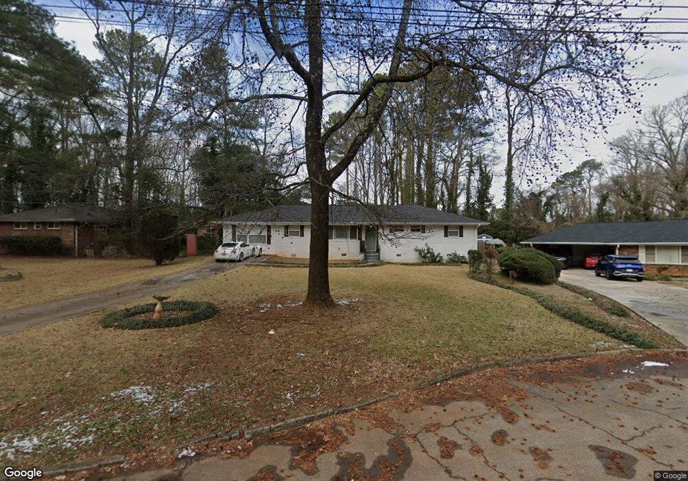
2019 Farris Dr Decatur, GA 30032
Estimated Value: $255,172 - $283,000
3
Beds
2
Baths
1,855
Sq Ft
$145/Sq Ft
Est. Value
About This Home
This home is located at 2019 Farris Dr, Decatur, GA 30032 and is currently estimated at $269,043, approximately $145 per square foot. 2019 Farris Dr is a home located in DeKalb County with nearby schools including Toney Elementary School, Columbia Middle School, and Columbia High School.
Ownership History
Date
Name
Owned For
Owner Type
Purchase Details
Closed on
Mar 31, 2020
Sold by
Thomas Charles Edward Estate
Bought by
Bell Lasara
Current Estimated Value
Home Financials for this Owner
Home Financials are based on the most recent Mortgage that was taken out on this home.
Original Mortgage
$215,970
Outstanding Balance
$190,167
Interest Rate
3.2%
Mortgage Type
New Conventional
Estimated Equity
$78,876
Create a Home Valuation Report for This Property
The Home Valuation Report is an in-depth analysis detailing your home's value as well as a comparison with similar homes in the area
Home Values in the Area
Average Home Value in this Area
Purchase History
| Date | Buyer | Sale Price | Title Company |
|---|---|---|---|
| Bell Lasara | $82,600 | -- |
Source: Public Records
Mortgage History
| Date | Status | Borrower | Loan Amount |
|---|---|---|---|
| Open | Bell Lasara | $215,970 |
Source: Public Records
Tax History Compared to Growth
Tax History
| Year | Tax Paid | Tax Assessment Tax Assessment Total Assessment is a certain percentage of the fair market value that is determined by local assessors to be the total taxable value of land and additions on the property. | Land | Improvement |
|---|---|---|---|---|
| 2025 | $2,588 | $86,640 | $24,560 | $62,080 |
| 2024 | $2,572 | $82,760 | $24,560 | $58,200 |
| 2023 | $2,572 | $89,080 | $24,560 | $64,520 |
| 2022 | $2,038 | $62,680 | $14,040 | $48,640 |
| 2021 | $2,178 | $68,720 | $14,040 | $54,680 |
| 2020 | $2,823 | $56,360 | $12,000 | $44,360 |
| 2019 | $2,645 | $52,320 | $12,000 | $40,320 |
| 2018 | $1,728 | $39,080 | $12,000 | $27,080 |
| 2017 | $1,972 | $36,800 | $3,200 | $33,600 |
| 2016 | $1,547 | $27,120 | $3,200 | $23,920 |
| 2014 | $1,023 | $14,880 | $3,000 | $11,880 |
Source: Public Records
Map
Nearby Homes
- 1857 Derrill Dr
- 3815 Glenwood Rd
- 1884 Derrill Dr
- 1911 Rosewood Rd
- 1923 Rosewood Rd
- 1879 Rosewood Rd
- 1852 Shamrock Dr
- 1846 Shamrock Dr
- 1841 Glendale Dr
- 2361 Lynn Lris Dr
- 1932 Rosewood Rd
- 1882 Rosewood Rd
- 3260 Glenco Dr
- 3235 Glenwood Rd
- 1764 Thomas Terrace
- 1761 Derrill Dr
- 1819 Rosewood Rd
- 1968 Rosewood Rd
- 1860 Farris Dr
- 2013 Farris Dr
- 1850 Farris Dr
- 0 Farris Dr Unit 7108769
- 0 Farris Dr Unit 7322574
- 0 Farris Dr Unit 7245976
- 0 Farris Dr Unit 3149020
- 0 Farris Dr Unit 8847171
- 0 Farris Dr Unit 8643526
- 0 Farris Dr Unit 8568082
- 0 Farris Dr Unit 8404317
- 0 Farris Dr Unit 8039615
- 0 Farris Dr Unit 8384975
- 0 Farris Dr Unit 7421182
- 0 Farris Dr Unit 7360453
- 0 Farris Dr
- 2007 Farris Dr
- 0 Sheffield Cir Unit 7416533
- 0 Mountain Dr Unit 7535260
- 0 Springside Ln Unit 7412732