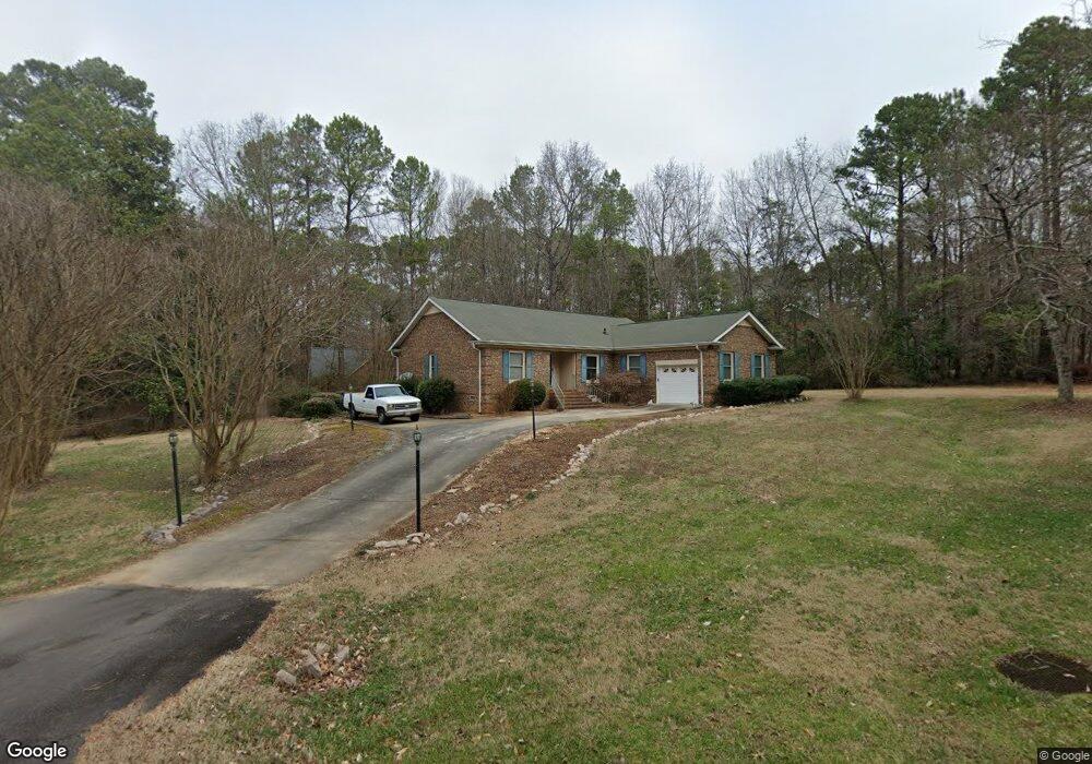
2019 High Pines Rd Rock Hill, SC 29732
Estimated Value: $440,000 - $529,000
3
Beds
2
Baths
2,055
Sq Ft
$232/Sq Ft
Est. Value
About This Home
This home is located at 2019 High Pines Rd, Rock Hill, SC 29732 and is currently estimated at $477,495, approximately $232 per square foot. 2019 High Pines Rd is a home located in York County with nearby schools including York Road Elementary School, Rawlinson Road Middle School, and Northwestern High School.
Ownership History
Date
Name
Owned For
Owner Type
Purchase Details
Closed on
Apr 14, 2010
Sold by
Camp Barbara A and Camp Axel O
Bought by
Zaloudek William K and Zaloudek Marie E
Current Estimated Value
Home Financials for this Owner
Home Financials are based on the most recent Mortgage that was taken out on this home.
Original Mortgage
$180,000
Outstanding Balance
$119,529
Interest Rate
4.94%
Mortgage Type
New Conventional
Estimated Equity
$357,966
Purchase Details
Closed on
May 10, 2006
Sold by
Atherton Cindy M
Bought by
Camp Barbara A and Camp Axel O
Home Financials for this Owner
Home Financials are based on the most recent Mortgage that was taken out on this home.
Original Mortgage
$150,000
Interest Rate
6.41%
Mortgage Type
New Conventional
Purchase Details
Closed on
Nov 12, 1998
Sold by
Cauthen John M
Bought by
Atherton Cindy M
Create a Home Valuation Report for This Property
The Home Valuation Report is an in-depth analysis detailing your home's value as well as a comparison with similar homes in the area
Home Values in the Area
Average Home Value in this Area
Purchase History
| Date | Buyer | Sale Price | Title Company |
|---|---|---|---|
| Zaloudek William K | $200,000 | -- | |
| Camp Barbara A | $187,500 | None Available | |
| Atherton Cindy M | $156,660 | -- |
Source: Public Records
Mortgage History
| Date | Status | Borrower | Loan Amount |
|---|---|---|---|
| Open | Zaloudek William K | $180,000 | |
| Previous Owner | Camp Barbara A | $150,000 |
Source: Public Records
Tax History Compared to Growth
Tax History
| Year | Tax Paid | Tax Assessment Tax Assessment Total Assessment is a certain percentage of the fair market value that is determined by local assessors to be the total taxable value of land and additions on the property. | Land | Improvement |
|---|---|---|---|---|
| 2024 | $1,176 | $8,394 | $1,655 | $6,739 |
| 2023 | $1,206 | $8,394 | $1,655 | $6,739 |
| 2022 | $1,211 | $8,394 | $1,655 | $6,739 |
| 2021 | -- | $8,394 | $1,655 | $6,739 |
| 2020 | $1,208 | $8,394 | $0 | $0 |
| 2019 | $1,100 | $7,300 | $0 | $0 |
| 2018 | $1,094 | $7,300 | $0 | $0 |
| 2017 | $1,031 | $7,300 | $0 | $0 |
| 2016 | $1,011 | $7,300 | $0 | $0 |
| 2014 | $1,057 | $7,300 | $1,800 | $5,500 |
| 2013 | $1,057 | $8,300 | $1,800 | $6,500 |
Source: Public Records
Map
Nearby Homes
- 2085 Cavendale Dr
- 981 Meadowlark Dr
- 2210 Canberra Dr
- 2274 Olde Creek Rd
- 1087 Hummingbird Ln
- 1750 Trellis Dr
- 1821 Huntington Place
- 2345 Nuthatch Dr
- 1904 Steeplechase Dr
- 720 Herlong Ave
- 1545 Patio Point
- 2317 Kestrel Dr
- 926 Meadow Lakes Rd
- 2290 Kestrel Dr
- 1581 Huntmoor Dr
- 311 Notable Ln
- 829 Rawlinson Rd
- 297 Notable Ln
- 418 Tysons Forest Dr
- 2014 Steeplechase Dr
- 2045 High Pines Rd
- 1993 High Pines Rd
- 2014 High Pines Rd
- 2038 High Pines Rd
- 1992 High Pines Rd
- 1992 High Pines Rd
- 2004 High Pines Rd
- 2059 High Pines Rd
- 1979 High Pines Rd
- 2046 High Pines Rd
- 2054 High Pines Rd
- 1980 High Pines Rd
- 2077 High Pines Rd
- 1967 High Pines Rd
- 2030 High Pines Rd
- 2030 Cavendale Dr
- 1968 High Pines Rd
- 2038 Cavendale Dr
- 2020 Cavendale Dr
- 2046 Cavendale Dr