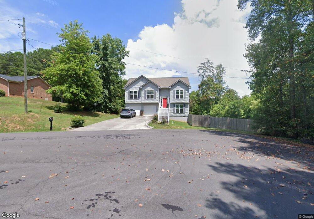
2019 Kate Ann Dr Dalton, GA 30721
Estimated Value: $229,000 - $247,000
--
Bed
--
Bath
1,393
Sq Ft
$170/Sq Ft
Est. Value
About This Home
This home is located at 2019 Kate Ann Dr, Dalton, GA 30721 and is currently estimated at $236,519, approximately $169 per square foot. 2019 Kate Ann Dr is a home with nearby schools including Cedar Ridge Elementary School, Eastbrook Middle School, and Southeast Whitfield County High School.
Ownership History
Date
Name
Owned For
Owner Type
Purchase Details
Closed on
Nov 20, 2020
Sold by
Gaston Nancy L
Bought by
Henderson Sonja
Current Estimated Value
Purchase Details
Closed on
Aug 2, 2013
Sold by
Cobb Oliver Frederick
Bought by
Cobb Jean
Purchase Details
Closed on
Jun 7, 2013
Sold by
Cobb Oliver Fredrick
Bought by
Cobb Oliver Frederick and Cobb Frances Anita
Purchase Details
Closed on
Jul 24, 2006
Sold by
Pioneer Savings & Invest
Bought by
Cobb Oliver Federick
Purchase Details
Closed on
Apr 15, 2005
Sold by
Prather Robert
Bought by
Pioneer Savings & Investment
Purchase Details
Closed on
Feb 1, 1997
Bought by
Prather Robert and Prather Melanie
Create a Home Valuation Report for This Property
The Home Valuation Report is an in-depth analysis detailing your home's value as well as a comparison with similar homes in the area
Home Values in the Area
Average Home Value in this Area
Purchase History
| Date | Buyer | Sale Price | Title Company |
|---|---|---|---|
| Henderson Sonja | -- | None Listed On Document | |
| Cobb Jean | -- | -- | |
| Cobb Oliver Frederick | -- | -- | |
| Cobb Oliver Federick | $7,500 | -- | |
| Pioneer Savings & Investment | -- | -- | |
| Prather Robert | $7,500 | -- |
Source: Public Records
Tax History Compared to Growth
Tax History
| Year | Tax Paid | Tax Assessment Tax Assessment Total Assessment is a certain percentage of the fair market value that is determined by local assessors to be the total taxable value of land and additions on the property. | Land | Improvement |
|---|---|---|---|---|
| 2024 | $2,084 | $87,240 | $7,000 | $80,240 |
| 2023 | $2,084 | $69,472 | $3,200 | $66,272 |
| 2022 | $1,584 | $53,698 | $3,200 | $50,498 |
| 2021 | $1,584 | $53,698 | $3,200 | $50,498 |
| 2020 | $1,638 | $53,698 | $3,200 | $50,498 |
| 2019 | $1,665 | $53,698 | $3,200 | $50,498 |
| 2018 | $1,692 | $53,698 | $3,200 | $50,498 |
| 2017 | $1,693 | $53,698 | $3,200 | $50,498 |
| 2016 | $1,513 | $49,919 | $3,990 | $45,929 |
| 2014 | $1,344 | $49,919 | $3,990 | $45,929 |
| 2013 | -- | $3,990 | $3,990 | $0 |
Source: Public Records
Map
Nearby Homes
- 296 Wagner Dr
- 3657 Airport Rd
- 00 Tibbs Bridge Rd
- 01 Headrick Cir SE
- 00 Headrick Cir SE
- 00 Hill Rd
- 1142 Ben Hill Rd SE
- 1401 Eastbrook Dr SE
- 1271 Ridge Rd SE
- 118 Hill Rd
- 136 Wiltshire Dr
- TBD Old Grade Rd
- 0 Old Grade Rd
- 0 Tibbs Bridge Rd SE
- 1401 Eastbrook Rd SE
- 1629 Roosevelt Dr
- 307 Gay St
- 143 Staten St
- 00 Wooten Dr
- 115 Wooten Dr
- 2039 Winnwood Dr
- 2007 Kate Ann Dr
- 2007 Kate Ann Dr
- 2007 Kate Ann Dr
- 2045 Winnwood Dr
- 2035 Winnwood Dr
- 2047 Winnwood Dr
- 2008 Kate Ann Dr
- 2032 Winnwood Dr
- 2050 Winnwood Dr
- 2002 Kate Ann Dr
- 2026 Winnwood Dr
- 2034 Winnwood Dr
- 0 Kate Ann Dr Unit 1283809
- 0 Kate Ann Dr
- 0 Wynnwood Rd Unit 1104699
- 0 Wynnwood Rd Unit 1112914
- 0 Wynnwood Rd Unit LOT11 1112914
- 0 Wynnwood Rd Unit LOT11 1104699
- 2000 Winnwood Dr