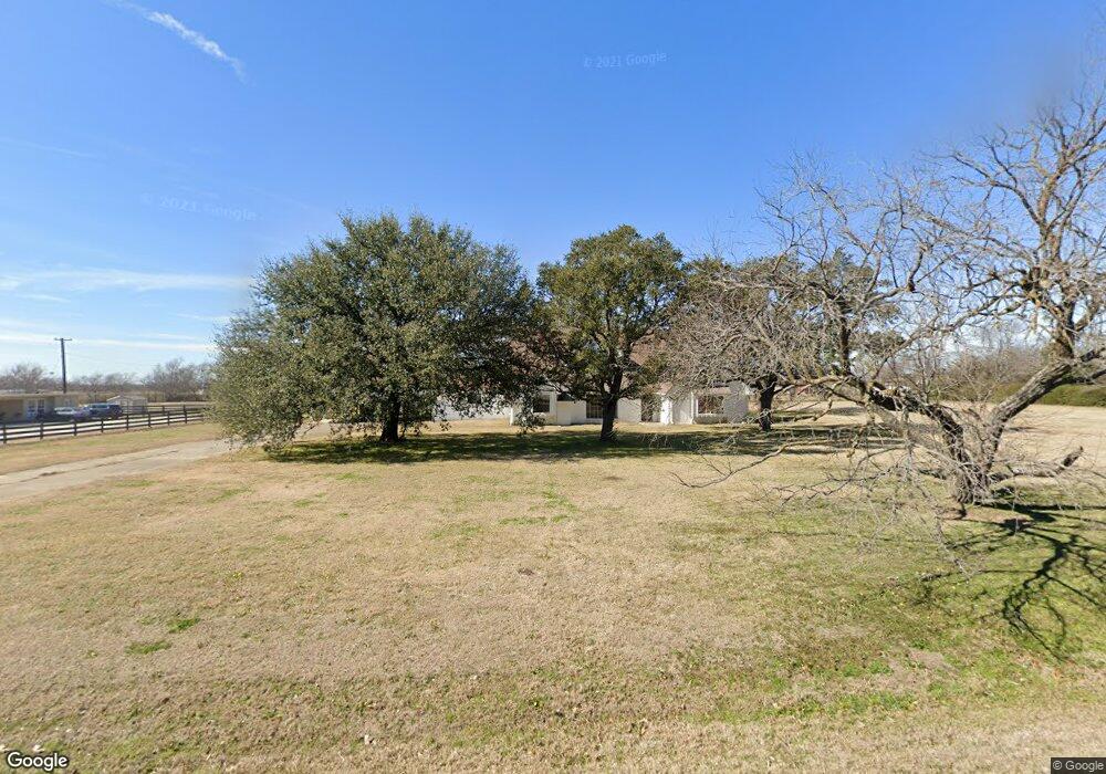
2019 N Lariat Rd Denton, TX 76207
Estimated Value: $582,000 - $823,000
5
Beds
4
Baths
3,608
Sq Ft
$194/Sq Ft
Est. Value
About This Home
This home is located at 2019 N Lariat Rd, Denton, TX 76207 and is currently estimated at $698,350, approximately $193 per square foot. 2019 N Lariat Rd is a home located in Denton County with nearby schools including Evers Park Elementary School, Calhoun Middle School, and Denton High School.
Ownership History
Date
Name
Owned For
Owner Type
Purchase Details
Closed on
Oct 9, 2013
Sold by
Sadeghian Khosrow
Bought by
Sadeghian Amy and Kamy Real Estate Trust
Current Estimated Value
Purchase Details
Closed on
Mar 20, 2006
Sold by
Sadeghian Mariam
Bought by
Sadeghian Khosrow
Purchase Details
Closed on
Feb 7, 2005
Sold by
Sadeghian Khosrow
Bought by
Sadeghian Mariam
Purchase Details
Closed on
Dec 22, 2004
Sold by
Ib Property Holdings Llc
Bought by
Sadeghian Khosrow
Purchase Details
Closed on
Aug 5, 2003
Sold by
Hgu Investments Inc
Bought by
Surety Bank Na
Purchase Details
Closed on
Apr 30, 2002
Sold by
Interbay Funding Llc
Bought by
Roan James Dylan
Home Financials for this Owner
Home Financials are based on the most recent Mortgage that was taken out on this home.
Original Mortgage
$179,550
Interest Rate
7.19%
Mortgage Type
Seller Take Back
Create a Home Valuation Report for This Property
The Home Valuation Report is an in-depth analysis detailing your home's value as well as a comparison with similar homes in the area
Home Values in the Area
Average Home Value in this Area
Purchase History
| Date | Buyer | Sale Price | Title Company |
|---|---|---|---|
| Sadeghian Amy | -- | None Available | |
| Sadeghian Khosrow | -- | None Available | |
| Sadeghian Mariam | -- | -- | |
| Sadeghian Khosrow | -- | Fnt | |
| Surety Bank Na | $35,000 | -- | |
| Roan James Dylan | -- | Alamo Title Company |
Source: Public Records
Mortgage History
| Date | Status | Borrower | Loan Amount |
|---|---|---|---|
| Previous Owner | Roan James Dylan | $179,550 |
Source: Public Records
Tax History Compared to Growth
Tax History
| Year | Tax Paid | Tax Assessment Tax Assessment Total Assessment is a certain percentage of the fair market value that is determined by local assessors to be the total taxable value of land and additions on the property. | Land | Improvement |
|---|---|---|---|---|
| 2025 | $6,370 | $415,000 | $233,279 | $181,721 |
| 2024 | $11,056 | $572,803 | $233,279 | $339,524 |
| 2023 | $10,778 | $564,471 | $233,279 | $331,192 |
| 2022 | $9,234 | $435,000 | $144,080 | $290,920 |
| 2021 | $3,557 | $160,000 | $95,360 | $64,640 |
| 2020 | $3,886 | $170,000 | $95,360 | $74,640 |
| 2019 | $3,031 | $127,013 | $47,680 | $79,333 |
| 2018 | $6,015 | $249,000 | $95,360 | $153,640 |
| 2016 | $3,256 | $131,744 | $95,360 | $36,384 |
| 2015 | $3,428 | $23,335 | $6,364 | $16,971 |
Source: Public Records
Map
Nearby Homes
- 2001 N Lariat Rd
- 2007 Cindy Ln
- 1401 N Masch Branch Rd
- 0000 Mesa Dr
- 2816 Westglen Dr
- 2908 Lakewood Dr
- 2905 Lakewood Dr
- 2112 Carriage Hill
- 2501 Payne Dr
- 3211 Darby Ln
- 2204 Crestmeadow St
- 1155 Cottonwood Ln
- 2516 Bauer Dr
- 2225 Southway
- 8540 W University Dr
- 2320 Southway
- 328 Broken Bow
- 1627 Kawati Way
- 3400 Kingsview Dr
- 1620 Kawati Way
- 2013 N Lariat Rd
- 4001 Hampton Rd
- 4007 Hampton Rd
- 2018 N Lariat Rd
- 2007 N Lariat Rd
- 3919 Hampton Rd
- 4109 Hampton Rd
- 3913 Hampton Rd
- 2000 N Lariat Rd
- 3907 Hampton Rd
- 1918 N Lariat Rd
- 1919 N Lariat Rd
- 4115 Hampton Rd
- 2013 Cindy Ln
- 3901 Hampton Rd
- 1913 N Lariat Rd
- 2001 Cindy Ln
- 1912 N Lariat Rd
- 1913 Cindy Ln
- 1907 N Lariat Rd