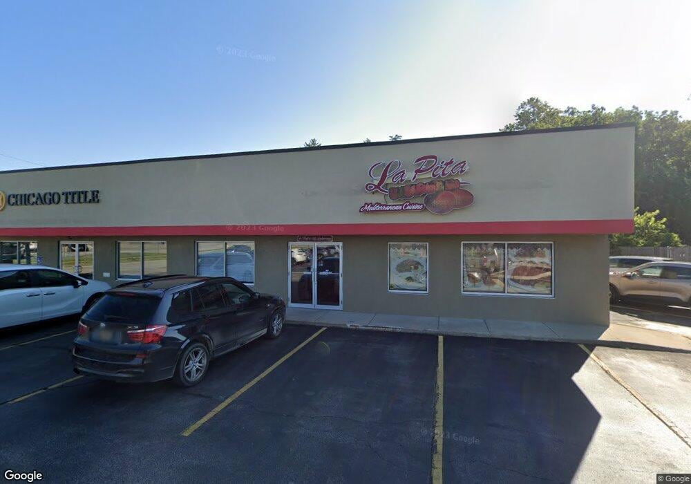
2019 Niles Rd Saint Joseph, MI 49085
Estimated Value: $4,200,480
Studio
--
Bath
2,600
Sq Ft
$1,616/Sq Ft
Est. Value
About This Home
This home is located at 2019 Niles Rd, Saint Joseph, MI 49085 and is currently estimated at $4,200,480, approximately $1,615 per square foot. 2019 Niles Rd is a home located in Berrien County with nearby schools including Upton Middle School, St. Joseph High School, and Trinity Lutheran School.
Ownership History
Date
Name
Owned For
Owner Type
Purchase Details
Closed on
Jul 6, 2020
Sold by
Southtown Llc
Bought by
Southtown Ii Llc
Current Estimated Value
Home Financials for this Owner
Home Financials are based on the most recent Mortgage that was taken out on this home.
Original Mortgage
$2,200,000
Outstanding Balance
$1,954,434
Interest Rate
3.2%
Mortgage Type
Credit Line Revolving
Estimated Equity
$2,246,046
Purchase Details
Closed on
Jul 1, 2020
Sold by
Southtown Llc
Bought by
Southtown Ii Llc
Home Financials for this Owner
Home Financials are based on the most recent Mortgage that was taken out on this home.
Original Mortgage
$2,200,000
Outstanding Balance
$1,954,434
Interest Rate
3.2%
Mortgage Type
Credit Line Revolving
Estimated Equity
$2,246,046
Purchase Details
Closed on
May 31, 1995
Purchase Details
Closed on
Jan 1, 1995
Create a Home Valuation Report for This Property
The Home Valuation Report is an in-depth analysis detailing your home's value as well as a comparison with similar homes in the area
Home Values in the Area
Average Home Value in this Area
Purchase History
| Date | Buyer | Sale Price | Title Company |
|---|---|---|---|
| Southtown Ii Llc | -- | Chicago Title | |
| Southtown Ii Llc | -- | Chicago Title Of Mi Inc | |
| -- | $100 | -- | |
| -- | $100 | -- |
Source: Public Records
Mortgage History
| Date | Status | Borrower | Loan Amount |
|---|---|---|---|
| Open | Southtown Ii Llc | $2,200,000 | |
| Closed | Southtown Ii Llc | $2,200,000 |
Source: Public Records
Tax History
| Year | Tax Paid | Tax Assessment Tax Assessment Total Assessment is a certain percentage of the fair market value that is determined by local assessors to be the total taxable value of land and additions on the property. | Land | Improvement |
|---|---|---|---|---|
| 2025 | $21,703 | $486,300 | $0 | $0 |
| 2024 | $16,582 | $431,000 | $0 | $0 |
| 2023 | $17,957 | $466,700 | $0 | $0 |
| 2022 | $17,992 | $467,600 | $0 | $0 |
| 2021 | $23,216 | $462,700 | $107,800 | $354,900 |
| 2020 | $24,665 | $508,200 | $0 | $0 |
| 2019 | $25,242 | $610,200 | $156,800 | $453,400 |
| 2018 | $29,274 | $610,200 | $0 | $0 |
| 2017 | $28,892 | $630,400 | $0 | $0 |
| 2016 | $28,343 | $673,500 | $0 | $0 |
| 2015 | $28,053 | $655,200 | $0 | $0 |
| 2014 | $22,429 | $633,500 | $0 | $0 |
Source: Public Records
Map
Nearby Homes
- Parcel 2-B Niles Road M-63
- 1189 Lydia Dr
- 422 Briar Ct
- 705 Columbia Ave
- 325 Winwood Ave
- 924 Eagle Point Dr
- 944 Eagle Point Dr
- V/L Niles Rd
- 2401 Bay Pointe Dr
- 2500 Bay Pointe Dr
- 2491 Bay Pointe Dr
- 2510 Bay Pointe Dr
- 2511 Riverwood Terrace
- 851 Kingsley Ave
- 711 Kingsley Ave
- 2301 Willa Dr
- 2311 Bryan St
- 318 Kingsley Ave
- 3711 Michigan 63
- 2461 Riverbend Dr
- 2019 Niles Rd
- 2015 Niles Rd Unit 2043
- 2015 Niles Rd
- 718 Melody Ln
- 814 Saint Joseph Dr
- 2944 Niles Ave
- 2129 Washington Ave
- 816 St Joseph Dr
- 815 Saint Joseph Dr
- 1169 Lydia Dr
- 731 St Joseph Dr
- 731 Saint Joseph Dr
- 850 Saint Joseph Dr
- 717 Saint Joseph Dr
- 2143 Washington Ave
- 2930 Niles Ave
- 2910 Willa Dr
- 1161 Lydia Dr
- 2945 Niles Ave
- 2926 Niles Ave Unit Suite 1
Your Personal Tour Guide
Ask me questions while you tour the home.