2019 Northeast Ave Halethorpe, MD 21227
Estimated payment $2,069/month
Highlights
- Bungalow
- Central Air
- Hot Water Heating System
About This Home
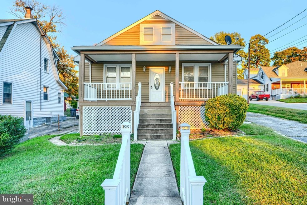
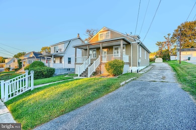
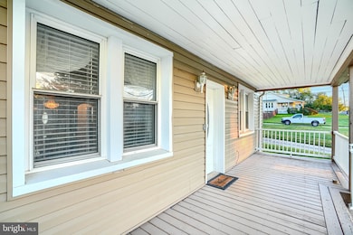
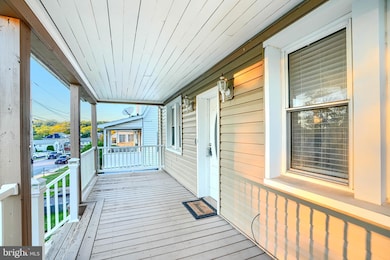
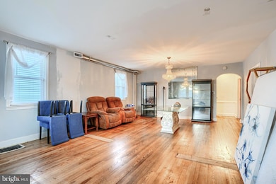
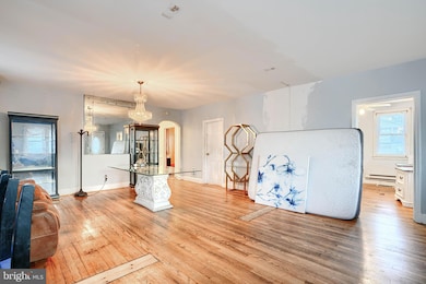
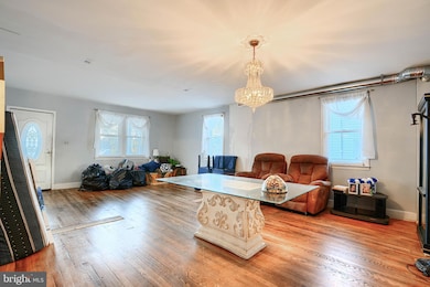
Welcome to 2019 Northeast Ave, a charming 3 unit home offering space, warmth, and room to make it your own. From the moment you arrive, you’ll be greeted by a welcoming covered front porch—perfect for morning coffee or evening relaxation. The long private driveway offers ample off-street parking and leads to a spacious backyard complete with a large deck and storage shed. Inside, the home opens into a spacious living room filled with natural light and original hardwood floors. The kitchen features granite countertops, stainless steel appliances, and ample cabinet and counter space. A bonus rear room off the kitchen features sliding glass doors that open to the back deck. This space also includes laundry hookups and easy access to the backyard, adding convenience and versatility to the home’s layout. The home offers three inviting bedrooms, each with hardwood floors and and plenty of natural light. Step outside to enjoy your large backyard—a wonderful space for outdoor gatherings, gardening, or relaxation. The deck provides the perfect setting for summer barbecues, while the storage shed offers ample storage space. Schedule your showing today.
Property Details
Home Type
- Multi-Family
Est. Annual Taxes
- $2,715
Year Built
- Built in 1947
Lot Details
- 10,650 Sq Ft Lot
Parking
- Driveway
Home Design
- Triplex
- Bungalow
- Aluminum Siding
Utilities
- Central Air
- Hot Water Heating System
- Electric Water Heater
Additional Features
- Unfinished Basement
Community Details
- 3 Units
- Halethorpe Subdivision
Listing and Financial Details
- Tax Lot 1
- Assessor Parcel Number 04131304000020
Map
Home Values in the Area
Average Home Value in this Area
Tax History
| Year | Tax Paid | Tax Assessment Tax Assessment Total Assessment is a certain percentage of the fair market value that is determined by local assessors to be the total taxable value of land and additions on the property. | Land | Improvement |
|---|---|---|---|---|
| 2025 | $3,867 | $242,233 | -- | -- |
| 2024 | $3,867 | $224,000 | $86,600 | $137,400 |
| 2023 | $1,991 | $220,133 | $0 | $0 |
| 2022 | $3,418 | $216,267 | $0 | $0 |
| 2021 | $3,279 | $212,400 | $70,100 | $142,300 |
| 2020 | $3,279 | $211,433 | $0 | $0 |
| 2019 | $3,112 | $210,467 | $0 | $0 |
| 2018 | $2,933 | $209,500 | $70,100 | $139,400 |
| 2017 | $2,731 | $202,000 | $0 | $0 |
| 2016 | $2,540 | $194,500 | $0 | $0 |
| 2015 | $2,540 | $187,000 | $0 | $0 |
| 2014 | $2,540 | $187,000 | $0 | $0 |
Property History
| Date | Event | Price | List to Sale | Price per Sq Ft |
|---|---|---|---|---|
| 12/10/2025 12/10/25 | Price Changed | $355,000 | -1.4% | $197 / Sq Ft |
| 12/07/2025 12/07/25 | For Sale | $360,000 | 0.0% | $200 / Sq Ft |
| 12/06/2025 12/06/25 | Off Market | $360,000 | -- | -- |
| 10/07/2025 10/07/25 | For Sale | $360,000 | -- | $200 / Sq Ft |
Purchase History
| Date | Type | Sale Price | Title Company |
|---|---|---|---|
| Deed | -- | Home First Title | |
| Deed | -- | Home First Title | |
| Deed | -- | Home First Title | |
| Deed | -- | Home First Title | |
| Deed | $88,000 | -- | |
| Foreclosure Deed | $62,000 | -- |
Mortgage History
| Date | Status | Loan Amount | Loan Type |
|---|---|---|---|
| Previous Owner | $49,600 | No Value Available |
Source: Bright MLS
MLS Number: MDBC2142496
APN: 13-1304000020
- 4304 Spencer St
- 1942 Catanna Ave
- 4209 Spring Ave
- 1911 Halethorpe Ave
- 1816 Fairview Ave
- 4606 Ridge Ave
- 0 Monumental Ave Unit MDBC2082542
- 5605 Oregon Ave
- 31 3rd Ave
- 30 3rd Ave
- 108 4th Ave
- 121 3rd Ave
- 5527 Willys Ave
- 5506 Carville Ave
- 1416 Sulphur Spring Rd
- 0 Dewitt Rd
- 0 Sulphur Spring Unit MDBC2146808
- 1110 Francis Ave
- 5522 Ashbourne Rd
- 216 Clyde Ave
- 4151 Maple Ave
- 24 Colony Hill Ct
- 2715 Hammonds Ferry Rd
- 2713 Hammonds Ferry Rd
- 4369 Hollins Ferry Rd
- 1813 Wind Gate Rd
- 212 Fourth Ave Unit 212 AptB
- 1163 Kelfield Dr
- 5513 Ashbourne Rd Unit B
- 5300 East Dr Unit H
- 2926 Lakebrook Cir
- 2 Fallen Tree Ct Unit C
- 600 Fifth Ave
- 811 Regis Ct
- 1003 Fredonia Ct
- 817 5th Ave
- 945 Elm Rd
- 5651 Selford Rd
- 4007 Hollins Ferry Rd
- 5705 Selford Rd
