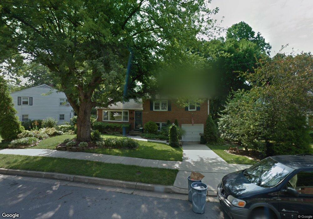
2019 Rollingwood Rd Catonsville, MD 21228
Estimated Value: $482,000 - $522,000
--
Bed
2
Baths
1,944
Sq Ft
$255/Sq Ft
Est. Value
About This Home
This home is located at 2019 Rollingwood Rd, Catonsville, MD 21228 and is currently estimated at $496,651, approximately $255 per square foot. 2019 Rollingwood Rd is a home located in Baltimore County with nearby schools including Westchester Elementary School, Catonsville Middle School, and Catonsville High School.
Ownership History
Date
Name
Owned For
Owner Type
Purchase Details
Closed on
Sep 2, 2005
Sold by
Oles Carol
Bought by
Bartlett Freddy L and Bartlett Jill R
Current Estimated Value
Home Financials for this Owner
Home Financials are based on the most recent Mortgage that was taken out on this home.
Original Mortgage
$262,400
Outstanding Balance
$137,153
Interest Rate
5.68%
Mortgage Type
New Conventional
Estimated Equity
$359,498
Purchase Details
Closed on
Aug 23, 1995
Sold by
Shaughness Albert J
Bought by
Oles Carol
Home Financials for this Owner
Home Financials are based on the most recent Mortgage that was taken out on this home.
Original Mortgage
$143,865
Interest Rate
7.32%
Create a Home Valuation Report for This Property
The Home Valuation Report is an in-depth analysis detailing your home's value as well as a comparison with similar homes in the area
Home Values in the Area
Average Home Value in this Area
Purchase History
| Date | Buyer | Sale Price | Title Company |
|---|---|---|---|
| Bartlett Freddy L | $328,000 | -- | |
| Oles Carol | $145,000 | -- |
Source: Public Records
Mortgage History
| Date | Status | Borrower | Loan Amount |
|---|---|---|---|
| Open | Bartlett Freddy L | $262,400 | |
| Closed | Bartlett Freddy L | $49,200 | |
| Previous Owner | Oles Carol | $143,865 |
Source: Public Records
Tax History Compared to Growth
Tax History
| Year | Tax Paid | Tax Assessment Tax Assessment Total Assessment is a certain percentage of the fair market value that is determined by local assessors to be the total taxable value of land and additions on the property. | Land | Improvement |
|---|---|---|---|---|
| 2025 | $4,820 | $355,867 | -- | -- |
| 2024 | $4,820 | $337,800 | $127,000 | $210,800 |
| 2023 | $2,508 | $326,633 | $0 | $0 |
| 2022 | $4,775 | $315,467 | $0 | $0 |
| 2021 | $4,202 | $304,300 | $127,000 | $177,300 |
| 2020 | $4,202 | $292,500 | $0 | $0 |
| 2019 | $4,234 | $280,700 | $0 | $0 |
| 2018 | $4,055 | $268,900 | $91,000 | $177,900 |
| 2017 | $4,050 | $261,600 | $0 | $0 |
| 2016 | $3,488 | $254,300 | $0 | $0 |
| 2015 | $3,488 | $247,000 | $0 | $0 |
| 2014 | $3,488 | $247,000 | $0 | $0 |
Source: Public Records
Map
Nearby Homes
- 231 Gralan Rd
- 1900 Lismore Ln
- 2110 Edmondson Ave
- 11 Clay Lodge Ln Unit 204
- 19 Clay Lodge Ln Unit 104
- 302 Wessling Cir
- 105 Oella Ave
- 8 Seminole Ave
- 311 Radstock Rd
- 627 Meyers Dr
- 627 Meyers Dr Unit PARCEL 108
- 2305 Rockwell Ave
- 2310 Rockwell Ave
- 1300 Rice Ave
- 2208 W Geipe Rd
- 230 N Beaumont Ave
- 343 N Beaumont Ave
- 353 N Beaumont Ave
- 332 Suter Rd
- 201 Suter Rd
- 2021 Rollingwood Rd
- 2017 Rollingwood Rd
- 2023 Rollingwood Rd
- 2016 Rollingwood Rd
- 2018 Rollingwood Rd
- 2014 Rollingwood Rd
- 2020 Rollingwood Rd
- 212 Brookside Dr
- 216 Brookside Dr
- 2025 Rollingwood Rd
- 210 Brookside Dr
- 2012 Rollingwood Rd
- 2022 Rollingwood Rd
- 208 Brookside Dr
- 2027 Rollingwood Rd
- 206 Brookside Dr
- 2024 Rollingwood Rd
- 200 Elpin Dr W
- 225 Gralan Rd
- 2006 Rollingwood Rd