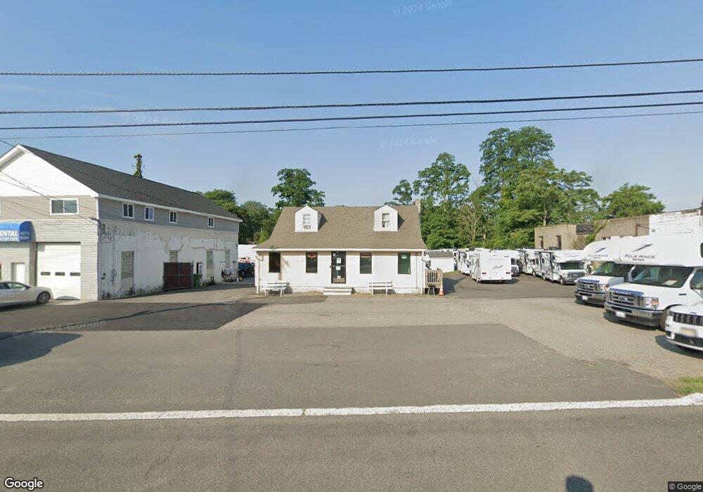
2019 State Route 35 South Amboy, NJ 08879
Estimated Value: $487,926 - $614,000
--
Bed
--
Bath
--
Sq Ft
0.86
Acres
About This Home
This home is located at 2019 State Route 35, South Amboy, NJ 08879 and is currently estimated at $569,309. 2019 State Route 35 is a home located in Middlesex County with nearby schools including Sayreville War Memorial High School, St. Mary Elementary School, and New Road School of Parlin.
Ownership History
Date
Name
Owned For
Owner Type
Purchase Details
Closed on
Mar 18, 2015
Sold by
Gomolka Matthew
Bought by
Ryan Ltd Inc
Current Estimated Value
Home Financials for this Owner
Home Financials are based on the most recent Mortgage that was taken out on this home.
Original Mortgage
$175,000
Outstanding Balance
$134,032
Interest Rate
3.68%
Mortgage Type
Commercial
Estimated Equity
$435,277
Purchase Details
Closed on
Jun 13, 2003
Purchase Details
Closed on
Mar 8, 2001
Sold by
Gomolka Albert
Bought by
Gomaolka Properties
Home Financials for this Owner
Home Financials are based on the most recent Mortgage that was taken out on this home.
Original Mortgage
$150,000
Interest Rate
7.01%
Create a Home Valuation Report for This Property
The Home Valuation Report is an in-depth analysis detailing your home's value as well as a comparison with similar homes in the area
Home Values in the Area
Average Home Value in this Area
Purchase History
| Date | Buyer | Sale Price | Title Company |
|---|---|---|---|
| Ryan Ltd Inc | $325,000 | First American Title | |
| -- | -- | -- | |
| Gomaolka Properties | $150,000 | -- |
Source: Public Records
Mortgage History
| Date | Status | Borrower | Loan Amount |
|---|---|---|---|
| Open | Ryan Ltd Inc | $175,000 | |
| Open | Ryan Ltd Inc | $6,500,000 | |
| Previous Owner | Gomaolka Properties | $150,000 |
Source: Public Records
Tax History Compared to Growth
Tax History
| Year | Tax Paid | Tax Assessment Tax Assessment Total Assessment is a certain percentage of the fair market value that is determined by local assessors to be the total taxable value of land and additions on the property. | Land | Improvement |
|---|---|---|---|---|
| 2025 | $10,812 | $186,000 | $122,300 | $63,700 |
| 2024 | $10,513 | $177,100 | $122,300 | $54,800 |
| 2023 | $10,513 | $177,100 | $122,300 | $54,800 |
| 2022 | $9,820 | $177,100 | $122,300 | $54,800 |
| 2021 | $9,712 | $177,100 | $122,300 | $54,800 |
| 2020 | $9,466 | $177,100 | $122,300 | $54,800 |
| 2019 | $9,268 | $177,100 | $122,300 | $54,800 |
| 2018 | $9,101 | $177,100 | $122,300 | $54,800 |
| 2017 | $8,890 | $177,100 | $122,300 | $54,800 |
| 2016 | $8,653 | $177,100 | $122,300 | $54,800 |
| 2015 | $8,457 | $177,100 | $122,300 | $54,800 |
| 2014 | $8,230 | $177,100 | $122,300 | $54,800 |
Source: Public Records
Map
Nearby Homes
- 466 Brook Ave
- 415 Brook Ave
- 434 S Pine Ave
- 42 Merritt Ave
- 191 Wessco St
- 18 Grand St
- 503 Woodland Ave
- 21 Luke St
- 161 Manor St
- 164 Liberty St
- 1200 Ernston Rd
- 158 Liberty St St
- 158 Liberty St
- 1511 Pebble Place
- 21 Gordon Ave
- 363 Portia St
- 179 Gabriel Terrace
- 741 Bordentown Ave
- 10 Martha Blvd
- 320 Parker Ave
- 2015 State Route 35
- 2009 State Route 35
- 2033 State Route 35
- 5 Saint Peter Dr
- 9 Saint Peter Dr
- 1999 State Route 35
- 7 Saint Peter Dr
- 11 Saint Peter Dr
- 2008 State Route 35
- 13 Saint Peter Dr
- 1991 New Jersey 35
- 1991 State Route 35
- 15 Saint Peter Dr
- 2 Slesinski Ct
- 6 Fairview Ave
- 14 Fairview Ave
- 4 Fairview Ave
- 12 Fairview Ave
- 10 Saint Peter Dr
- 12 Saint Peter Dr