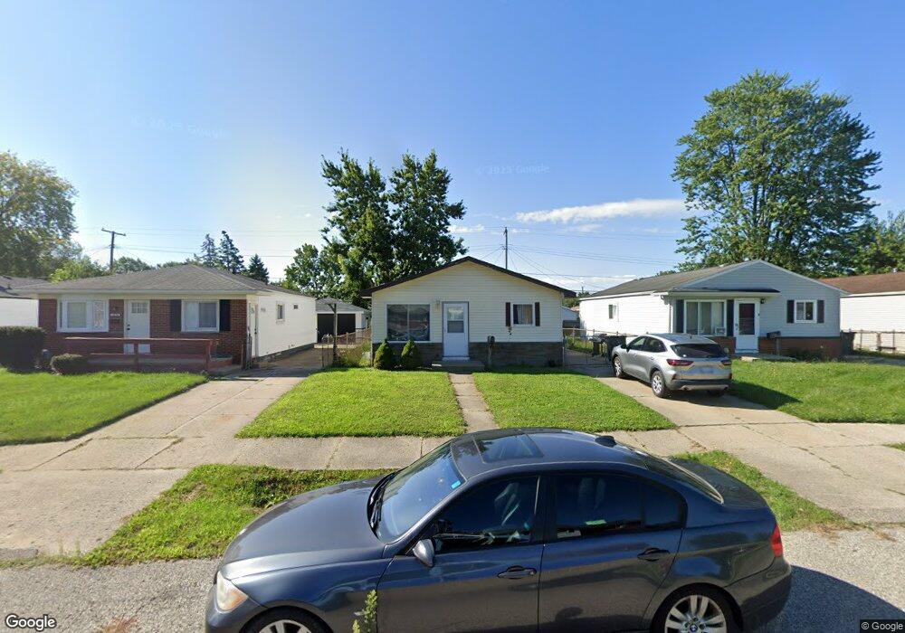
20198 Abrahm St Clinton Township, MI 48035
Estimated Value: $142,000 - $168,000
3
Beds
1
Bath
864
Sq Ft
$179/Sq Ft
Est. Value
About This Home
This home is located at 20198 Abrahm St, Clinton Township, MI 48035 and is currently estimated at $154,529, approximately $178 per square foot. 20198 Abrahm St is a home located in Macomb County with nearby schools including Clintondale High School and St. Thecla Catholic School.
Ownership History
Date
Name
Owned For
Owner Type
Purchase Details
Closed on
Aug 18, 2009
Sold by
Michigan Property Superstore Inc
Bought by
Sultini Rodney and Sultini Jeanne
Current Estimated Value
Purchase Details
Closed on
Mar 19, 2009
Sold by
Secretary Of Housing & Urban Development
Bought by
Michigan Property Superstore
Purchase Details
Closed on
Apr 16, 2008
Sold by
Lacroix Mary C
Bought by
Hud
Purchase Details
Closed on
Jun 29, 2001
Sold by
Schutt Jeffrey A
Bought by
Lacroix Mary C
Home Financials for this Owner
Home Financials are based on the most recent Mortgage that was taken out on this home.
Original Mortgage
$104,176
Interest Rate
6.99%
Create a Home Valuation Report for This Property
The Home Valuation Report is an in-depth analysis detailing your home's value as well as a comparison with similar homes in the area
Home Values in the Area
Average Home Value in this Area
Purchase History
| Date | Buyer | Sale Price | Title Company |
|---|---|---|---|
| Sultini Rodney | $24,000 | Chirco Title Company | |
| Michigan Property Superstore | $16,000 | None Available | |
| Hud | -- | None Available | |
| Lacroix Mary C | $105,000 | -- |
Source: Public Records
Mortgage History
| Date | Status | Borrower | Loan Amount |
|---|---|---|---|
| Previous Owner | Lacroix Mary C | $104,176 |
Source: Public Records
Tax History Compared to Growth
Tax History
| Year | Tax Paid | Tax Assessment Tax Assessment Total Assessment is a certain percentage of the fair market value that is determined by local assessors to be the total taxable value of land and additions on the property. | Land | Improvement |
|---|---|---|---|---|
| 2025 | $1,483 | $66,400 | $0 | $0 |
| 2024 | $881 | $61,700 | $0 | $0 |
| 2023 | $1,093 | $56,400 | $0 | $0 |
| 2022 | $1,617 | $50,500 | $0 | $0 |
| 2021 | $1,362 | $46,900 | $0 | $0 |
| 2020 | $753 | $42,200 | $0 | $0 |
| 2019 | $1,524 | $35,900 | $0 | $0 |
| 2018 | $2,147 | $30,500 | $0 | $0 |
| 2017 | $2,011 | $27,100 | $5,500 | $21,600 |
| 2016 | $1,933 | $27,100 | $0 | $0 |
| 2015 | -- | $24,100 | $0 | $0 |
| 2014 | -- | $22,200 | $0 | $0 |
| 2011 | -- | $31,700 | $8,500 | $23,200 |
Source: Public Records
Map
Nearby Homes
- 20174 Abrahm St
- 20309 Abrahm St
- 20176 15 Mile Rd
- 20011 Abrahm St
- 20410 Woodward St
- 0000 Garfield
- 20550 Vermander Ave
- 19793 Electra St
- 34606 Beaconsfield St
- 19851 Kemp St
- 35403 Seville St
- 34559 Chope Place
- 35501 Griswald St
- 34161 Beaconsfield St
- 34029 Little MacK Ave
- 20219 Finley St
- 20975 Catalano St
- 35685 Griswald St
- 35375 Groesbeck Hwy
- 21132 Woodward St
- 20206 Abrahm St
- 20190 Abrahm St
- 20214 Abrahm St
- 20182 Abrahm St
- 20197 Vermander Ave
- 20205 Vermander Ave
- 20189 Vermander Ave
- 20215 Vermander Ave
- 20181 Vermander Ave
- 20207 Abrahm St
- 20219 Abrahm St
- 20211 Abrahm St
- 20215 Abrahm St
- 20230 Abrahm St
- 20166 Abrahm St
- 20223 Vermander Ave Unit Bldg-Unit
- 20223 Vermander Ave
- 20173 Vermander Ave
- 20223 Abrahm St
- 20227 Abrahm St