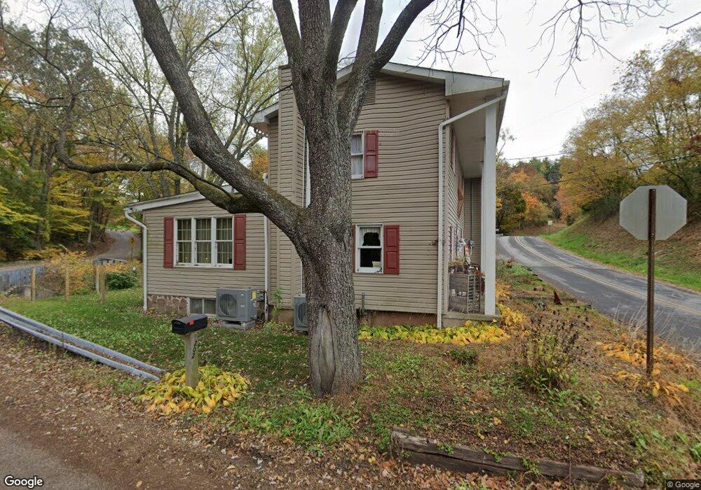
202 Andersontown Rd Mechanicsburg, PA 17055
Estimated Value: $299,000 - $469,000
2
Beds
2
Baths
2,649
Sq Ft
$144/Sq Ft
Est. Value
About This Home
This home is located at 202 Andersontown Rd, Mechanicsburg, PA 17055 and is currently estimated at $381,460, approximately $144 per square foot. 202 Andersontown Rd is a home located in York County with nearby schools including Northern Middle School and Northern High School.
Ownership History
Date
Name
Owned For
Owner Type
Purchase Details
Closed on
Jun 16, 2023
Sold by
Lex Carl G
Bought by
Dominick Steven M and Dominick Autumn N
Current Estimated Value
Home Financials for this Owner
Home Financials are based on the most recent Mortgage that was taken out on this home.
Original Mortgage
$319,500
Outstanding Balance
$310,957
Interest Rate
6.39%
Mortgage Type
New Conventional
Estimated Equity
$70,503
Purchase Details
Closed on
Feb 16, 1971
Sold by
Lex Carl G and Lex Judy K
Bought by
Lex Carl G and Lex Judy K
Create a Home Valuation Report for This Property
The Home Valuation Report is an in-depth analysis detailing your home's value as well as a comparison with similar homes in the area
Home Values in the Area
Average Home Value in this Area
Purchase History
| Date | Buyer | Sale Price | Title Company |
|---|---|---|---|
| Dominick Steven M | $355,000 | None Listed On Document | |
| Lex Carl G | $7,900 | -- |
Source: Public Records
Mortgage History
| Date | Status | Borrower | Loan Amount |
|---|---|---|---|
| Open | Dominick Steven M | $319,500 |
Source: Public Records
Tax History Compared to Growth
Tax History
| Year | Tax Paid | Tax Assessment Tax Assessment Total Assessment is a certain percentage of the fair market value that is determined by local assessors to be the total taxable value of land and additions on the property. | Land | Improvement |
|---|---|---|---|---|
| 2025 | $4,522 | $158,490 | $42,470 | $116,020 |
| 2024 | $4,475 | $158,490 | $42,470 | $116,020 |
| 2023 | $4,390 | $158,490 | $42,470 | $116,020 |
| 2022 | $4,285 | $158,490 | $42,470 | $116,020 |
| 2021 | $4,002 | $158,490 | $42,470 | $116,020 |
| 2020 | $3,894 | $158,490 | $42,470 | $116,020 |
| 2019 | $3,753 | $158,490 | $42,470 | $116,020 |
| 2018 | $3,675 | $158,490 | $42,470 | $116,020 |
| 2017 | $3,675 | $158,490 | $42,470 | $116,020 |
| 2016 | $0 | $158,490 | $42,470 | $116,020 |
| 2015 | -- | $158,490 | $42,470 | $116,020 |
| 2014 | -- | $158,490 | $42,470 | $116,020 |
Source: Public Records
Map
Nearby Homes
- 1145 Highland Dr
- 708 Bencru Ave
- 1024 E Lisburn Rd
- 0 Meadow Trail
- 767 Pinetown Rd
- 635 Observatory Dr
- 335 N Lewisberry Rd
- Lot 19 N Lewisberry Rd
- Lot 18 N Lewisberry Rd
- 281 N Lewisberry Rd
- 100 Bramblewood Ln
- Lot 15 Willow Oak Dr
- Lot 22 Willow Oak Dr
- Lot 21 Willow Oak Dr
- Lot 20 Willow Oak Dr
- 5 Mowery Rd
- 15 Orchard Dr
- 413 Willow Oak Dr
- 3240 LOT 1 Lisburn Rd
- 565 Nauvoo Rd
- 41 S Wharf Rd
- Lot 15 (+3 combined) S Wharf Rd
- 135 Andersontown Rd
- 220 Andersontown Rd
- 225 Andersontown Rd
- 26 S Wharf Rd
- 118 S Wharf Rd
- 129 S Wharf Rd
- 24 S Wharf Rd
- 25 N Wharf Rd
- 628 E Siddonsburg Rd
- 240 Andersontown Rd
- 113 Andersontown Rd
- 110 Andersontown Rd
- 20 S Wharf Rd
- 135 S Wharf Rd
- 630 E Siddonsburg Rd
- 109 Andersontown Rd
- 620 E Siddonsburg Rd
- 648 E Siddonsburg Rd