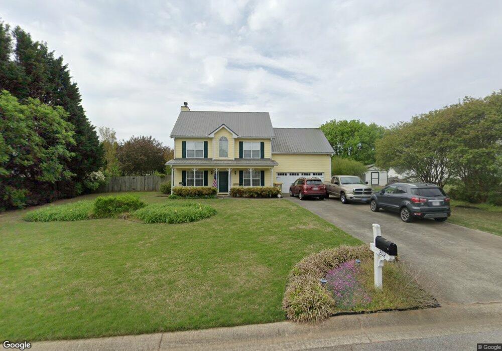
202 Angie Way Unit 2 Bethlehem, GA 30620
Estimated Value: $344,000 - $355,000
3
Beds
3
Baths
1,960
Sq Ft
$178/Sq Ft
Est. Value
About This Home
This home is located at 202 Angie Way Unit 2, Bethlehem, GA 30620 and is currently estimated at $348,035, approximately $177 per square foot. 202 Angie Way Unit 2 is a home located in Barrow County with nearby schools including Yargo Elementary School, Haymon-Morris Middle School, and Apalachee High School.
Ownership History
Date
Name
Owned For
Owner Type
Purchase Details
Closed on
Jun 30, 1998
Sold by
Stancil Brenda
Bought by
Towler James W and Towler Line M
Current Estimated Value
Home Financials for this Owner
Home Financials are based on the most recent Mortgage that was taken out on this home.
Original Mortgage
$107,900
Outstanding Balance
$20,483
Interest Rate
7.1%
Mortgage Type
New Conventional
Estimated Equity
$327,552
Purchase Details
Closed on
Jan 22, 1998
Sold by
C G S Development In
Bought by
Brenda Stancil Real
Purchase Details
Closed on
Jul 9, 1996
Bought by
C G S Development In
Create a Home Valuation Report for This Property
The Home Valuation Report is an in-depth analysis detailing your home's value as well as a comparison with similar homes in the area
Home Values in the Area
Average Home Value in this Area
Purchase History
| Date | Buyer | Sale Price | Title Company |
|---|---|---|---|
| Towler James W | $119,900 | -- | |
| Brenda Stancil Real | $38,000 | -- | |
| C G S Development In | -- | -- |
Source: Public Records
Mortgage History
| Date | Status | Borrower | Loan Amount |
|---|---|---|---|
| Open | Towler James W | $107,900 |
Source: Public Records
Tax History
| Year | Tax Paid | Tax Assessment Tax Assessment Total Assessment is a certain percentage of the fair market value that is determined by local assessors to be the total taxable value of land and additions on the property. | Land | Improvement |
|---|---|---|---|---|
| 2025 | $2,220 | $103,997 | $26,800 | $77,197 |
| 2024 | $2,274 | $101,795 | $26,800 | $74,995 |
| 2023 | $1,863 | $102,195 | $26,800 | $75,395 |
| 2022 | $2,300 | $88,685 | $22,400 | $66,285 |
| 2021 | $2,256 | $82,285 | $16,000 | $66,285 |
| 2020 | $1,884 | $66,526 | $16,000 | $50,526 |
| 2019 | $1,914 | $66,526 | $16,000 | $50,526 |
| 2018 | $1,821 | $63,726 | $13,200 | $50,526 |
| 2017 | $1,615 | $55,484 | $13,200 | $42,284 |
| 2016 | $1,390 | $48,276 | $13,200 | $35,076 |
| 2015 | $1,408 | $48,678 | $13,200 | $35,478 |
| 2014 | $1,228 | $42,346 | $6,468 | $35,878 |
| 2013 | -- | $39,776 | $6,468 | $33,308 |
Source: Public Records
Map
Nearby Homes
- 209 Angie Way
- 1256 Loganville Hwy
- 1129 Loganville Hwy
- 627 Bridle Creek Dr
- 907 Downing Dr
- 923 Downing Dr
- 1188 Carl-Bethlehem Rd
- 449 Carl Bethlehem Rd SW
- 732 Ridgeland Rd
- 611 Mcdowell Ln
- 1202 Benton Ct
- 1309 Tom Miller Rd
- 738 Worth Ct
- 724 Westbury Dr
- 253 Meadows Dr
- 286 Meadows Dr
- 308 Meadows Dr
- 631 Saddle Ridge Dr
- 713 Carl Bethlehem Rd
- 236 Vision St
- 200 Angie Way
- 204 Angie Way Unit 2
- 206 Angie Way
- 301 Ron Dr
- 305 Ron Dr
- 203 Angie Way
- 782 Brookelynn Trace
- 201 Angie Way Unit 2
- 205 Angie Way Unit 2
- 307 Ron Dr Unit 2
- 0 Stonewilde at Turnberr Unit 3173599
- 208 Angie Way Unit 2
- 780 Brookelynn Trace
- 207 Angie Way
- 784 Brookelynn Trace
- 778 Brookelynn Trace
- 778 Brookelyn Trace
- 786 Brookelynn Trace Unit 2
- 786 Brookelyn Trace
- 776 Brookelynn Trace
Your Personal Tour Guide
Ask me questions while you tour the home.