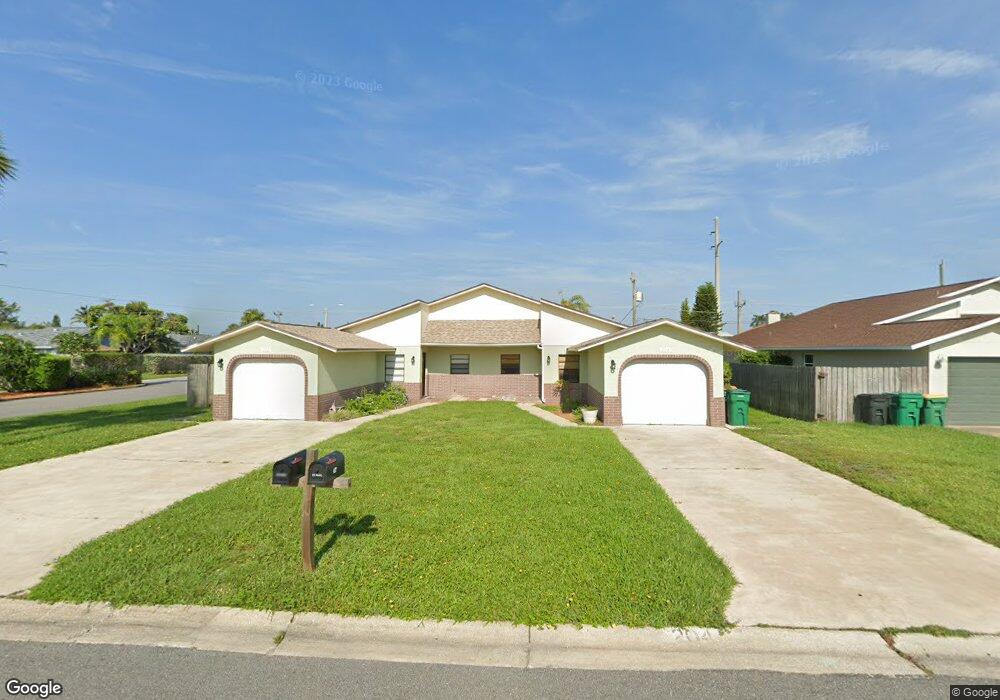
202 Atlas Ln Satellite Beach, FL 32937
Estimated Value: $494,000 - $569,966
--
Bed
3
Baths
2,236
Sq Ft
$242/Sq Ft
Est. Value
About This Home
This home is located at 202 Atlas Ln, Satellite Beach, FL 32937 and is currently estimated at $540,742, approximately $241 per square foot. 202 Atlas Ln is a home located in Brevard County with nearby schools including Spessard L. Holland Elementary School, Satellite Senior High School, and DeLaura Middle School.
Ownership History
Date
Name
Owned For
Owner Type
Purchase Details
Closed on
Jul 29, 2002
Sold by
Hobbs Roderick A
Bought by
Ogle Virgil Dean
Current Estimated Value
Home Financials for this Owner
Home Financials are based on the most recent Mortgage that was taken out on this home.
Original Mortgage
$140,000
Outstanding Balance
$59,537
Interest Rate
6.62%
Estimated Equity
$481,205
Purchase Details
Closed on
Jul 22, 1998
Sold by
Eaton Margaret Anne
Bought by
Hobbs Roderick A and Hobbs Alma M
Home Financials for this Owner
Home Financials are based on the most recent Mortgage that was taken out on this home.
Original Mortgage
$141,780
Interest Rate
6.97%
Mortgage Type
VA
Create a Home Valuation Report for This Property
The Home Valuation Report is an in-depth analysis detailing your home's value as well as a comparison with similar homes in the area
Home Values in the Area
Average Home Value in this Area
Purchase History
| Date | Buyer | Sale Price | Title Company |
|---|---|---|---|
| Ogle Virgil Dean | $179,500 | -- | |
| Hobbs Roderick A | $139,000 | -- |
Source: Public Records
Mortgage History
| Date | Status | Borrower | Loan Amount |
|---|---|---|---|
| Open | Ogle Virgil Dean | $140,000 | |
| Previous Owner | Hobbs Roderick A | $141,780 |
Source: Public Records
Tax History Compared to Growth
Tax History
| Year | Tax Paid | Tax Assessment Tax Assessment Total Assessment is a certain percentage of the fair market value that is determined by local assessors to be the total taxable value of land and additions on the property. | Land | Improvement |
|---|---|---|---|---|
| 2025 | $6,397 | $538,560 | -- | -- |
| 2024 | $6,001 | $538,560 | -- | -- |
| 2023 | $6,001 | $491,040 | $0 | $0 |
| 2022 | $4,730 | $352,130 | $0 | $0 |
| 2021 | $4,343 | $262,640 | $100,000 | $162,640 |
| 2020 | $4,166 | $250,140 | $85,000 | $165,140 |
| 2019 | $4,084 | $248,230 | $85,000 | $163,230 |
Source: Public Records
Map
Nearby Homes
- 867 S Patrick Dr
- 336 Jupiter Dr
- 335 Coral Reef Dr
- 935 & 937 S Patrick Dr
- 432 N Neptune Dr
- 429 S Neptune Dr
- 437 N Neptune Dr
- 313 Polaris Dr
- 27 Tortuga Trail
- 29 Tortuga Trail
- 31 Tortuga Trail
- 11 Barbara Ct
- 33 Tortuga Trail
- 35 Tortuga Trail
- 37 Tortuga Trail
- 53 Emerald Ct
- 36 Sunset St
- 345 S Point Ct
- Pearson End Unit Plan at Tortuga Cay
- Pearson Interior Unit Plan at Tortuga Cay
- 206 Atlas Ln
- 208 Atlas Ln
- 365 Titan Dr
- 363 Titan Dr
- 210 Atlas Ln
- 340 Apollo Dr
- 913 S Patrick Dr
- 911 S Patrick Dr
- 911 South Patrick Dr Unit 911
- 911 South Patrick Dr
- 911 N South Patrick Unit 911
- 911913 S Patrick
- 341 Apollo Dr
- 917 South Patrick Dr
- 917 South Patrick Dr
- 150 Atlas Ln
- 341 Gemini Dr
- 152 Atlas Ln
- 142 Atlas Ln
- 140 Atlas Ln