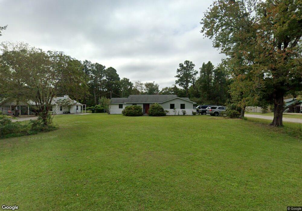
202 Bayshore Dr Wilmington, NC 28411
Estimated Value: $357,000 - $426,000
3
Beds
2
Baths
1,509
Sq Ft
$266/Sq Ft
Est. Value
About This Home
This home is located at 202 Bayshore Dr, Wilmington, NC 28411 and is currently estimated at $400,742, approximately $265 per square foot. 202 Bayshore Dr is a home located in New Hanover County with nearby schools including Ogden Elementary School, Holly Shelter Middle School, and Emsley A. Laney High School.
Ownership History
Date
Name
Owned For
Owner Type
Purchase Details
Closed on
Oct 1, 1987
Sold by
Brown Haywood B Eleanor B
Bought by
Motsinger J Kent Theresa
Current Estimated Value
Purchase Details
Closed on
Jun 1, 1986
Sold by
Farmer Tony Caroll Sara P
Bought by
Brown Haywood B Eleanor B
Purchase Details
Closed on
May 1, 1982
Sold by
Farmer Thomas Edison
Bought by
Farmer Tony Caroll Sara P
Purchase Details
Closed on
Sep 1, 1968
Bought by
Farmer Thomas Edison
Create a Home Valuation Report for This Property
The Home Valuation Report is an in-depth analysis detailing your home's value as well as a comparison with similar homes in the area
Home Values in the Area
Average Home Value in this Area
Purchase History
| Date | Buyer | Sale Price | Title Company |
|---|---|---|---|
| Motsinger J Kent Theresa | $4,500 | -- | |
| Brown Haywood B Eleanor B | $45,000 | -- | |
| Farmer Tony Caroll Sara P | $19,500 | -- | |
| Farmer Thomas Edison | -- | -- |
Source: Public Records
Tax History Compared to Growth
Tax History
| Year | Tax Paid | Tax Assessment Tax Assessment Total Assessment is a certain percentage of the fair market value that is determined by local assessors to be the total taxable value of land and additions on the property. | Land | Improvement |
|---|---|---|---|---|
| 2025 | $1,278 | $374,500 | $132,200 | $242,300 |
| 2023 | $1,278 | $230,500 | $103,500 | $127,000 |
| 2022 | $1,284 | $230,500 | $103,500 | $127,000 |
| 2021 | $1,274 | $230,500 | $103,500 | $127,000 |
| 2020 | $1,213 | $191,700 | $78,800 | $112,900 |
| 2019 | $1,054 | $191,700 | $78,800 | $112,900 |
| 2018 | $1,213 | $191,700 | $78,800 | $112,900 |
| 2017 | $1,241 | $191,700 | $78,800 | $112,900 |
| 2016 | $1,316 | $189,900 | $78,800 | $111,100 |
| 2015 | $1,223 | $189,900 | $78,800 | $111,100 |
| 2014 | $1,202 | $189,900 | $78,800 | $111,100 |
Source: Public Records
Map
Nearby Homes
- 7625 Lost Tree Rd
- 7301 Featherstone Ct
- 229 Derry Ct
- 7417 Coker Ct
- 430 Upland Dr
- 208 Bloomington Ln
- 7432 Ern Way
- 232 Bloomington Ln
- 7613 Yvonne Rd
- 437 Biscayne Dr
- 512 Diane Dr
- 249 Palm Grove Dr
- 133 Graystone Rd
- 7135 Maple Leaf Dr
- 7219 Twin Ash Ct
- 7124 Maple Leaf Dr
- 628 Middle Sound Loop Rd
- 121 S Branch Rd
- 7204 Twin Ash Ct
- 608 Countryside Ln
- 206 Bayshore Dr
- 142 Bayshore Dr
- 201 Shorepoint Dr
- 210 Bayshore Dr
- 205 Shorepoint Dr
- 7470 Thais Trail Unit 582
- 138 Bayshore Dr
- 201 Bayshore Dr
- 143 Bayshore Dr
- 7466 Thais Trail
- 205 Bayshore Dr
- 209 Shorepoint Dr
- 214 Bayshore Dr
- 139 Bayshore Dr
- 7468 Thais Trail Unit 572
- 7460 Thais Trail Unit 54
- 7464 Thais Trail Unit 552
- 209 Bayshore Dr
- 7456 Thais Trail
- 7456 Thais