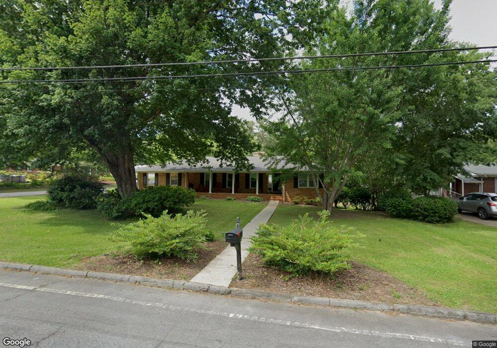
202 Belva St Carrollton, GA 30117
Estimated Value: $218,281 - $237,000
3
Beds
2
Baths
1,378
Sq Ft
$166/Sq Ft
Est. Value
About This Home
This home is located at 202 Belva St, Carrollton, GA 30117 and is currently estimated at $228,570, approximately $165 per square foot. 202 Belva St is a home located in Carroll County with nearby schools including Carrollton Elementary School, Carrollton Upper Elementary School, and Carrollton Middle School.
Ownership History
Date
Name
Owned For
Owner Type
Purchase Details
Closed on
Apr 9, 2014
Sold by
Parham Curtis James
Bought by
Miller Angelia Nicole
Current Estimated Value
Purchase Details
Closed on
Mar 30, 2010
Sold by
Federal Natinal Mortgage Association
Bought by
Parham Curtis
Purchase Details
Closed on
Dec 1, 2009
Sold by
Bac Home Loans Servicing L
Bought by
Federal National Mtg Associati
Purchase Details
Closed on
May 1, 1985
Bought by
Martin
Create a Home Valuation Report for This Property
The Home Valuation Report is an in-depth analysis detailing your home's value as well as a comparison with similar homes in the area
Home Values in the Area
Average Home Value in this Area
Purchase History
| Date | Buyer | Sale Price | Title Company |
|---|---|---|---|
| Miller Angelia Nicole | -- | -- | |
| Parham Curtis | $21,500 | -- | |
| Federal National Mtg Associati | $49,044 | -- | |
| Bac Home Loans Servicing Lp | $49,044 | -- | |
| Martin | -- | -- |
Source: Public Records
Tax History Compared to Growth
Tax History
| Year | Tax Paid | Tax Assessment Tax Assessment Total Assessment is a certain percentage of the fair market value that is determined by local assessors to be the total taxable value of land and additions on the property. | Land | Improvement |
|---|---|---|---|---|
| 2024 | $1,701 | $75,197 | $4,000 | $71,197 |
| 2023 | $1,701 | $68,744 | $4,000 | $64,744 |
| 2022 | $1,403 | $55,939 | $4,000 | $51,939 |
| 2021 | $1,245 | $48,580 | $4,000 | $44,580 |
| 2020 | $1,110 | $43,258 | $4,000 | $39,258 |
| 2019 | $1,033 | $39,934 | $4,000 | $35,934 |
| 2018 | $731 | $27,841 | $4,000 | $23,841 |
| 2017 | $733 | $27,841 | $4,000 | $23,841 |
| 2016 | $734 | $27,841 | $4,000 | $23,841 |
| 2015 | $513 | $18,351 | $4,000 | $14,351 |
| 2014 | $515 | $18,351 | $4,000 | $14,351 |
Source: Public Records
Map
Nearby Homes
- 122 Mandeville Ave
- 114 Bennett Cir
- 119 Oxford Square
- 103 Oxford Square
- 120 Stewart St
- 201 Stewart St
- 322 Cedar St
- 406 Harmon Ave
- 317 Bledsoe St
- 114 Green Point Way
- 521 Adamson Ave
- 509 Adamson Ave
- Plan 2121 at Canterbury Villas
- Plan 2307 at Canterbury Villas
- 204 Chaucer Ln
- Plan 1522 at Canterbury Villas
- Plan 1634 at Canterbury Villas
- Plan 2628 at Canterbury Villas
- 0 Burns Rd Unit LOT 2 10571612
- 0 Burns Rd Unit LOT 3 10571635