Estimated Value: $391,000 - $436,000
Studio
--
Bath
2,792
Sq Ft
$149/Sq Ft
Est. Value
About This Home
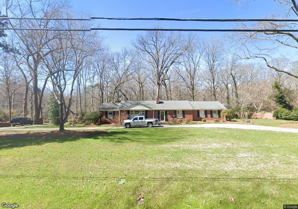
This home is located at 202 Bratton Ave, York, SC 29745 and is currently estimated at $415,152, approximately $148 per square foot. 202 Bratton Ave is a home located in York County with nearby schools including Cotton Belt Elementary School, York Intermediate School, and York Middle School.
Ownership History
Date
Name
Owned For
Owner Type
Purchase Details
Closed on
Oct 9, 2019
Sold by
Iman R M and Inman Elzabeth Ann S
Bought by
Mellon Leann A and Mellon Steven Wayne
Current Estimated Value
Home Financials for this Owner
Home Financials are based on the most recent Mortgage that was taken out on this home.
Original Mortgage
$256,500
Outstanding Balance
$223,713
Interest Rate
3.5%
Mortgage Type
New Conventional
Estimated Equity
$191,439
Create a Home Valuation Report for This Property
The Home Valuation Report is an in-depth analysis detailing your home's value as well as a comparison with similar homes in the area
Home Values in the Area
Average Home Value in this Area
Purchase History
| Date | Buyer | Sale Price | Title Company |
|---|---|---|---|
| Mellon Leann A | $270,000 | None Available |
Source: Public Records
Mortgage History
| Date | Status | Borrower | Loan Amount |
|---|---|---|---|
| Open | Mellon Leann A | $256,500 |
Source: Public Records
Tax History
| Year | Tax Paid | Tax Assessment Tax Assessment Total Assessment is a certain percentage of the fair market value that is determined by local assessors to be the total taxable value of land and additions on the property. | Land | Improvement |
|---|---|---|---|---|
| 2025 | $3,196 | $11,756 | $1,514 | $10,242 |
| 2024 | $2,761 | $10,223 | $1,520 | $8,703 |
| 2023 | $2,798 | $10,223 | $1,520 | $8,703 |
| 2022 | $2,813 | $10,223 | $1,520 | $8,703 |
| 2021 | -- | $10,223 | $1,520 | $8,703 |
| 2020 | $2,776 | $10,223 | $0 | $0 |
| 2019 | $1,998 | $15,390 | $0 | $0 |
| 2018 | $1,955 | $8,840 | $0 | $0 |
| 2017 | $1,847 | $8,840 | $0 | $0 |
| 2016 | $1,833 | $8,840 | $0 | $0 |
| 2014 | $1,635 | $8,840 | $1,520 | $7,320 |
| 2013 | $1,635 | $8,400 | $1,520 | $6,880 |
Source: Public Records
Map
Nearby Homes
- 405 Bratton Ave
- 27 Southbrook Dr
- 2038 Crooked Oak Ln Unit 16
- 223 Wiley Ave
- 133 Hickory Ln
- 814 Sparano Loop
- 1124 Haltom Hollow
- 1120 Haltom Hollow
- 239 Ella Claire Dr
- 227 Ella Claire Dr
- 267 E Jefferson St
- 1590 Autumn Ln Unit 116
- 454 Brick House Rd
- 458 Brick House Rd
- 231 Ella Claire Dr
- 467 Brick House Rd
- 5 Cartwright St
- 534 Emily Katelyn Rd
- 538 Emily Katelyn Rd
- 542 Emily Katelyn Rd
- 204 Bratton Ave
- 200 Bratton Ave
- 205 Bratton Ave
- 206 Bratton Ave
- 203 Bratton Ave
- 211 Bratton Ave
- 1 Park Dr
- 110 Benfield Ave
- 201 Bratton Ave
- 403 Lakeview Dr
- 108 Benfield Ave
- 112 Benfield Ave
- 104 Bratton Ave
- 7 Park Dr
- 107 Bratton Ave
- 2 Park Dr
- 5 Tucker Ave
- 106 Benfield Ave
- 503 Lakeview Dr
- 102 Bratton Ave
Your Personal Tour Guide
Ask me questions while you tour the home.