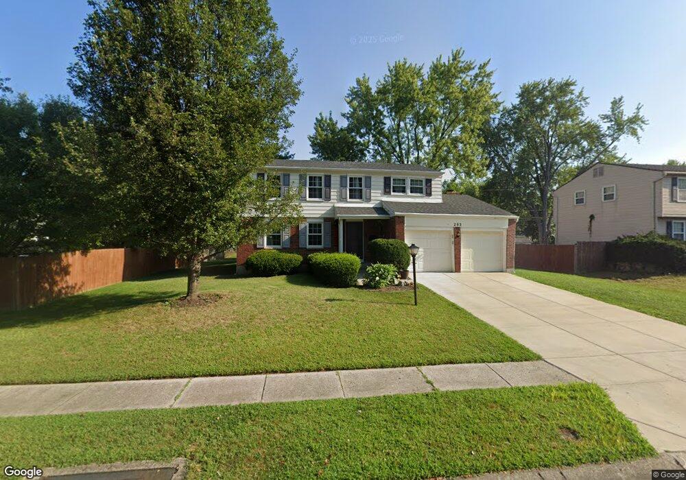
202 Brentwood Dr Englewood, OH 45322
Estimated Value: $237,000 - $261,000
4
Beds
3
Baths
1,862
Sq Ft
$135/Sq Ft
Est. Value
About This Home
This home is located at 202 Brentwood Dr, Englewood, OH 45322 and is currently estimated at $251,108, approximately $134 per square foot. 202 Brentwood Dr is a home located in Montgomery County with nearby schools including Englewood Hills Elementary School, Northmont High School, and Trotwood Preparatory & Fitness Academy.
Ownership History
Date
Name
Owned For
Owner Type
Purchase Details
Closed on
Sep 30, 2003
Sold by
Williams Curtis R and Williams Argiro F
Bought by
Colstock Feleman R and Domineck Colstock Chaka A
Current Estimated Value
Home Financials for this Owner
Home Financials are based on the most recent Mortgage that was taken out on this home.
Original Mortgage
$112,500
Outstanding Balance
$48,545
Interest Rate
5.12%
Mortgage Type
Purchase Money Mortgage
Estimated Equity
$202,563
Create a Home Valuation Report for This Property
The Home Valuation Report is an in-depth analysis detailing your home's value as well as a comparison with similar homes in the area
Home Values in the Area
Average Home Value in this Area
Purchase History
| Date | Buyer | Sale Price | Title Company |
|---|---|---|---|
| Colstock Feleman R | $125,000 | Hallmark Title |
Source: Public Records
Mortgage History
| Date | Status | Borrower | Loan Amount |
|---|---|---|---|
| Open | Colstock Feleman R | $112,500 |
Source: Public Records
Tax History Compared to Growth
Tax History
| Year | Tax Paid | Tax Assessment Tax Assessment Total Assessment is a certain percentage of the fair market value that is determined by local assessors to be the total taxable value of land and additions on the property. | Land | Improvement |
|---|---|---|---|---|
| 2024 | $3,678 | $64,510 | $12,600 | $51,910 |
| 2023 | $3,678 | $64,510 | $12,600 | $51,910 |
| 2022 | $3,319 | $44,800 | $8,750 | $36,050 |
| 2021 | $3,329 | $44,800 | $8,750 | $36,050 |
| 2020 | $3,268 | $44,800 | $8,750 | $36,050 |
| 2019 | $3,118 | $38,320 | $8,750 | $29,570 |
| 2018 | $3,061 | $38,320 | $8,750 | $29,570 |
| 2017 | $3,040 | $38,320 | $8,750 | $29,570 |
| 2016 | $3,272 | $40,550 | $8,750 | $31,800 |
| 2015 | $2,991 | $40,550 | $8,750 | $31,800 |
| 2014 | $2,991 | $40,550 | $8,750 | $31,800 |
| 2012 | -- | $47,430 | $8,400 | $39,030 |
Source: Public Records
Map
Nearby Homes
- 1008 Merrywood Dr
- 229 Brookwood Dr
- 1017 Terracewood Dr
- 505 Durst Dr
- 1010 Heathwood Dr
- 510 Lambert Ln
- 4220 Pleasanton Rd
- 4230 Pleasanton Rd
- 4030 Gateway Dr
- 206 Gardengrove Way
- 4329 Gorman Ave
- 0 Taywood Rd
- 717 Woodlawn Ave
- 174 Candle Ct Unit 12
- 178 Candle Ct Unit 14
- 718 Bonnycastle Ave
- 510 Rohr Ln
- 830 W Wenger Rd
- 4161 Gorman Ave
- 7000 Kinsey Rd
- 204 Brentwood Dr
- 204 Brookwood Dr
- 202 Brookwood Dr
- 261 Porter Dr
- 259 Porter Dr
- 206 Brentwood Dr
- 203 Brentwood Dr
- 263 Porter Dr
- 206 Brookwood Dr
- 205 Brentwood Dr
- 257 Porter Dr
- 207 Brentwood Dr
- 208 Brentwood Dr
- 255 Porter Dr
- 205 Brookwood Dr
- 208 Brookwood Dr
- 203 Brookwood Dr
- 210 Brookwood Dr
- 260 Porter Dr
- 447 Katy Ln