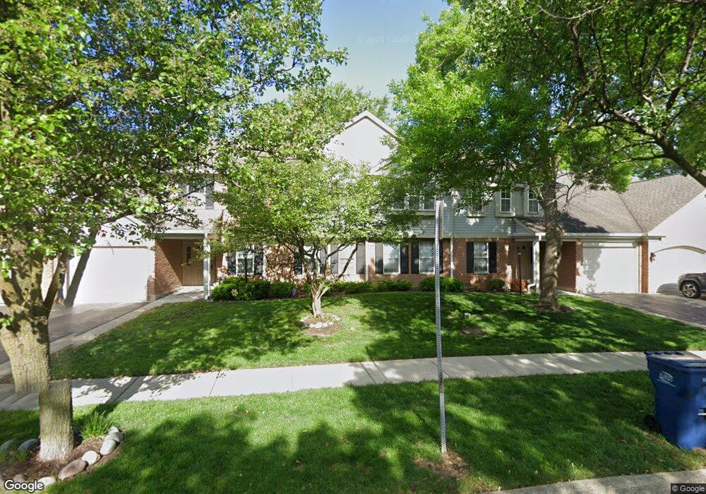
202 Brookston Dr Unit 1212LB Schaumburg, IL 60193
East Schaumburg NeighborhoodEstimated Value: $242,000 - $284,000
2
Beds
--
Bath
1,500
Sq Ft
$179/Sq Ft
Est. Value
About This Home
This home is located at 202 Brookston Dr Unit 1212LB, Schaumburg, IL 60193 and is currently estimated at $268,423, approximately $178 per square foot. 202 Brookston Dr Unit 1212LB is a home located in Cook County with nearby schools including Michael Collins Elementary School, Margaret Mead Junior High School, and J B Conant High School.
Ownership History
Date
Name
Owned For
Owner Type
Purchase Details
Closed on
Jan 13, 2016
Sold by
Blase Nancy
Bought by
Blase Nancy and The Nancy Blase Trust
Current Estimated Value
Create a Home Valuation Report for This Property
The Home Valuation Report is an in-depth analysis detailing your home's value as well as a comparison with similar homes in the area
Home Values in the Area
Average Home Value in this Area
Purchase History
| Date | Buyer | Sale Price | Title Company |
|---|---|---|---|
| Blase Nancy | -- | Attorney |
Source: Public Records
Mortgage History
| Date | Status | Borrower | Loan Amount |
|---|---|---|---|
| Closed | Blase Nancy | $25,000 | |
| Closed | Blase Nancy L | $38,000 | |
| Closed | Blase Nancy L | $25,000 | |
| Closed | Blase Nancy L | $12,000 |
Source: Public Records
Tax History Compared to Growth
Tax History
| Year | Tax Paid | Tax Assessment Tax Assessment Total Assessment is a certain percentage of the fair market value that is determined by local assessors to be the total taxable value of land and additions on the property. | Land | Improvement |
|---|---|---|---|---|
| 2024 | $3,661 | $19,037 | $3,680 | $15,357 |
| 2023 | $3,499 | $19,037 | $3,680 | $15,357 |
| 2022 | $3,499 | $19,037 | $3,680 | $15,357 |
| 2021 | $551 | $14,117 | $4,715 | $9,402 |
| 2020 | $505 | $14,117 | $4,715 | $9,402 |
| 2019 | $502 | $15,693 | $4,715 | $10,978 |
| 2018 | $563 | $10,560 | $3,967 | $6,593 |
| 2017 | $544 | $10,560 | $3,967 | $6,593 |
| 2016 | $1,129 | $10,560 | $3,967 | $6,593 |
| 2015 | $1,845 | $8,792 | $3,450 | $5,342 |
| 2014 | $1,841 | $8,792 | $3,450 | $5,342 |
| 2013 | $1,777 | $8,792 | $3,450 | $5,342 |
Source: Public Records
Map
Nearby Homes
- 1301 Timberwood Ct Unit D1
- 1254 Plum Tree Ct Unit A2
- 1256 Plum Tree Ct Unit B2
- 321 Woodbury Ct Unit D2
- 1300 Woodside Ct Unit B1
- 101 Bar Harbour Rd Unit 3
- 15 Bar Harbour Rd Unit 4F
- 26 Egg Harbour Ct
- 236 Deerpath Ct Unit A2
- 327 Wildberry Ct Unit D2
- 232 Driftwood Ln Unit D1
- 263 Driftwood Ln Unit 2D
- 307 University Ln Unit A
- 1810 Fox Run Dr Unit C
- 251 University Ln
- 1862 Fox Run Dr Unit D4
- 1532 Petersham Ln
- 243 Spring Creek Cir Unit 462
- 1771 Vermont Dr
- 1527 Lexington Cir
- 202 Brookston Dr Unit 1212LA
- 202 Brookston Dr Unit 1212LA
- 202 Brookston Dr Unit 1212LB
- 202 Brookston Dr Unit B1
- 202 Brookston Dr Unit A1
- 200 Brookston Dr Unit 1212RD
- 200 Brookston Dr Unit 1212RC
- 200 Brookston Dr Unit 1212RC
- 200 Brookston Dr Unit 1212RD
- 200 Brookston Dr Unit C1
- 200 Brookston Dr Unit C2
- 200 Brookston Dr Unit 2R
- 152 Brookston Dr Unit 913RD1
- 152 Brookston Dr Unit 913RD2
- 152 Brookston Dr Unit 913RC1
- 152 Brookston Dr Unit 913RC2
- 152 Brookston Dr Unit D2
- 152 Brookston Dr Unit D1
- 154 Brookston Dr Unit B1
- 154 Brookston Dr Unit 913LB1