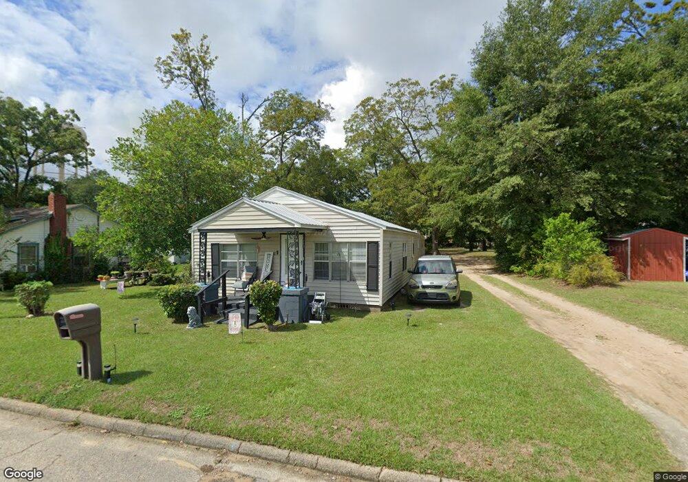
202 Cable St Headland, AL 36345
Estimated Value: $88,703 - $178,000
--
Bed
--
Bath
1,275
Sq Ft
$101/Sq Ft
Est. Value
About This Home
This home is located at 202 Cable St, Headland, AL 36345 and is currently estimated at $129,176, approximately $101 per square foot. 202 Cable St is a home located in Henry County with nearby schools including Headland Elementary School, Headland Middle School, and Headland High School.
Ownership History
Date
Name
Owned For
Owner Type
Purchase Details
Closed on
Jul 31, 2024
Sold by
Mcnealey Willie Fred and Mcnealey Alice Maudeline
Bought by
Wiregrass Capital Group Llc Isaoa/Atima
Current Estimated Value
Home Financials for this Owner
Home Financials are based on the most recent Mortgage that was taken out on this home.
Original Mortgage
$60,000
Interest Rate
6.2%
Mortgage Type
New Conventional
Purchase Details
Closed on
Dec 18, 2023
Sold by
Mcnealey Willie Fred and Mcnealey Alice M
Bought by
Bond Bill G and Bond Melinda
Purchase Details
Closed on
Sep 25, 2009
Sold by
Reynolds Jerry W
Bought by
Mcnealey Willie F and Mcnealey
Create a Home Valuation Report for This Property
The Home Valuation Report is an in-depth analysis detailing your home's value as well as a comparison with similar homes in the area
Home Values in the Area
Average Home Value in this Area
Purchase History
| Date | Buyer | Sale Price | Title Company |
|---|---|---|---|
| Wiregrass Capital Group Llc Isaoa/Atima | $60,000 | None Listed On Document | |
| Bond Bill G | -- | None Listed On Document | |
| Mcnealey Willie F | $10,000 | -- |
Source: Public Records
Mortgage History
| Date | Status | Borrower | Loan Amount |
|---|---|---|---|
| Previous Owner | Wiregrass Capital Group Llc Isaoa/Atima | $60,000 |
Source: Public Records
Tax History Compared to Growth
Tax History
| Year | Tax Paid | Tax Assessment Tax Assessment Total Assessment is a certain percentage of the fair market value that is determined by local assessors to be the total taxable value of land and additions on the property. | Land | Improvement |
|---|---|---|---|---|
| 2024 | $701 | $15,147 | $1,110 | $14,037 |
| 2023 | $667 | $14,024 | $1,110 | $12,914 |
| 2022 | $544 | $14,586 | $1,110 | $13,476 |
| 2021 | $477 | $10,821 | $1,110 | $9,711 |
| 2020 | $465 | $10,554 | $1,110 | $9,444 |
| 2019 | $465 | $10,554 | $1,110 | $9,444 |
| 2018 | $436 | $9,910 | $1,000 | $8,910 |
| 2017 | $426 | $11,487 | $1,000 | $10,487 |
| 2016 | $426 | $9,677 | $1,000 | $8,677 |
| 2015 | $433 | $48,383 | $0 | $0 |
| 2014 | $433 | $49,201 | $0 | $0 |
Source: Public Records
Map
Nearby Homes
- Lot 5 Block "B" County Road 20
- Lot 6 Block "B" County Road 20
- Lot 2 Block "B" County Road 20
- Lot 3 Block "B" County Road 20
- 611 Mitchell St
- 505 Cleveland St
- 622 Peachtree St
- 207 Cambridge Dr
- 124 Edgewood Trail
- 128 Edgewood Trail
- 126 Edgewood Trail
- 123 Edgewood Trail
- 127 Edgewood Trail
- 125 Edgewood Trail
- 129 Edgewood Trail
- 204 Scarlet Oak Dr
- 206 Cambridge Dr
- TBD Us Hwy 431
- 418 S Main St
- 111 Creekridge St