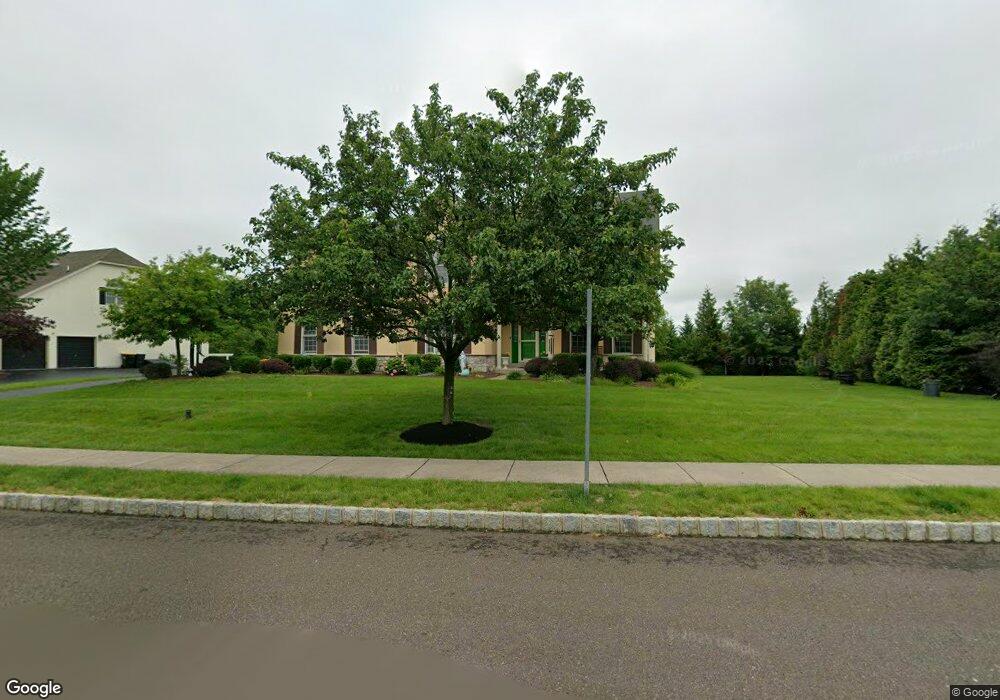
202 Cadwallader Dr Warrington, PA 18976
Estimated Value: $903,626 - $1,073,000
4
Beds
4
Baths
3,262
Sq Ft
$308/Sq Ft
Est. Value
About This Home
This home is located at 202 Cadwallader Dr, Warrington, PA 18976 and is currently estimated at $1,003,407, approximately $307 per square foot. 202 Cadwallader Dr is a home located in Bucks County with nearby schools including Kutz Elementary School, Lenape Middle School, and Central Bucks High School-West.
Ownership History
Date
Name
Owned For
Owner Type
Purchase Details
Closed on
Jul 11, 2008
Sold by
The Cutler Group Inc
Bought by
Dcosta Agnello M and Dcosta Rupa A
Current Estimated Value
Home Financials for this Owner
Home Financials are based on the most recent Mortgage that was taken out on this home.
Original Mortgage
$400,000
Outstanding Balance
$263,490
Interest Rate
6.49%
Mortgage Type
Purchase Money Mortgage
Estimated Equity
$739,917
Create a Home Valuation Report for This Property
The Home Valuation Report is an in-depth analysis detailing your home's value as well as a comparison with similar homes in the area
Home Values in the Area
Average Home Value in this Area
Purchase History
| Date | Buyer | Sale Price | Title Company |
|---|---|---|---|
| Dcosta Agnello M | $540,000 | None Available |
Source: Public Records
Mortgage History
| Date | Status | Borrower | Loan Amount |
|---|---|---|---|
| Open | Dcosta Agnello M | $400,000 |
Source: Public Records
Tax History Compared to Growth
Tax History
| Year | Tax Paid | Tax Assessment Tax Assessment Total Assessment is a certain percentage of the fair market value that is determined by local assessors to be the total taxable value of land and additions on the property. | Land | Improvement |
|---|---|---|---|---|
| 2025 | $10,343 | $56,030 | $10,380 | $45,650 |
| 2024 | $10,343 | $56,030 | $10,380 | $45,650 |
| 2023 | $2,360 | $56,030 | $10,380 | $45,650 |
| 2022 | $9,387 | $56,030 | $10,380 | $45,650 |
| 2021 | $9,282 | $56,030 | $10,380 | $45,650 |
| 2020 | $9,282 | $56,030 | $10,380 | $45,650 |
| 2019 | $9,226 | $56,030 | $10,380 | $45,650 |
| 2018 | $9,124 | $56,030 | $10,380 | $45,650 |
| 2017 | $9,001 | $56,030 | $10,380 | $45,650 |
| 2016 | $8,973 | $56,030 | $10,380 | $45,650 |
| 2015 | -- | $56,030 | $10,380 | $45,650 |
| 2014 | -- | $56,030 | $10,380 | $45,650 |
Source: Public Records
Map
Nearby Homes
- 612 Bethel Ln Unit THE ROOSEVELT PLAN
- 100 Ginko St Unit 202
- 200 Beech Blvd Unit 301
- 1323 School Ln
- 858 Elbow Ln
- 20 Woodstone Dr
- 430 Homestead Cir
- 623 Addison Way
- 2420 Dogleg Dr Unit 33G
- 242 Snapdragon St
- 2226 Orchard Hill Cir
- 73 Tradesville Dr
- 73 Tradesville Dr Unit 80
- 52 Tradesville Dr Unit 83
- Vetri Plan at Doylestown Walk
- 52 Tradesville Dr
- 625 N Settlers Cir
- 803 Sweet Cherry St
- 2 Mill Creek Dr
- 2 Mill Creek Dr Unit 137
- 204 Cadwallader Dr
- 203 Cadwallader Dr
- 201 Cadwallader Dr
- 205 Cadwallader Dr
- 206 Cadwallader Dr
- 403 Bens Run Ct
- 401 Bens Run Ct
- 207 Cadwallader Dr
- 208 Cadwallader Dr
- 207 Cadwallader Rd
- 207 Cadwallader Rd
- 405 Bens Run Ct
- 409 Bens Run Ct
- 402 Bens Run Ct
- 210 Cadwallader Dr
- 404 Bens Run Ct
- 211 Cadwallader Dr
- 411 Bens Run Ct
- 211 Cadwallader Rd Unit 15
- 406 Bens Run Ct