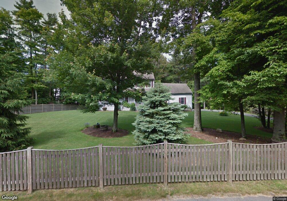
202 Captain Nathaniel Dr Hanson, MA 02341
Estimated Value: $704,540 - $1,093,000
4
Beds
3
Baths
1,886
Sq Ft
$441/Sq Ft
Est. Value
About This Home
This home is located at 202 Captain Nathaniel Dr, Hanson, MA 02341 and is currently estimated at $830,885, approximately $440 per square foot. 202 Captain Nathaniel Dr is a home located in Plymouth County with nearby schools including St Bridget School.
Ownership History
Date
Name
Owned For
Owner Type
Purchase Details
Closed on
Jun 28, 2005
Sold by
Guarino Joseph E and Guarino Ann M
Bought by
Phelps Edward R and Phelps Susan R
Current Estimated Value
Home Financials for this Owner
Home Financials are based on the most recent Mortgage that was taken out on this home.
Original Mortgage
$359,650
Outstanding Balance
$189,678
Interest Rate
5.82%
Mortgage Type
Purchase Money Mortgage
Estimated Equity
$641,207
Purchase Details
Closed on
Apr 24, 1998
Sold by
Collamore Ests Rt and Konish William D
Bought by
Guarino Joseph E and Guarino Ann M
Create a Home Valuation Report for This Property
The Home Valuation Report is an in-depth analysis detailing your home's value as well as a comparison with similar homes in the area
Home Values in the Area
Average Home Value in this Area
Purchase History
| Date | Buyer | Sale Price | Title Company |
|---|---|---|---|
| Phelps Edward R | $545,000 | -- | |
| Guarino Joseph E | $249,574 | -- |
Source: Public Records
Mortgage History
| Date | Status | Borrower | Loan Amount |
|---|---|---|---|
| Open | Guarino Joseph E | $359,650 | |
| Closed | Guarino Joseph E | $115,000 |
Source: Public Records
Tax History
| Year | Tax Paid | Tax Assessment Tax Assessment Total Assessment is a certain percentage of the fair market value that is determined by local assessors to be the total taxable value of land and additions on the property. | Land | Improvement |
|---|---|---|---|---|
| 2025 | $8,087 | $604,400 | $191,800 | $412,600 |
| 2024 | $7,854 | $587,000 | $186,300 | $400,700 |
| 2023 | $7,591 | $535,300 | $186,300 | $349,000 |
| 2022 | $7,405 | $490,700 | $169,300 | $321,400 |
| 2021 | $6,620 | $438,400 | $162,800 | $275,600 |
| 2020 | $6,520 | $427,000 | $157,300 | $269,700 |
| 2019 | $6,484 | $417,500 | $169,000 | $248,500 |
| 2018 | $6,403 | $404,500 | $162,500 | $242,000 |
| 2017 | $6,116 | $382,700 | $154,700 | $228,000 |
| 2016 | $6,125 | $370,100 | $154,700 | $215,400 |
| 2015 | $5,803 | $364,500 | $154,700 | $209,800 |
Source: Public Records
Map
Nearby Homes
- Lot 5 Princeton Way
- 724 Whitman St
- 84 Liberty St
- 26 Stonebridge Dr
- 139 Fairwood Dr
- 22 Howland Trail Unit 34
- 17 Hayford Trail Unit 12
- 7 Hayford Trail Unit 12
- 5 Hayford Trail Unit 11
- 23 Live Oak Way
- 161 Winter St Unit 11
- 361 County Rd
- 108 Waterford Dr
- 361A County Rd
- 430 Brook Bend Rd
- Lot 6 Way
- 10 Proud Foot Way
- 10 Birch Bottom Cir
- 61 Sawmill Ln
- 61 Sawmill Ln Unit 61
- 260 Captain Nathaniel Dr
- 186 Captain Nathaniel Dr
- 294 Captain Nathaniel Dr
- 235 Captain Nathaniel Dr
- 191 Captain Nathaniel Dr
- 247 Captain Nathaniel Dr
- 140 Captain Nathaniel Dr
- 273 Captain Nathaniel Dr
- 311 Captain Nathaniel Dr
- 163 Captain Nathaniel Dr
- 86 Captain Nathaniel Dr
- 117 Lexington St
- 71 Captain Nathaniel Dr
- 64 Captain Nathaniel Dr
- 101 Lexington St
- 60 Bowker Ave
- 53 Captain Nathaniel Dr
- 239 E Washington St
- 118 Lexington St
- 85 Lexington St
Your Personal Tour Guide
Ask me questions while you tour the home.