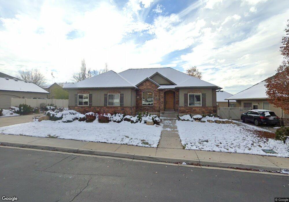
202 E 1280 N Unit 7 Pleasant Grove, UT 84062
Estimated Value: $650,000 - $752,319
2
Beds
3
Baths
1,752
Sq Ft
$401/Sq Ft
Est. Value
About This Home
This home is located at 202 E 1280 N Unit 7, Pleasant Grove, UT 84062 and is currently estimated at $702,830, approximately $401 per square foot. 202 E 1280 N Unit 7 is a home located in Utah County with nearby schools including Grovecrest Elementary School, Pleasant Grove Junior High School, and Pleasant Grove High School.
Ownership History
Date
Name
Owned For
Owner Type
Purchase Details
Closed on
Feb 15, 2018
Sold by
Sparks Andrea Byrle and The Teancum Trust
Bought by
Maldonado Frederico H and Maldonado Leilani
Current Estimated Value
Home Financials for this Owner
Home Financials are based on the most recent Mortgage that was taken out on this home.
Original Mortgage
$377,325
Outstanding Balance
$319,239
Interest Rate
3.95%
Mortgage Type
New Conventional
Estimated Equity
$383,591
Purchase Details
Closed on
Aug 26, 2015
Sold by
Sparks Timothy Randall
Bought by
Sparks Andrea Byrle and The Teaneum Trust
Home Financials for this Owner
Home Financials are based on the most recent Mortgage that was taken out on this home.
Original Mortgage
$227,500
Interest Rate
4.05%
Mortgage Type
New Conventional
Purchase Details
Closed on
May 21, 2015
Sold by
Sparks Timothy Randall
Bought by
Sparks Andrea Byele and The Teancum Trust
Purchase Details
Closed on
May 10, 2013
Sold by
Nielsen Michael D and Nielsen Trudy H
Bought by
Sparks Timothy Randall
Home Financials for this Owner
Home Financials are based on the most recent Mortgage that was taken out on this home.
Original Mortgage
$255,000
Interest Rate
3.54%
Mortgage Type
Purchase Money Mortgage
Purchase Details
Closed on
Nov 29, 2005
Sold by
Summit Building & Development Inc
Bought by
Nielsen Michael D and Nielsen Trudy H
Home Financials for this Owner
Home Financials are based on the most recent Mortgage that was taken out on this home.
Original Mortgage
$37,260
Interest Rate
6.07%
Mortgage Type
Purchase Money Mortgage
Purchase Details
Closed on
Aug 17, 2005
Sold by
Hunter Holdings Llc
Bought by
Summit Building & Development Inc
Home Financials for this Owner
Home Financials are based on the most recent Mortgage that was taken out on this home.
Original Mortgage
$478,800
Interest Rate
5.61%
Mortgage Type
Purchase Money Mortgage
Create a Home Valuation Report for This Property
The Home Valuation Report is an in-depth analysis detailing your home's value as well as a comparison with similar homes in the area
Home Values in the Area
Average Home Value in this Area
Purchase History
| Date | Buyer | Sale Price | Title Company |
|---|---|---|---|
| Maldonado Frederico H | -- | Integrated Title Ins Svcs Ll | |
| Sparks Andrea Byrle | -- | Accommodation | |
| Sparks Timothy Randall | -- | Magellan Title | |
| Sparks Andrea Byele | -- | None Available | |
| Sparks Timothy Randall | -- | Investors Title Ins | |
| Nielsen Michael D | -- | Equity Title | |
| Summit Building & Development Inc | -- | Inwest Title Services Inc |
Source: Public Records
Mortgage History
| Date | Status | Borrower | Loan Amount |
|---|---|---|---|
| Open | Maldonado Frederico H | $377,325 | |
| Previous Owner | Sparks Timothy Randall | $227,500 | |
| Previous Owner | Sparks Timothy Randall | $255,000 | |
| Previous Owner | Nielsen Michael D | $37,260 | |
| Previous Owner | Summit Building & Development Inc | $478,800 |
Source: Public Records
Tax History Compared to Growth
Tax History
| Year | Tax Paid | Tax Assessment Tax Assessment Total Assessment is a certain percentage of the fair market value that is determined by local assessors to be the total taxable value of land and additions on the property. | Land | Improvement |
|---|---|---|---|---|
| 2025 | $3,173 | $391,820 | $292,500 | $419,900 |
| 2024 | $3,173 | $370,260 | $0 | $0 |
| 2023 | $3,001 | $366,630 | $0 | $0 |
| 2022 | $3,218 | $391,160 | $0 | $0 |
| 2021 | $2,670 | $494,200 | $171,900 | $322,300 |
| 2020 | $2,537 | $460,400 | $159,200 | $301,200 |
| 2019 | $2,366 | $444,000 | $148,400 | $295,600 |
| 2018 | $2,361 | $419,000 | $144,700 | $274,300 |
| 2017 | $2,168 | $204,820 | $0 | $0 |
| 2016 | $2,150 | $196,075 | $0 | $0 |
| 2015 | $2,270 | $196,075 | $0 | $0 |
| 2014 | $2,167 | $185,350 | $0 | $0 |
Source: Public Records
Map
Nearby Homes
- 344 E 900 N
- 1152 N 200 W
- 429 E 1600 N
- 825 N 350 E
- 1656 N Siena Cir Unit 7
- 1726 N Siena Cir Unit 10
- 1727 N Siena Cir Unit 4
- 540 E 990 N
- 1192 N 730 E
- 1051 N 600 W
- 1031 N 600 W
- 1041 N 600 W
- 405 N 200 E
- 641 E 700 N
- 575 E 500 N
- 731 W 1590 N Unit 15
- 1534 N 750 W Unit 16
- 685 W 1000 N
- 674 W 1590 N Unit 11
- Konlee Plan at Makin Dreams
- 202 E 1280 N
- 228 E 1280 N
- 228 E 1280 N Unit 8
- 176 E 1280 N
- 176 E 1280 N Unit 6
- 231 E 1220 N
- 223 E 1220 N
- 247 E 1220 N Unit 11
- 251 E 1280 N Unit 2
- 252 E 1280 N
- 252 E 1280 N Unit 9
- 165 E 1220 N
- 162 E 1280 N
- 162 E 1280 N Unit 5
- 294 E 1220 N
- 253 E 1220 N
- 1212 N 220 E
- 1209 N 250 E Unit 17
- 1209 N 250 E
- 1431 N 260 E