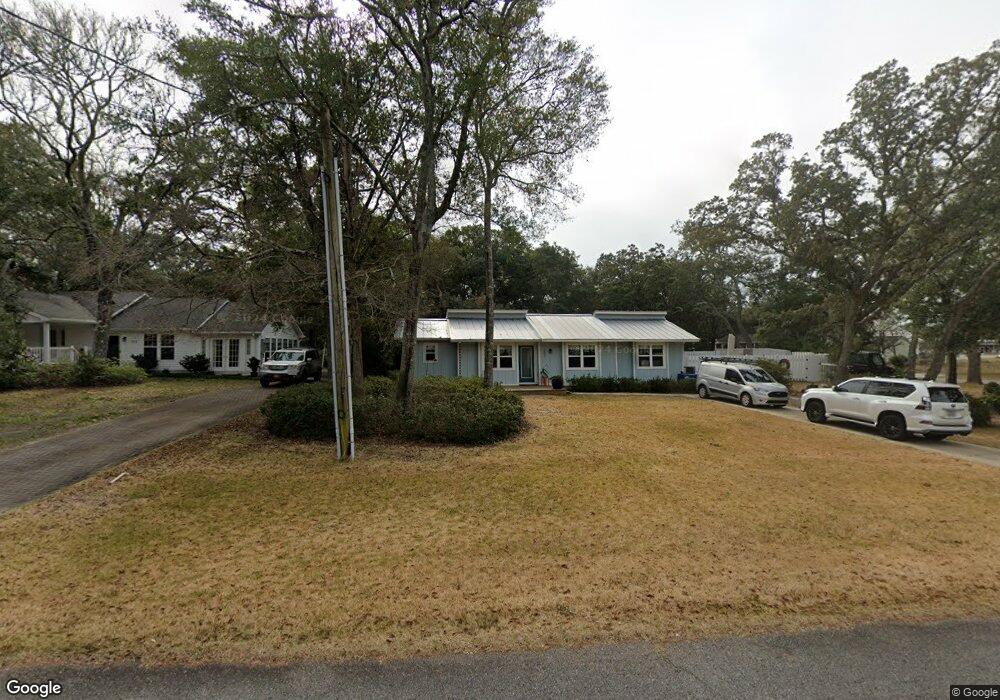
202 E 8th St Southport, NC 28461
Estimated Value: $411,000 - $436,000
3
Beds
3
Baths
1,191
Sq Ft
$356/Sq Ft
Est. Value
About This Home
This home is located at 202 E 8th St, Southport, NC 28461 and is currently estimated at $423,463, approximately $355 per square foot. 202 E 8th St is a home located in Brunswick County with nearby schools including Southport Elementary School, South Brunswick Middle School, and South Brunswick High School.
Ownership History
Date
Name
Owned For
Owner Type
Purchase Details
Closed on
Apr 30, 2015
Sold by
Chatfield Victoria Lynn and Ezzell Vicki C
Bought by
Dickens Andrea L
Current Estimated Value
Home Financials for this Owner
Home Financials are based on the most recent Mortgage that was taken out on this home.
Original Mortgage
$71,950
Outstanding Balance
$55,568
Interest Rate
3.75%
Mortgage Type
Adjustable Rate Mortgage/ARM
Estimated Equity
$367,895
Purchase Details
Closed on
Jan 1, 1998
Bought by
Ezzell Vicki C
Create a Home Valuation Report for This Property
The Home Valuation Report is an in-depth analysis detailing your home's value as well as a comparison with similar homes in the area
Home Values in the Area
Average Home Value in this Area
Purchase History
| Date | Buyer | Sale Price | Title Company |
|---|---|---|---|
| Dickens Andrea L | $82,500 | None Available | |
| Ezzell Vicki C | $68,000 | -- |
Source: Public Records
Mortgage History
| Date | Status | Borrower | Loan Amount |
|---|---|---|---|
| Open | Dickens Andrea L | $71,950 | |
| Closed | Dickens Andrea L | $71,950 |
Source: Public Records
Tax History Compared to Growth
Tax History
| Year | Tax Paid | Tax Assessment Tax Assessment Total Assessment is a certain percentage of the fair market value that is determined by local assessors to be the total taxable value of land and additions on the property. | Land | Improvement |
|---|---|---|---|---|
| 2025 | $2,638 | $352,310 | $134,200 | $218,110 |
| 2024 | $2,638 | $352,310 | $134,200 | $218,110 |
| 2023 | $2,236 | $352,310 | $134,200 | $218,110 |
| 2022 | $2,236 | $221,140 | $82,500 | $138,640 |
| 2021 | $1,952 | $221,140 | $82,500 | $138,640 |
| 2020 | $1,933 | $218,860 | $82,500 | $136,360 |
| 2019 | $1,872 | $123,400 | $75,000 | $48,400 |
| 2018 | $1,304 | $63,160 | $60,000 | $3,160 |
| 2017 | $1,292 | $63,160 | $60,000 | $3,160 |
| 2016 | $1,195 | $63,160 | $60,000 | $3,160 |
| 2015 | $1,172 | $139,140 | $60,000 | $79,140 |
| 2014 | $928 | $113,730 | $45,500 | $68,230 |
Source: Public Records
Map
Nearby Homes
- 716 N Atlantic Ave
- Lot 5a N Caswell Ave
- 826 N Caswell Ave
- 610 N Fodale Ave
- 27 Lots N Caswell Ave
- 205 W Leonard St
- 213 E 11th St
- 403 N Howe St
- 520 Clarendon Ave
- 2020 Oakton Dr Unit 14
- 311 College St
- Lot 5b Hankinsville Rd
- Tr-1 Hankinsville
- 2028 Oakton Dr
- 607 Burrington Ave
- 2075 Rosin Dr
- 1676 N Howe St
- 2079 Rosin Dr
- 2079 Rosin Dr Unit 17
- 712 Longleaf Dr
- 204 E 8th St
- 718 N Atlantic Ave
- 203 E 8th St
- 208 E 8th St
- 705 Cape Harbor Dr
- 205 E 8th St
- 719 N Atlantic Ave
- 721 N Atlantic Ave
- 717 N Atlantic Ave
- 207 E 8th St
- 714 N Atlantic Ave
- 703 Cape Harbor Dr
- 801 N Atlantic Ave
- 715 N Atlantic Ave
- 805 Cape Harbor Dr
- 712 N Atlantic Ave
- 304 E 8th St
- 711 N Atlantic Ave
- 728 N Howe St Unit 1
- 728 N Howe St Unit 1 & 2