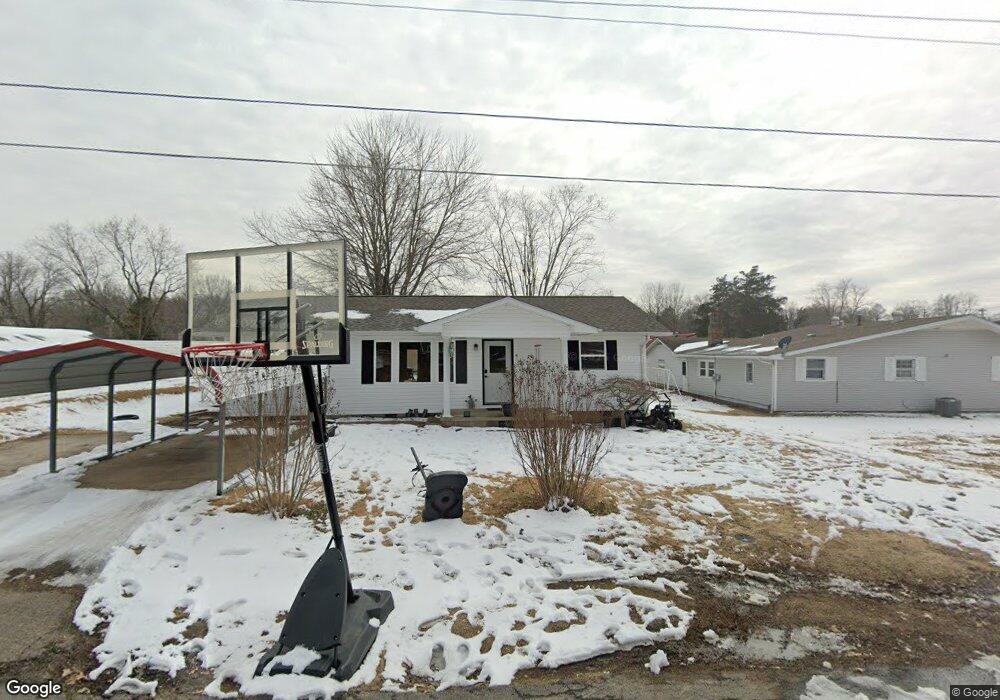
202 E Taylor St Bloomfield, MO 63825
Estimated Value: $122,000 - $144,000
2
Beds
2
Baths
928
Sq Ft
$143/Sq Ft
Est. Value
About This Home
This home is located at 202 E Taylor St, Bloomfield, MO 63825 and is currently estimated at $132,612, approximately $142 per square foot. 202 E Taylor St is a home located in Stoddard County with nearby schools including Bloomfield Elementary School, Bloomfield Middle School, and Bloomfield High School.
Ownership History
Date
Name
Owned For
Owner Type
Purchase Details
Closed on
Apr 12, 2018
Sold by
Brown Kory A and Brown Jared
Bought by
Tilley Aaron L and Tilley Ashley M
Current Estimated Value
Home Financials for this Owner
Home Financials are based on the most recent Mortgage that was taken out on this home.
Original Mortgage
$69,595
Outstanding Balance
$59,837
Interest Rate
4.43%
Mortgage Type
New Conventional
Estimated Equity
$72,775
Create a Home Valuation Report for This Property
The Home Valuation Report is an in-depth analysis detailing your home's value as well as a comparison with similar homes in the area
Purchase History
| Date | Buyer | Sale Price | Title Company |
|---|---|---|---|
| Tilley Aaron L | $86,993 | National Title & Escrow Inc |
Source: Public Records
Mortgage History
| Date | Status | Borrower | Loan Amount |
|---|---|---|---|
| Open | Tilley Aaron L | $69,595 |
Source: Public Records
Tax History
| Year | Tax Paid | Tax Assessment Tax Assessment Total Assessment is a certain percentage of the fair market value that is determined by local assessors to be the total taxable value of land and additions on the property. | Land | Improvement |
|---|---|---|---|---|
| 2025 | $576 | $11,267 | $0 | $0 |
| 2024 | $6 | $10,697 | $0 | $0 |
| 2023 | $576 | $10,697 | $0 | $0 |
| 2022 | $541 | $10,051 | $0 | $0 |
| 2021 | $541 | $10,051 | $0 | $0 |
| 2020 | $452 | $8,930 | $0 | $0 |
| 2019 | $452 | $9,595 | $0 | $0 |
| 2018 | $420 | $8,930 | $0 | $0 |
| 2016 | $368 | $7,828 | $0 | $0 |
| 2015 | -- | $7,828 | $0 | $0 |
| 2014 | -- | $7,847 | $0 | $0 |
| 2013 | -- | $0 | $0 | $0 |
Source: Public Records
Map
Nearby Homes
- 305 Cape Rd
- 301 Cape Rd
- 306R Miller St
- 404 Locust St
- 301 W Shawnee St
- 17800 County Road 527
- 16501 County Road 420
- 0 E Hwy Unit MIS26003606
- 21895 County Road 550
- 22348 County Road 503
- 0 County Road 237
- 23847 Friar Tuck Ct
- 15676 State Highway Ad
- 14089 County Road 405
- 14038 County Road 405
- 14033 County Road 405
- 13920 County Road 403
- 18328 Lake Circle Dr
- 24898 State Highway Ab
- 1008 N Mulberry St
- 714 N Viola St
- 713 N Miller St
- 712 N Viola St
- 201 E Taylor St
- 203 E Taylor St
- 711 N Miller St
- 205 E Taylor St
- 710 N Viola St
- 704 N Miller St
- 704 N Prairie St
- 202 Franklin St
- 708 N Viola St
- 204 Franklin St
- 200 Franklin St
- 712 N Miller St
- 705 N Miller St
- 710 N Prairie St
- 708 N Prairie St
- 706 N Viola St
- 708 N Miller St
Your Personal Tour Guide
Ask me questions while you tour the home.