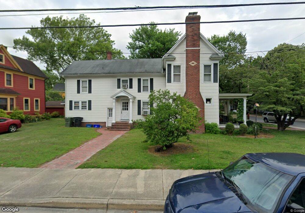
202 E William St Salisbury, MD 21801
Newtown-North Division NeighborhoodEstimated Value: $233,160 - $348,000
--
Bed
2
Baths
2,560
Sq Ft
$107/Sq Ft
Est. Value
About This Home
This home is located at 202 E William St, Salisbury, MD 21801 and is currently estimated at $274,290, approximately $107 per square foot. 202 E William St is a home located in Wicomico County with nearby schools including West Salisbury Elementary School, North Salisbury Elementary School, and Salisbury Middle School.
Ownership History
Date
Name
Owned For
Owner Type
Purchase Details
Closed on
Sep 14, 2012
Sold by
Robins John B and Deed Of Trust From Samuel L Mi
Bought by
Miller Samuel L and Miller Cathy S
Current Estimated Value
Purchase Details
Closed on
Dec 11, 2003
Sold by
Miller Samuel L and Miller Cathy S
Bought by
Miller Samuel L
Purchase Details
Closed on
Nov 10, 1997
Sold by
Lewis Cecil F
Bought by
Miller Samuel L and Miller Cathy S
Purchase Details
Closed on
Oct 25, 1995
Sold by
Lewis Cecil F and Lewis Norma E
Bought by
Lewis Cecil F
Create a Home Valuation Report for This Property
The Home Valuation Report is an in-depth analysis detailing your home's value as well as a comparison with similar homes in the area
Home Values in the Area
Average Home Value in this Area
Purchase History
| Date | Buyer | Sale Price | Title Company |
|---|---|---|---|
| Miller Samuel L | $60,000 | None Available | |
| Miller Samuel L | $10,000 | -- | |
| Miller Samuel L | $40,000 | -- | |
| Lewis Cecil F | -- | -- |
Source: Public Records
Mortgage History
| Date | Status | Borrower | Loan Amount |
|---|---|---|---|
| Closed | Miller Samuel L | -- |
Source: Public Records
Tax History Compared to Growth
Tax History
| Year | Tax Paid | Tax Assessment Tax Assessment Total Assessment is a certain percentage of the fair market value that is determined by local assessors to be the total taxable value of land and additions on the property. | Land | Improvement |
|---|---|---|---|---|
| 2025 | $1,498 | $167,767 | $0 | $0 |
| 2024 | $1,498 | $156,200 | $18,900 | $137,300 |
| 2023 | $1,375 | $139,033 | $0 | $0 |
| 2022 | $1,242 | $121,867 | $0 | $0 |
| 2021 | $1,070 | $104,700 | $18,900 | $85,800 |
| 2020 | $1,080 | $104,700 | $18,900 | $85,800 |
| 2019 | $1,096 | $104,700 | $18,900 | $85,800 |
| 2018 | $2,206 | $107,400 | $18,900 | $88,500 |
| 2017 | $2,206 | $107,400 | $0 | $0 |
| 2016 | -- | $107,400 | $0 | $0 |
| 2015 | $2,902 | $112,600 | $0 | $0 |
| 2014 | $2,902 | $112,600 | $0 | $0 |
Source: Public Records
Map
Nearby Homes
- 309 Gay St
- 304 Poplar Hill Ave
- LOT D4 International Dr
- 601 Lakeside Dr
- 400 Lake St
- 403 Rose St
- 322 Naylor St
- 416 Rose St
- 701 Lake St Unit 1
- 309 Marshall St
- 304 Brooklyn Ave
- 201 Marshall St
- 609 Germania Cir
- 313 W London Ave
- 616 1 W Main St
- 401 Newton Terrace
- 317 Delaware Ave
- 231 Newton St
- 902 Lake St
- 309 Park Heights Ave
- 328 Poplar Hill Ave
- 200 E William St
- 205 E William St
- 324 Poplar Hill Ave
- 203 E William St
- 313 Gay St
- 300 E William St
- 301 E William St
- 201 E William St
- 322 Poplar Hill Ave
- 329 Poplar Hill Ave
- 114 E William St
- 311 Gay St
- 312 Gay St Unit 2
- 312 Gay St
- 303 E William St
- 404 Poplar Hill Ave
- 320 Poplar Hill Ave
- 304 E William St
- 115 E William St