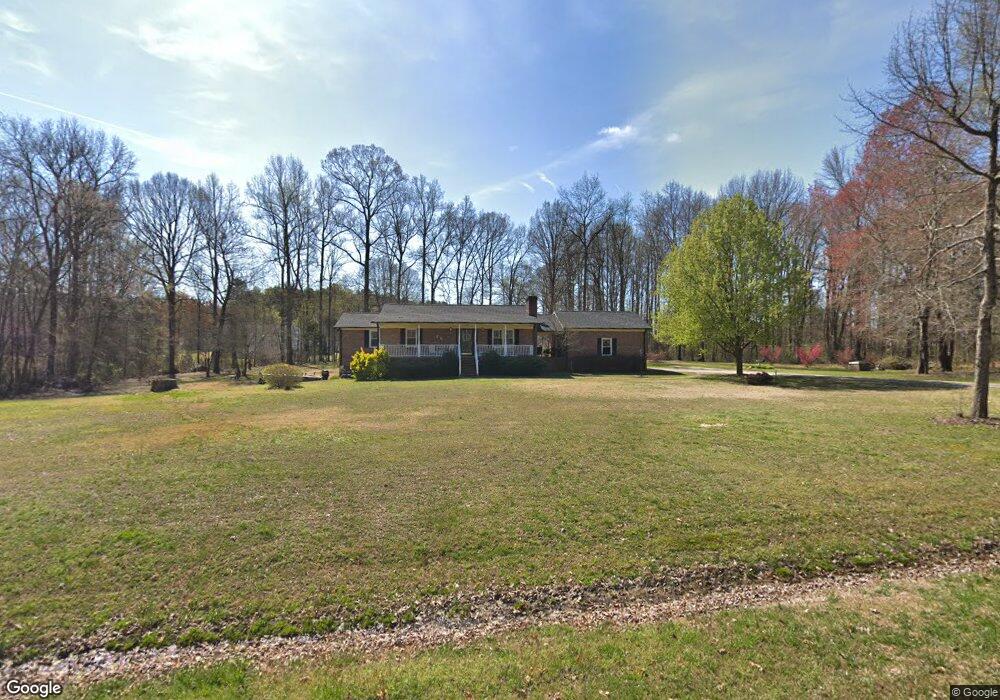
202 Frontier Cir China Grove, NC 28023
Estimated Value: $362,594 - $458,000
--
Bed
2
Baths
1,440
Sq Ft
$290/Sq Ft
Est. Value
About This Home
This home is located at 202 Frontier Cir, China Grove, NC 28023 and is currently estimated at $417,399, approximately $289 per square foot. 202 Frontier Cir is a home located in Rowan County with nearby schools including China Grove Elementary School, China Grove Middle School, and Jesse C Carson High School.
Ownership History
Date
Name
Owned For
Owner Type
Purchase Details
Closed on
May 16, 2014
Sold by
Lewis Sammy Lee and Lewis Sandra
Bought by
Lewis Sammy Lee and Lewis Sandra
Current Estimated Value
Home Financials for this Owner
Home Financials are based on the most recent Mortgage that was taken out on this home.
Original Mortgage
$90,500
Interest Rate
4.4%
Mortgage Type
New Conventional
Create a Home Valuation Report for This Property
The Home Valuation Report is an in-depth analysis detailing your home's value as well as a comparison with similar homes in the area
Home Values in the Area
Average Home Value in this Area
Purchase History
| Date | Buyer | Sale Price | Title Company |
|---|---|---|---|
| Lewis Sammy Lee | -- | None Available |
Source: Public Records
Mortgage History
| Date | Status | Borrower | Loan Amount |
|---|---|---|---|
| Closed | Lewis Sammy Lee | $90,500 |
Source: Public Records
Tax History Compared to Growth
Tax History
| Year | Tax Paid | Tax Assessment Tax Assessment Total Assessment is a certain percentage of the fair market value that is determined by local assessors to be the total taxable value of land and additions on the property. | Land | Improvement |
|---|---|---|---|---|
| 2025 | $2,339 | $349,032 | $80,000 | $269,032 |
| 2024 | $2,339 | $349,032 | $80,000 | $269,032 |
| 2023 | $2,339 | $349,032 | $80,000 | $269,032 |
| 2022 | $1,677 | $224,371 | $65,000 | $159,371 |
| 2021 | $1,665 | $224,371 | $65,000 | $159,371 |
| 2020 | $1,665 | $224,371 | $65,000 | $159,371 |
| 2019 | $1,665 | $224,371 | $65,000 | $159,371 |
| 2018 | $1,450 | $197,121 | $65,000 | $132,121 |
| 2017 | $1,450 | $197,121 | $65,000 | $132,121 |
| 2016 | $1,450 | $197,121 | $65,000 | $132,121 |
| 2015 | $1,473 | $197,121 | $65,000 | $132,121 |
| 2014 | $1,413 | $198,493 | $65,000 | $133,493 |
Source: Public Records
Map
Nearby Homes
- 850 and 830 E Nc 152 Hwy E
- 1925 Mount Hope Church Rd
- 1660 Lentz Rd
- 220 Yost Town Rd
- 1335 Brookwood Dr
- 145 Ketchie Estates Rd
- 175 Ketchie Estates Rd
- 1352 Eva Ln
- 235 Madison Rd
- 1365 Safrit Rd
- 0 Heglar St
- TA3000 Plan at Kensington
- Hudson Plan at Kensington
- Devin Plan at Kensington
- Bayside Plan at Kensington
- TA4000 Plan at Kensington
- Kipling Plan at Kensington
- Declan Plan at Kensington
- Montcrest Plan at Kensington
- Jasper Plan at Kensington
- 204 Frontier Cir
- 203 Frontier Cir
- 204 Timberfield Trail
- 205 Frontier Cir
- 202 Timberfield Trail
- 104 Frontier Cir
- 113 Frontier Cir
- 206 Timberfield Trail
- 207 Frontier Cir
- 111 Frontier Cir
- 206 Frontier Cir
- 102 Frontier Cir
- 109 Frontier Cir
- 208 Timberfield Trail
- 605 Rock Ln
- 0000 Rock Ln
- 209 Frontier Cir
- 302 Frontier Cir
- 201 Timberfield Trail
- 107 Frontier Cir