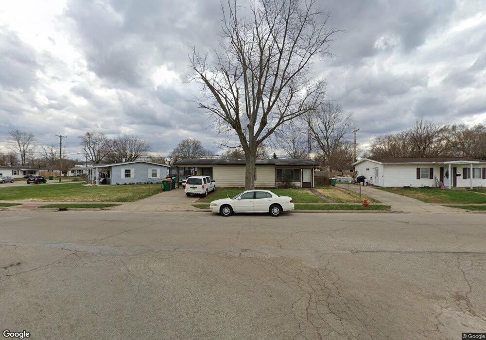
202 Galewood Dr New Carlisle, OH 45344
Estimated Value: $85,000 - $147,000
3
Beds
1
Bath
925
Sq Ft
$131/Sq Ft
Est. Value
About This Home
This home is located at 202 Galewood Dr, New Carlisle, OH 45344 and is currently estimated at $121,007, approximately $130 per square foot. 202 Galewood Dr is a home located in Clark County with nearby schools including New Carlisle Elementary School, Park Layne Elementary School, and Donnelsville Elementary School.
Ownership History
Date
Name
Owned For
Owner Type
Purchase Details
Closed on
May 30, 2018
Sold by
Roeth Larry and Roeth Paula J
Bought by
Plr Rentals Llc
Current Estimated Value
Purchase Details
Closed on
Apr 2, 2018
Sold by
Green Candy S
Bought by
Roeth Larry and Roeth Paula J
Purchase Details
Closed on
Apr 30, 2008
Sold by
Green Thomas S and Green Tammy
Bought by
Green Philip Kurtis
Purchase Details
Closed on
Apr 13, 2007
Sold by
Estate Of Susan Audra Green
Bought by
Green Thomas S and Green Philip Kurtis
Create a Home Valuation Report for This Property
The Home Valuation Report is an in-depth analysis detailing your home's value as well as a comparison with similar homes in the area
Home Values in the Area
Average Home Value in this Area
Purchase History
| Date | Buyer | Sale Price | Title Company |
|---|---|---|---|
| Plr Rentals Llc | -- | Sterling Land Title Agency I | |
| Roeth Larry | $36,000 | Sterling Land Title Agency I | |
| Green Philip Kurtis | $40,000 | Attorney | |
| Green Thomas S | -- | None Available |
Source: Public Records
Tax History Compared to Growth
Tax History
| Year | Tax Paid | Tax Assessment Tax Assessment Total Assessment is a certain percentage of the fair market value that is determined by local assessors to be the total taxable value of land and additions on the property. | Land | Improvement |
|---|---|---|---|---|
| 2024 | $2,184 | $27,190 | $5,800 | $21,390 |
| 2023 | $3,039 | $27,190 | $5,800 | $21,390 |
| 2022 | $2,188 | $27,190 | $5,800 | $21,390 |
| 2021 | $1,343 | $22,890 | $4,460 | $18,430 |
| 2020 | $1,346 | $22,890 | $4,460 | $18,430 |
| 2019 | $1,368 | $22,890 | $4,460 | $18,430 |
| 2018 | $1,006 | $15,500 | $5,510 | $9,990 |
| 2017 | $939 | $19,565 | $5,509 | $14,056 |
| 2016 | $934 | $19,565 | $5,509 | $14,056 |
| 2015 | $1,096 | $18,666 | $5,796 | $12,870 |
| 2014 | $1,086 | $18,666 | $5,796 | $12,870 |
| 2013 | $1,088 | $18,666 | $5,796 | $12,870 |
Source: Public Records
Map
Nearby Homes
- 202 Fenwick Dr
- 906 N Scott St
- 1204 N Scott St
- 203 Monroe Way
- 201 Lightfoot Ct
- 519 Brubaker Dr
- 1212 N Scott St
- 1206 N Scott St
- 1205 N Scott St
- 1209 N Scott St
- 1210 N Scott St
- 209 Lightfoot Ct
- 609 Brubaker Dr
- 315 N Main St
- 315 Fenwick Dr
- 216 Lightfoot Ct
- Spruce Plan at Monroe Meadows
- Norway Plan at Monroe Meadows
- 201 Monroe Way
- Cooper Plan at Monroe Meadows
- 204 Galewood Dr
- 703 N Scott St
- 203 Prentice Dr
- 205 Prentice Dr
- 206 Galewood Dr
- 207 Prentice Dr
- 701 N Scott St
- 208 Galewood Dr
- 209 Prentice Dr
- 800 N Scott St
- 111 Galewood Dr
- 108 Galewood Dr
- 802 N Scott St
- 211 Prentice Dr
- 210 Galewood Dr
- 109 Galewood Dr
- 204 Prentice Dr
- 202 Prentice Dr
- 702 N Scott St
- 804 N Scott St