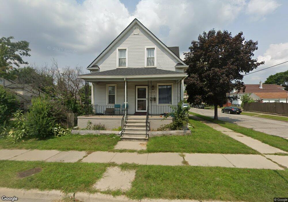
202 Goddard St Wyandotte, MI 48192
Estimated Value: $172,921 - $212,000
4
Beds
3
Baths
1,378
Sq Ft
$141/Sq Ft
Est. Value
About This Home
This home is located at 202 Goddard St, Wyandotte, MI 48192 and is currently estimated at $194,980, approximately $141 per square foot. 202 Goddard St is a home located in Wayne County with nearby schools including James A. Garfield Elementary School, Woodrow Wilson School, and Roosevelt High School.
Ownership History
Date
Name
Owned For
Owner Type
Purchase Details
Closed on
Apr 19, 2018
Sold by
Federal Home Loan Mortgage Corporation
Bought by
Doko Construction Inc Llc
Current Estimated Value
Purchase Details
Closed on
Nov 30, 2017
Sold by
Madary Richard
Bought by
Federal Home Loan Mortgage Corporation
Purchase Details
Closed on
Apr 5, 2016
Sold by
Madary Richard and Madary Richard
Bought by
Madary Richard
Purchase Details
Closed on
Feb 9, 2005
Sold by
Richard Madary Revocable Living Trust
Bought by
Madary Richard
Purchase Details
Closed on
Mar 5, 2004
Sold by
Madary Richard and Madary Geraldine
Bought by
Richard Madary Revocable Living Trust
Create a Home Valuation Report for This Property
The Home Valuation Report is an in-depth analysis detailing your home's value as well as a comparison with similar homes in the area
Home Values in the Area
Average Home Value in this Area
Purchase History
| Date | Buyer | Sale Price | Title Company |
|---|---|---|---|
| Doko Construction Inc Llc | $53,600 | None Available | |
| Federal Home Loan Mortgage Corporation | -- | None Available | |
| Madary Richard | -- | Title Source Inc | |
| Madary Richard | -- | Minnesota Title Agency | |
| Richard Madary Revocable Living Trust | -- | -- |
Source: Public Records
Tax History Compared to Growth
Tax History
| Year | Tax Paid | Tax Assessment Tax Assessment Total Assessment is a certain percentage of the fair market value that is determined by local assessors to be the total taxable value of land and additions on the property. | Land | Improvement |
|---|---|---|---|---|
| 2025 | $2,407 | $82,900 | $0 | $0 |
| 2024 | $2,407 | $75,200 | $0 | $0 |
| 2023 | $2,295 | $66,800 | $0 | $0 |
| 2022 | $2,789 | $59,200 | $0 | $0 |
| 2021 | $2,729 | $50,200 | $0 | $0 |
| 2020 | $2,929 | $43,500 | $0 | $0 |
| 2019 | $3,053 | $41,800 | $0 | $0 |
| 2018 | $1,538 | $36,100 | $0 | $0 |
| 2017 | $786 | $36,100 | $0 | $0 |
| 2016 | $1,914 | $36,100 | $0 | $0 |
| 2015 | $3,159 | $33,500 | $0 | $0 |
| 2013 | $3,060 | $30,600 | $0 | $0 |
| 2012 | $1,507 | $32,000 | $4,900 | $27,100 |
Source: Public Records
Map
Nearby Homes