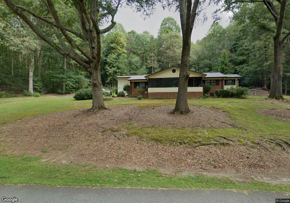
202 Heath Rd Dawsonville, GA 30534
Dawson County NeighborhoodEstimated Value: $391,000 - $523,000
2
Beds
2
Baths
1,575
Sq Ft
$288/Sq Ft
Est. Value
About This Home
This home is located at 202 Heath Rd, Dawsonville, GA 30534 and is currently estimated at $452,978, approximately $287 per square foot. 202 Heath Rd is a home located in Dawson County with nearby schools including Kilough Elementary School, Dawson County Junior High School, and Dawson County Middle School.
Ownership History
Date
Name
Owned For
Owner Type
Purchase Details
Closed on
Feb 7, 2012
Sold by
Swanger Jerome L
Bought by
Swanger Jerome L
Current Estimated Value
Purchase Details
Closed on
Aug 12, 1992
Bought by
Swanger Joyce W
Purchase Details
Closed on
Aug 17, 1981
Sold by
Joyce W
Bought by
Swanger Jerome L
Purchase Details
Closed on
Oct 14, 1980
Sold by
Lee Lee and Lee Victoria
Bought by
Westerfield Larry
Create a Home Valuation Report for This Property
The Home Valuation Report is an in-depth analysis detailing your home's value as well as a comparison with similar homes in the area
Home Values in the Area
Average Home Value in this Area
Purchase History
| Date | Buyer | Sale Price | Title Company |
|---|---|---|---|
| Swanger Jerome L | -- | -- | |
| Swanger Joyce W | -- | -- | |
| Swanger Jerome L | $4,800 | -- | |
| Westerfield Larry | $38,500 | -- |
Source: Public Records
Tax History Compared to Growth
Tax History
| Year | Tax Paid | Tax Assessment Tax Assessment Total Assessment is a certain percentage of the fair market value that is determined by local assessors to be the total taxable value of land and additions on the property. | Land | Improvement |
|---|---|---|---|---|
| 2024 | $1 | $141,320 | $34,320 | $107,000 |
| 2023 | $340 | $136,040 | $25,680 | $110,360 |
| 2022 | $94 | $84,892 | $20,080 | $64,812 |
| 2021 | $53 | $73,672 | $20,080 | $53,592 |
| 2020 | $55 | $67,392 | $14,840 | $52,552 |
| 2019 | $1,410 | $58,952 | $14,840 | $44,112 |
| 2018 | $87 | $58,952 | $14,840 | $44,112 |
| 2017 | $17 | $48,014 | $16,585 | $31,429 |
| 2016 | $690 | $46,119 | $16,585 | $29,534 |
| 2015 | $618 | $42,349 | $15,091 | $27,258 |
| 2014 | $559 | $39,297 | $15,091 | $24,206 |
| 2013 | -- | $35,216 | $15,091 | $20,124 |
Source: Public Records
Map
Nearby Homes
- 299 Landrum Rd
- 4 Fredricks Cove
- 135 Scarlet Oak Ln
- 189 Scarlet Oak Ln
- 184 Scarlet Oak Ln
- Lot 4 Fredricks Cove
- 380 Fredericks Cove
- 505 Mill Cove Dr
- 8070 Beachwood Dr
- 407 Mill Cove Dr
- 121 River Sound Alley
- 8083 Beachwood Dr
- 8079 Beachwood Dr
- 503 Night Fire Dr
- 95 Ridgetop Ct
- 116 River Sound Alley
- 147 Blue Heron Bluff
- 142 Heath Rd
- 262 Heath Rd
- 54 Heath Rd
- 282 Heath Rd
- 121 Heath Rd
- 352 Heath Rd
- 45 Heath Rd
- 26 Heath Rd
- 354 Heath Rd
- 406 Heath Rd
- 507 John D Reeves Rd
- 4470 Highway 400 N
- 4470 Georgia 400
- 78 Landrum Rd
- 1 John D Reeves Rd
- 246 Landrum Rd
- 246 Landrum Rd Unit A
- 0 Hickory Nut Trail Unit LOT 8
- 0 Hickory Nut Trail Unit LOT 8 7320536
- 0 Hickory Nut Trail Unit 7207538