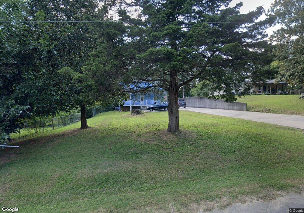
202 Hewitt Dr Dalton, GA 30721
Estimated Value: $214,156 - $271,000
--
Bed
2
Baths
1,536
Sq Ft
$158/Sq Ft
Est. Value
About This Home
This home is located at 202 Hewitt Dr, Dalton, GA 30721 and is currently estimated at $243,039, approximately $158 per square foot. 202 Hewitt Dr is a home located in Whitfield County with nearby schools including Eastside Elementary School, Eastbrook Middle School, and Southeast Whitfield County High School.
Ownership History
Date
Name
Owned For
Owner Type
Purchase Details
Closed on
Mar 9, 2009
Sold by
Macias Rolando
Bought by
Macias Rolando
Current Estimated Value
Home Financials for this Owner
Home Financials are based on the most recent Mortgage that was taken out on this home.
Original Mortgage
$88,726
Outstanding Balance
$56,895
Interest Rate
5.29%
Mortgage Type
FHA
Estimated Equity
$186,144
Purchase Details
Closed on
Oct 1, 1999
Bought by
Macias Rolando and Macias Martha
Create a Home Valuation Report for This Property
The Home Valuation Report is an in-depth analysis detailing your home's value as well as a comparison with similar homes in the area
Home Values in the Area
Average Home Value in this Area
Purchase History
| Date | Buyer | Sale Price | Title Company |
|---|---|---|---|
| Macias Rolando | -- | -- | |
| Macias Rolando | -- | -- |
Source: Public Records
Mortgage History
| Date | Status | Borrower | Loan Amount |
|---|---|---|---|
| Open | Macias Rolando | $88,726 |
Source: Public Records
Tax History Compared to Growth
Tax History
| Year | Tax Paid | Tax Assessment Tax Assessment Total Assessment is a certain percentage of the fair market value that is determined by local assessors to be the total taxable value of land and additions on the property. | Land | Improvement |
|---|---|---|---|---|
| 2024 | $1,181 | $84,022 | $5,000 | $79,022 |
| 2023 | $1,181 | $45,865 | $4,200 | $41,665 |
| 2022 | $786 | $35,218 | $4,200 | $31,018 |
| 2021 | $787 | $35,218 | $4,200 | $31,018 |
| 2020 | $802 | $35,218 | $4,200 | $31,018 |
| 2019 | $809 | $35,218 | $4,200 | $31,018 |
| 2018 | $817 | $35,218 | $4,200 | $31,018 |
| 2017 | $817 | $35,218 | $4,200 | $31,018 |
| 2016 | $714 | $32,412 | $4,200 | $28,212 |
| 2014 | $674 | $32,412 | $4,200 | $28,212 |
| 2013 | -- | $32,411 | $4,200 | $28,211 |
Source: Public Records
Map
Nearby Homes
- 359 Pacer Ln Unit 4
- 143 Staten St
- 213 Nashville St
- 1902 Bartenfield Dr
- 0 Dogwood Dr
- 115 Wooten Dr
- 00 Wooten Dr
- 0 Robinwood Dr
- 1407 Stacy Dr
- 307 Gay St
- 104 Elrod Dr
- trac 2 Roosevelt Dr
- trac 3 Roosevelt Dr
- 514 Sheridan Ave
- 1629 Roosevelt Dr
- 118 Hill Rd
- 136 Wiltshire Dr
- 2410 Martin Luther King Junior Blvd
- 1118 Dozier St
- 1007 Locke Dr
- 200 Hewitt Dr
- 206 Hewitt Dr
- 212 Hewitt Dr
- 201 Hewitt Dr
- 209 Hewitt Dr
- 401 Van Buren Dr
- 213 Hewitt Dr
- 104 Ridge Crest Dr
- 2181 Hewitt Dr
- 215 Hewitt Dr
- 108 Ridge Crest Dr
- 417 Van Buren Dr
- 350 Van Buren Dr
- 300 Hewitt Dr
- 413 Van Buren Dr
- 202 Platte St
- 419 Van Buren Dr
- 302 Hewitt Dr
- 410 Van Buren Dr
- 416 Van Buren Dr