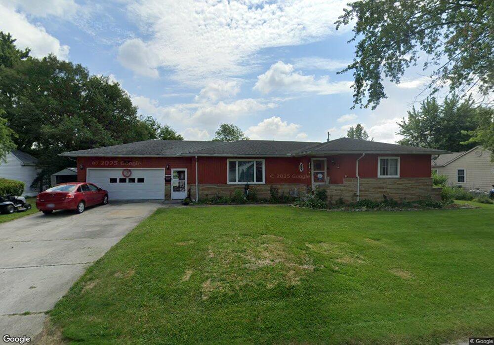
202 Independence Ave Fostoria, OH 44830
Estimated Value: $150,000 - $176,000
3
Beds
1
Bath
1,768
Sq Ft
$90/Sq Ft
Est. Value
About This Home
This home is located at 202 Independence Ave, Fostoria, OH 44830 and is currently estimated at $159,810, approximately $90 per square foot. 202 Independence Ave is a home located in Hancock County with nearby schools including Fostoria Intermediate Elementary School and Fostoria Junior/Senior High School.
Ownership History
Date
Name
Owned For
Owner Type
Purchase Details
Closed on
Sep 25, 1991
Bought by
Kodor Mildred C
Current Estimated Value
Create a Home Valuation Report for This Property
The Home Valuation Report is an in-depth analysis detailing your home's value as well as a comparison with similar homes in the area
Home Values in the Area
Average Home Value in this Area
Purchase History
| Date | Buyer | Sale Price | Title Company |
|---|---|---|---|
| Kodor Mildred C | -- | -- |
Source: Public Records
Tax History Compared to Growth
Tax History
| Year | Tax Paid | Tax Assessment Tax Assessment Total Assessment is a certain percentage of the fair market value that is determined by local assessors to be the total taxable value of land and additions on the property. | Land | Improvement |
|---|---|---|---|---|
| 2024 | $1,807 | $36,310 | $2,590 | $33,720 |
| 2023 | $1,803 | $36,310 | $2,590 | $33,720 |
| 2022 | $1,964 | $36,310 | $2,590 | $33,720 |
| 2021 | $1,759 | $31,280 | $2,420 | $28,860 |
| 2020 | $1,767 | $31,280 | $2,420 | $28,860 |
| 2019 | $1,758 | $31,280 | $2,420 | $28,860 |
| 2018 | $1,757 | $30,470 | $1,610 | $28,860 |
| 2017 | $878 | $30,470 | $1,610 | $28,860 |
| 2016 | $1,544 | $30,470 | $1,610 | $28,860 |
| 2015 | $1,710 | $33,900 | $1,610 | $32,290 |
| 2014 | $1,708 | $33,870 | $1,610 | $32,260 |
| 2012 | $2,074 | $40,960 | $1,610 | $39,350 |
Source: Public Records
Map
Nearby Homes
- 509 College Ave
- 411 Monticello Dr
- 348 W South St
- 418 W Ridge Dr
- 603 N Vine St
- 425 W Ridge Dr
- 603 Alma Dr
- 203 N Union St
- 1401 Van Buren St
- 461 W Lytle St
- 461 W Lytle St Unit 106
- 461 W Lytle St Unit 145
- 520 N Union St
- 0 W South Route 12
- 711 Hart Ave Unit 713
- 723 N Union St
- 211 Summit St
- 435 Park Ave
- 892 N Countyline St
- 931 N Union St
- 200 Independence Ave
- 204 Independence Ave
- 106 Ernest St
- 215 Cleveland St
- 210 Independence Ave
- 219 Cleveland St
- 221 Cleveland St
- 213 Independence Ave
- 223 Cleveland St
- 215 Independence Ave
- 302 Independence Ave
- 309 Cleveland St
- 212 Elwood Ave
- 301 Independence Ave
- 218 Cleveland St
- 214 Elwood Ave
- 220 Cleveland St
- 911 W Tiffin St
- 315 Cleveland St
- 222 Cleveland St