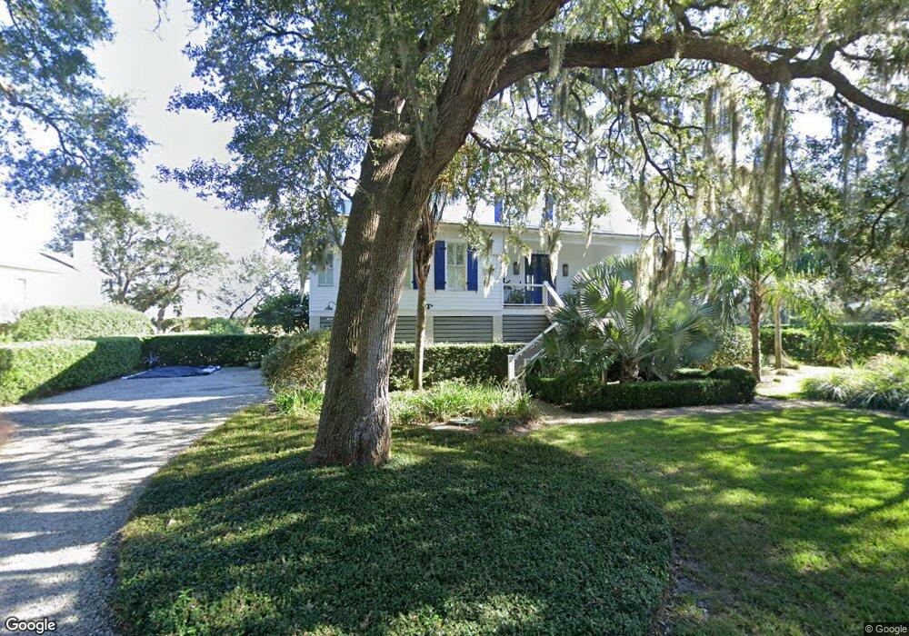
202 Kelvin Grove Dr Saint Simons Island, GA 31522
Estimated Value: $937,000 - $1,534,491
4
Beds
3
Baths
2,390
Sq Ft
$536/Sq Ft
Est. Value
About This Home
This home is located at 202 Kelvin Grove Dr, Saint Simons Island, GA 31522 and is currently estimated at $1,281,873, approximately $536 per square foot. 202 Kelvin Grove Dr is a home located in Glynn County with nearby schools including St. Simons Elementary School, Glynn Middle School, and Glynn Academy.
Ownership History
Date
Name
Owned For
Owner Type
Purchase Details
Closed on
Mar 4, 2016
Sold by
Mccaskill Annie Belle
Bought by
Shadron Heather Lang
Current Estimated Value
Create a Home Valuation Report for This Property
The Home Valuation Report is an in-depth analysis detailing your home's value as well as a comparison with similar homes in the area
Home Values in the Area
Average Home Value in this Area
Purchase History
| Date | Buyer | Sale Price | Title Company |
|---|---|---|---|
| Shadron Heather Lang | -- | -- |
Source: Public Records
Tax History Compared to Growth
Tax History
| Year | Tax Paid | Tax Assessment Tax Assessment Total Assessment is a certain percentage of the fair market value that is determined by local assessors to be the total taxable value of land and additions on the property. | Land | Improvement |
|---|---|---|---|---|
| 2025 | $13,567 | $540,960 | $295,680 | $245,280 |
| 2024 | $12,003 | $478,600 | $236,560 | $242,040 |
| 2023 | $6,428 | $478,600 | $236,560 | $242,040 |
| 2022 | $6,948 | $433,640 | $191,600 | $242,040 |
| 2021 | $7,161 | $386,400 | $191,600 | $194,800 |
| 2020 | $7,228 | $290,600 | $95,800 | $194,800 |
| 2019 | $7,228 | $290,600 | $95,800 | $194,800 |
| 2018 | $7,228 | $277,080 | $95,800 | $181,280 |
| 2017 | $6,581 | $247,280 | $95,800 | $151,480 |
| 2016 | $2,299 | $95,800 | $95,800 | $0 |
| 2015 | $2,309 | $95,800 | $95,800 | $0 |
| 2014 | $2,309 | $95,800 | $95,800 | $0 |
Source: Public Records
Map
Nearby Homes
- 207 Military Rd
- 135 Stewart St
- 10 Fern Ln
- 240 Peachtree St
- 238 Broadway St
- 239 Broadway St
- 524 Wesley Oak Cir
- 103 Cater St
- 220 Tennessee Ave
- 121 Killgriffe St
- 113 Peachtree St
- 516 Postell Dr
- 242 Mcintosh Ave
- 11822 Old Demere Rd
- 1704 Frederica Rd Unit 237
- 1704 Frederica Rd Unit 621
- 1704 Frederica Rd Unit 628 + 31 garage
- 1704 Frederica Rd Unit 723
- 1704 Frederica Rd Unit 635
- 1704 Frederica Rd Unit 602
- 204 Kelvin Grove Dr
- 204 Military Rd-Owner Will Finance
- 204 Military Rd
- 214 Military Rd
- 302 Bloody Marsh Rd
- 202 Military Rd
- 210 Kelvin Grove Dr
- 218 Military Rd
- 210 Cater St
- 211 Military Rd
- 307 Bloody Marsh Rd
- 303 Bloody Marsh Rd
- 212 Cater St
- 208 Cater St
- 301 Bloody Marsh Rd
- 309 Bloody Marsh Rd
- 205 Military Rd
- 213 Military Rd
- 207 Military Rd
- 215 Military Rd