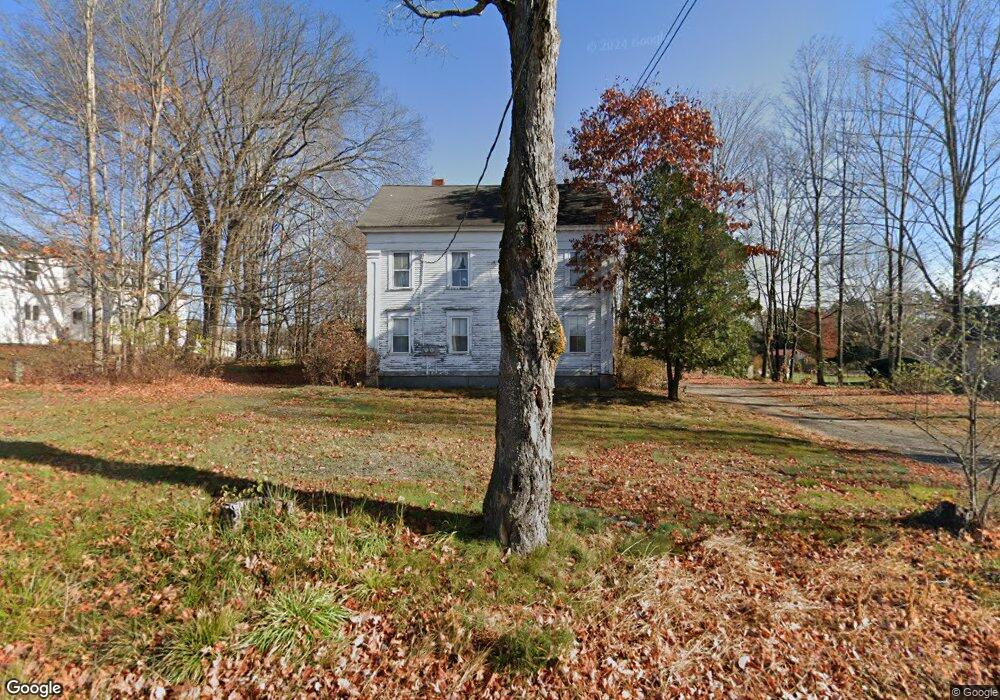
202 Kennebunk Rd Alfred, ME 04002
Estimated Value: $223,000 - $479,000
4
Beds
2
Baths
768
Sq Ft
$482/Sq Ft
Est. Value
About This Home
This home is located at 202 Kennebunk Rd, Alfred, ME 04002 and is currently estimated at $370,082, approximately $481 per square foot. 202 Kennebunk Rd is a home located in York County with nearby schools including Massabesic High School, St Thomas Consolidated School, and Sanford Christian Academy.
Ownership History
Date
Name
Owned For
Owner Type
Purchase Details
Closed on
Aug 29, 2025
Sold by
Carter Sara R
Bought by
Oak Street Realty Llc
Current Estimated Value
Home Financials for this Owner
Home Financials are based on the most recent Mortgage that was taken out on this home.
Original Mortgage
$195,000
Outstanding Balance
$194,663
Interest Rate
6.74%
Mortgage Type
Purchase Money Mortgage
Estimated Equity
$175,419
Create a Home Valuation Report for This Property
The Home Valuation Report is an in-depth analysis detailing your home's value as well as a comparison with similar homes in the area
Home Values in the Area
Average Home Value in this Area
Purchase History
| Date | Buyer | Sale Price | Title Company |
|---|---|---|---|
| Oak Street Realty Llc | $225,000 | -- |
Source: Public Records
Mortgage History
| Date | Status | Borrower | Loan Amount |
|---|---|---|---|
| Open | Oak Street Realty Llc | $195,000 |
Source: Public Records
Tax History Compared to Growth
Tax History
| Year | Tax Paid | Tax Assessment Tax Assessment Total Assessment is a certain percentage of the fair market value that is determined by local assessors to be the total taxable value of land and additions on the property. | Land | Improvement |
|---|---|---|---|---|
| 2025 | $2,599 | $269,325 | $103,790 | $165,535 |
| 2024 | $3,060 | $323,861 | $103,790 | $220,071 |
| 2023 | $3,463 | $184,200 | $69,300 | $114,900 |
| 2022 | $3,316 | $184,200 | $69,300 | $114,900 |
| 2021 | $3,177 | $184,200 | $69,300 | $114,900 |
| 2020 | $3,021 | $184,200 | $69,300 | $114,900 |
| 2019 | $3,021 | $184,200 | $69,300 | $114,900 |
| 2018 | $3,094 | $184,200 | $69,300 | $114,900 |
| 2017 | $2,929 | $184,200 | $69,300 | $114,900 |
| 2016 | $2,791 | $184,200 | $69,300 | $114,900 |
| 2015 | $2,671 | $184,200 | $69,300 | $114,900 |
| 2014 | $2,625 | $184,200 | $69,300 | $114,900 |
| 2013 | $2,533 | $184,200 | $69,300 | $114,900 |
Source: Public Records
Map
Nearby Homes
- 87 Drown Rd
- 330 Biddeford Rd
- 34 Cascade Cir Unit 30
- 58 Sanford Rd
- 23 Branch View Terrace N
- TBD Branch View Terrace Unit Lot 5
- TBD Branch View Terrace Unit Lot 4
- 2252 Alfred Rd
- Lot 35 Bennett Rd
- 533 Kennebunk Rd
- TBD Olde Farnham Rd
- Lot B Bernier Rd
- Lot A Bernier Rd
- 232 Waterboro Rd
- Lot 1 Kennebunk Rd
- 0 Sanford Rd
- 22 White House Cove Rd
- 6 Commodore Dr
- 9 Commodore Dr
- 8 Hummingbird Ln
- 206 Kennebunk Rd
- 196 Kennebunk Rd
- 212 Kennebunk Rd
- Lot 1 Burns Ln
- Lot 3 Burns Ln
- Lot 5 Burns Ln
- Lot 7 Burns Ln
- Lot 9 Burns Ln
- Lot 11 Burns Ln
- Lot 13 Burns Ln
- Lot 17 Burns Ln
- Lot 19 Burns Ln
- Lot 5 Colin's Meadow Ln
- Lot 3 Colin's Meadow Ln
- Lot 1 Colin's Meadow Ln
- Lot 15 Colin's Meadow Ln
- 189 Kennebunk Rd
- Lot 19 Colin's Meadow Ln
- Lot 2 Burns Ln
- Lot 4 Burns Ln