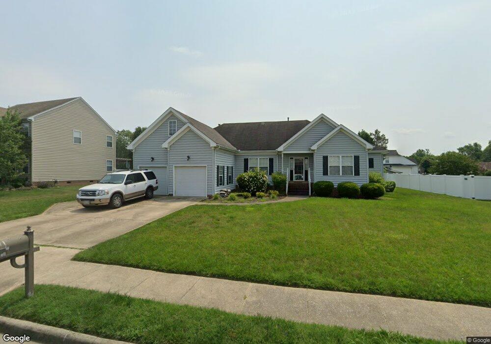
202 King Fisher Dr Suffolk, VA 23435
Sleepy Hole NeighborhoodEstimated Value: $510,063 - $537,000
4
Beds
2
Baths
2,586
Sq Ft
$202/Sq Ft
Est. Value
About This Home
This home is located at 202 King Fisher Dr, Suffolk, VA 23435 and is currently estimated at $521,266, approximately $201 per square foot. 202 King Fisher Dr is a home located in Suffolk City with nearby schools including Driver Elementary School, John Yeates Middle School, and Nansemond River High School.
Ownership History
Date
Name
Owned For
Owner Type
Purchase Details
Closed on
Dec 18, 2015
Sold by
Williams Vincent Antonio
Bought by
Williams Vincent Antonio
Current Estimated Value
Home Financials for this Owner
Home Financials are based on the most recent Mortgage that was taken out on this home.
Original Mortgage
$261,000
Outstanding Balance
$176,353
Interest Rate
3.75%
Mortgage Type
New Conventional
Estimated Equity
$344,913
Create a Home Valuation Report for This Property
The Home Valuation Report is an in-depth analysis detailing your home's value as well as a comparison with similar homes in the area
Home Values in the Area
Average Home Value in this Area
Purchase History
| Date | Buyer | Sale Price | Title Company |
|---|---|---|---|
| Williams Vincent Antonio | -- | None Available |
Source: Public Records
Mortgage History
| Date | Status | Borrower | Loan Amount |
|---|---|---|---|
| Open | Williams Vincent Antonio | $261,000 |
Source: Public Records
Tax History Compared to Growth
Tax History
| Year | Tax Paid | Tax Assessment Tax Assessment Total Assessment is a certain percentage of the fair market value that is determined by local assessors to be the total taxable value of land and additions on the property. | Land | Improvement |
|---|---|---|---|---|
| 2024 | $450 | $466,100 | $83,600 | $382,500 |
| 2023 | $5,380 | $455,200 | $83,600 | $371,600 |
| 2022 | $4,384 | $402,200 | $83,600 | $318,600 |
| 2021 | $4,058 | $365,600 | $76,000 | $289,600 |
| 2020 | $3,869 | $348,600 | $76,000 | $272,600 |
| 2019 | $3,928 | $353,900 | $76,000 | $277,900 |
| 2018 | $3,604 | $318,300 | $63,300 | $255,000 |
| 2017 | $3,406 | $318,300 | $63,300 | $255,000 |
| 2016 | $3,406 | $318,300 | $63,300 | $255,000 |
| 2015 | $1,797 | $318,300 | $63,300 | $255,000 |
| 2014 | $1,797 | $318,300 | $63,300 | $255,000 |
Source: Public Records
Map
Nearby Homes
- 5057 Bennetts Pasture Rd
- 2815 Cuttysark Ln
- 202 Charlemagne Dr
- 138 Brittany Ln
- 5210 Bennetts Pasture Rd
- Ava 2 Story Plan at Greenspring
- Nolan Plan at Greenspring
- Marie Plan at Greenspring
- Ashlynn Plan at Greenspring
- Sara - GENFLEX Plan at Greenspring
- Ronan II 3 Story Plan at Greenspring
- Ashlynn with Frog (IV) Plan at Greenspring
- Lochlan Plan at Greenspring
- Daisy Plan at Greenspring
- Emma Plan at Greenspring
- Daniella Plan at Greenspring
- William Plan at Greenspring
- Leigh Plan at Greenspring
- 4401 Kendal Way
- 3025 Dalton Cir
- 200 King Fisher Dr
- 204 King Fisher Dr
- 117 Whimbrel Dr
- 203 Willet Ct
- 206 King Fisher Dr
- 203 King Fisher Dr
- 205 King Fisher Dr
- 113 Whimbrel Dr
- 123 Willet Ct
- 126 Willet Ct
- 115 Willet Ct
- 102 Willet Ct
- 103 Willet Ct
- 101 Willet Ct
- 107 Willet Ct
- 105 Willet Ct
- 109 Willet Ct
- 113 Willet Ct
- 111 Willet Ct
- 117 Willet Ct