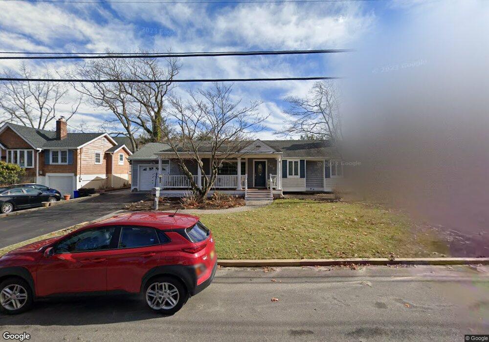
202 Lenape Trail Brielle, NJ 08730
Estimated Value: $910,451 - $1,028,000
3
Beds
2
Baths
1,844
Sq Ft
$519/Sq Ft
Est. Value
About This Home
This home is located at 202 Lenape Trail, Brielle, NJ 08730 and is currently estimated at $956,613, approximately $518 per square foot. 202 Lenape Trail is a home located in Monmouth County with nearby schools including Brielle Elementary School and The Brookside School.
Ownership History
Date
Name
Owned For
Owner Type
Purchase Details
Closed on
Sep 6, 1996
Sold by
Ramirez Juan
Bought by
Yerks Donald and Yerks Ann
Current Estimated Value
Home Financials for this Owner
Home Financials are based on the most recent Mortgage that was taken out on this home.
Original Mortgage
$152,000
Outstanding Balance
$12,695
Interest Rate
7.89%
Estimated Equity
$943,918
Create a Home Valuation Report for This Property
The Home Valuation Report is an in-depth analysis detailing your home's value as well as a comparison with similar homes in the area
Home Values in the Area
Average Home Value in this Area
Purchase History
| Date | Buyer | Sale Price | Title Company |
|---|---|---|---|
| Yerks Donald | $168,500 | -- |
Source: Public Records
Mortgage History
| Date | Status | Borrower | Loan Amount |
|---|---|---|---|
| Open | Yerks Donald | $152,000 |
Source: Public Records
Tax History Compared to Growth
Tax History
| Year | Tax Paid | Tax Assessment Tax Assessment Total Assessment is a certain percentage of the fair market value that is determined by local assessors to be the total taxable value of land and additions on the property. | Land | Improvement |
|---|---|---|---|---|
| 2025 | $9,278 | $828,600 | $489,900 | $338,700 |
| 2024 | $8,755 | $747,600 | $451,900 | $295,700 |
| 2023 | $8,755 | $681,300 | $392,500 | $288,800 |
| 2022 | $8,246 | $617,500 | $342,500 | $275,000 |
| 2021 | $8,246 | $537,900 | $292,500 | $245,400 |
| 2020 | $8,224 | $502,400 | $262,500 | $239,900 |
| 2019 | $7,920 | $491,000 | $252,500 | $238,500 |
| 2018 | $7,842 | $479,900 | $252,500 | $227,400 |
| 2017 | $7,741 | $468,000 | $247,500 | $220,500 |
| 2016 | $7,316 | $443,100 | $232,500 | $210,600 |
| 2015 | $7,377 | $443,600 | $242,500 | $201,100 |
| 2014 | $7,154 | $459,200 | $275,400 | $183,800 |
Source: Public Records
Map
Nearby Homes
- 14 Lebanon Dr
- 139 Lenape Trail
- 308 South St
- 38 Gertrude Place
- 610 Agnes Ave
- 130 Union Ave
- 1215 Church St
- 51-53 Main St
- 1422 Lakewood Rd
- 432 Oval Rd
- 11 Pearce Ave
- 642 Rankin Rd
- 323-325 Fisk Ave
- Kensington Plan at The Monmouth - The Villas 55+
- 816 Rathjen Rd
- 1041 Oval Rd Unit 5
- 65 Pearce Ave
- 18 Mountain Laurel Ln Unit A
- 329 Fisk Ave
- 2253 Wagner Ln
- 204 Lenape Trail
- 200 Lenape Trail
- 11 Lebanon Dr
- 9 Lebanon Dr
- 110 Lenape Trail
- 201 Lenape Trail
- 206 Lenape Trail
- 13 Lebanon Dr
- 7 Lebanon Dr
- 108 Lenape Trail
- 300 Lenape Trail
- 15 Lebanon Dr
- 205 Lenape Trail
- 103 Lenape Trail
- 106 Lenape Trail
- 5 Lebanon Dr
- 803 Oak Rd
- 302 Lenape Trail
- 301 Lenape Trail
- 101 Lenape Trail