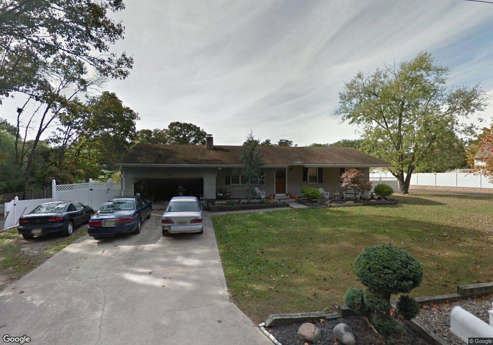
202 Lincoln Ave Mantua, NJ 08051
Mantua Township NeighborhoodEstimated Value: $198,000 - $367,000
--
Bed
--
Bath
1,356
Sq Ft
$226/Sq Ft
Est. Value
About This Home
This home is located at 202 Lincoln Ave, Mantua, NJ 08051 and is currently estimated at $305,815, approximately $225 per square foot. 202 Lincoln Ave is a home located in Gloucester County with nearby schools including Centre City School, J. Mason Tomlin Elementary School, and Clearview Regional Middle School.
Ownership History
Date
Name
Owned For
Owner Type
Purchase Details
Closed on
Apr 20, 2001
Sold by
Shepherd Eugene R and Shepherd Barbara H
Bought by
Shepherd Eugene R and Shepherd Barbara H
Current Estimated Value
Home Financials for this Owner
Home Financials are based on the most recent Mortgage that was taken out on this home.
Original Mortgage
$129,600
Interest Rate
6.9%
Create a Home Valuation Report for This Property
The Home Valuation Report is an in-depth analysis detailing your home's value as well as a comparison with similar homes in the area
Home Values in the Area
Average Home Value in this Area
Purchase History
| Date | Buyer | Sale Price | Title Company |
|---|---|---|---|
| Shepherd Eugene R | -- | -- |
Source: Public Records
Mortgage History
| Date | Status | Borrower | Loan Amount |
|---|---|---|---|
| Closed | Shepherd Eugene R | $129,600 |
Source: Public Records
Tax History Compared to Growth
Tax History
| Year | Tax Paid | Tax Assessment Tax Assessment Total Assessment is a certain percentage of the fair market value that is determined by local assessors to be the total taxable value of land and additions on the property. | Land | Improvement |
|---|---|---|---|---|
| 2025 | $7,589 | $294,700 | $75,500 | $219,200 |
| 2024 | $7,509 | $294,700 | $75,500 | $219,200 |
| 2023 | $7,509 | $294,700 | $75,500 | $219,200 |
| 2022 | $7,265 | $207,700 | $55,500 | $152,200 |
| 2021 | $7,319 | $207,700 | $55,500 | $152,200 |
| 2020 | $7,261 | $207,700 | $55,500 | $152,200 |
| 2019 | $7,139 | $207,700 | $55,500 | $152,200 |
| 2018 | $7,037 | $207,700 | $55,500 | $152,200 |
| 2017 | $6,931 | $207,700 | $55,500 | $152,200 |
| 2016 | $6,852 | $207,700 | $55,500 | $152,200 |
| 2015 | $6,684 | $207,700 | $55,500 | $152,200 |
| 2014 | $6,459 | $207,700 | $55,500 | $152,200 |
Source: Public Records
Map
Nearby Homes
- 119 Monroe Ave
- 325 Bridgeton Pike
- 26 Woodstream Ct
- 485 Harrison Ave
- 204 W Landing Rd
- 8 Barry Dr
- 261 Tony Cir
- 36 Bluebird Rd
- 1415 Tristram Cir Unit 1415
- 1410 Tristram Cir Unit 1410
- 41 Woodbrook Dr Unit C041
- 1230 Tristram Cir Unit 1230
- 12 Brittany St
- 530 Galahad Ct
- 190 Mockingbird Ln
- 1145 Tristram Cir
- 17 Oakton Dr
- 22 Marathon Dr
- 1134 Tristram Cir Unit 4
- 1137 Tristram Cir Unit 1137
- 201 Monroe Ave
- 118 Lincoln Ave
- 204 Lincoln Ave
- 203 Lincoln Ave
- 205 Monroe Ave
- 205 Lincoln Ave
- 117 Lincoln Ave
- 116 Lincoln Ave
- 202 Monroe Ave
- 210 Hampton Ave
- 207 Vermont Ave
- 215 Monroe Ave
- 206 Monroe Ave
- 212 Hampton Ave
- 115 Lincoln Ave
- 121 Taylor Ave
- 198 Vermont Ave
- 112 Lincoln Ave
- 113 Monroe Ave
- 203 Taylor Ave