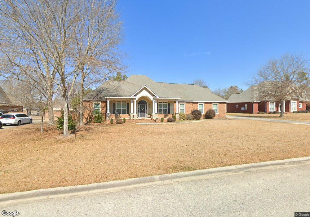
202 Lowpoint Trail Warner Robins, GA 31093
Estimated Value: $464,000 - $523,000
4
Beds
5
Baths
3,022
Sq Ft
$165/Sq Ft
Est. Value
About This Home
This home is located at 202 Lowpoint Trail, Warner Robins, GA 31093 and is currently estimated at $498,825, approximately $165 per square foot. 202 Lowpoint Trail is a home with nearby schools including Northside Elementary School, Thomson Middle School, and Northside High School.
Ownership History
Date
Name
Owned For
Owner Type
Purchase Details
Closed on
Apr 13, 2010
Sold by
C & Rw Homebuilders Inc
Bought by
Wade Victor F and Wade Robin S
Current Estimated Value
Home Financials for this Owner
Home Financials are based on the most recent Mortgage that was taken out on this home.
Original Mortgage
$100,000
Interest Rate
4.97%
Mortgage Type
Seller Take Back
Purchase Details
Closed on
Feb 16, 2007
Sold by
Newton Development Llc
Bought by
C&Rw Homebuilders Inc
Create a Home Valuation Report for This Property
The Home Valuation Report is an in-depth analysis detailing your home's value as well as a comparison with similar homes in the area
Home Values in the Area
Average Home Value in this Area
Purchase History
| Date | Buyer | Sale Price | Title Company |
|---|---|---|---|
| Wade Victor F | $42,000 | None Available | |
| C&Rw Homebuilders Inc | $46,000 | -- |
Source: Public Records
Mortgage History
| Date | Status | Borrower | Loan Amount |
|---|---|---|---|
| Closed | Wade Victor F | $100,000 |
Source: Public Records
Tax History Compared to Growth
Tax History
| Year | Tax Paid | Tax Assessment Tax Assessment Total Assessment is a certain percentage of the fair market value that is determined by local assessors to be the total taxable value of land and additions on the property. | Land | Improvement |
|---|---|---|---|---|
| 2024 | $4,273 | $180,640 | $17,000 | $163,640 |
| 2023 | $3,623 | $151,880 | $17,000 | $134,880 |
| 2022 | $3,224 | $135,400 | $17,000 | $118,400 |
| 2021 | $2,924 | $122,360 | $17,000 | $105,360 |
| 2020 | $2,837 | $118,240 | $17,000 | $101,240 |
| 2019 | $2,837 | $118,240 | $17,000 | $101,240 |
| 2018 | $2,837 | $118,240 | $17,000 | $101,240 |
| 2017 | $2,840 | $118,240 | $17,000 | $101,240 |
| 2016 | $2,844 | $118,240 | $17,000 | $101,240 |
| 2015 | $2,850 | $118,240 | $17,000 | $101,240 |
| 2014 | -- | $118,920 | $17,000 | $101,920 |
| 2013 | -- | $118,920 | $17,000 | $101,920 |
Source: Public Records
Map
Nearby Homes
- 211 River Birch Way
- 207 Longleaf Dr
- 102 Winged Elm Grove
- 205 Longleaf Dr
- 214 River Birch Way
- 204 River Birch Way
- 104 Winged Elm Grove
- 318 Air View Dr Unit 10
- Magnolia Plan at Ridgeview
- 320 Air View Dr Unit 11
- 317 Air View Dr
- 310 Air View Dr Unit 6
- 304 Air View Dr Unit 3
- 304 Air View Dr
- Aspen Plan at Ridgeview
- 317 Air View Dr Unit 15
- Jackson Plan at Ridgeview
- Oakwood Plan at Ridgeview
- 312 Air View Dr
- 310 Air View Dr
- 204 Lowpoint Trail
- 200 Lowpoint Trail Unit 36496638
- 200 Lowpoint Trail Unit 36438395
- 200 Lowpoint Trail Unit 36482599
- 200 Lowpoint Trail Unit 36477360
- 200 Lowpoint Trail Unit 36450886
- 200 Lowpoint Trail Unit 36501557
- 200 Lowpoint Trail
- 0 Lowpoint Trail
- 203 Lowpoint Trail
- 206 Lowpoint Trail
- 205 Lowpoint Trail
- 201 Lowpoint Trail
- 501 Mountain Trail
- 207 Lowpoint Trail
- 208 Lowpoint Trail
- 503 Mountain Trail
- 209 Lowpoint Trail
- 505 Mountain Trail
- 120 Lookout Trail