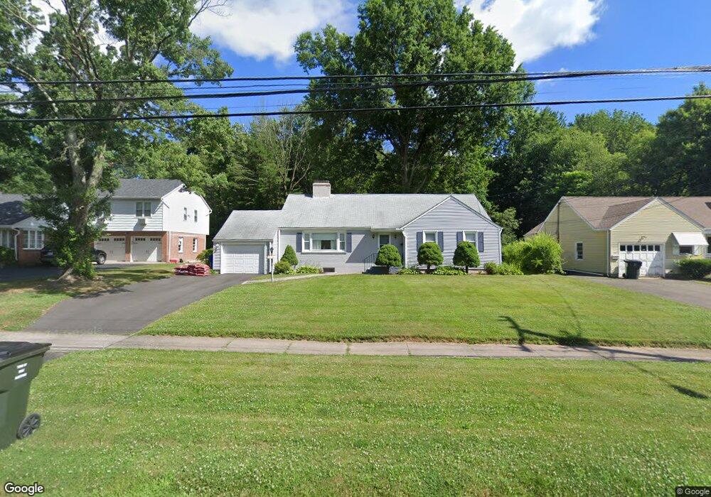
202 Mohawk Dr West Hartford, CT 06117
Estimated Value: $406,000 - $436,000
3
Beds
2
Baths
1,480
Sq Ft
$283/Sq Ft
Est. Value
About This Home
This home is located at 202 Mohawk Dr, West Hartford, CT 06117 and is currently estimated at $419,088, approximately $283 per square foot. 202 Mohawk Dr is a home located in Hartford County with nearby schools including Aiken School, King Philip Middle School, and Delta High School.
Create a Home Valuation Report for This Property
The Home Valuation Report is an in-depth analysis detailing your home's value as well as a comparison with similar homes in the area
Home Values in the Area
Average Home Value in this Area
Tax History Compared to Growth
Tax History
| Year | Tax Paid | Tax Assessment Tax Assessment Total Assessment is a certain percentage of the fair market value that is determined by local assessors to be the total taxable value of land and additions on the property. | Land | Improvement |
|---|---|---|---|---|
| 2025 | $8,075 | $180,320 | $79,520 | $100,800 |
| 2024 | $7,287 | $172,060 | $79,520 | $92,540 |
| 2023 | $7,041 | $172,060 | $79,520 | $92,540 |
| 2022 | $6,999 | $172,060 | $79,520 | $92,540 |
| 2021 | $6,429 | $151,550 | $71,610 | $79,940 |
| 2020 | $5,887 | $140,840 | $63,560 | $77,280 |
| 2019 | $5,887 | $140,840 | $63,560 | $77,280 |
| 2018 | $5,774 | $140,840 | $63,560 | $77,280 |
| 2017 | $5,780 | $140,840 | $63,560 | $77,280 |
| 2016 | $6,427 | $162,680 | $57,400 | $105,280 |
| 2015 | $6,232 | $162,680 | $57,400 | $105,280 |
| 2014 | $6,079 | $162,680 | $57,400 | $105,280 |
Source: Public Records
Map
Nearby Homes
- 139 Mohawk Dr
- 148 King Philip Dr
- 50 Magnolia Hill
- 11 Rye Ridge Pkwy
- 2581 Albany Ave
- 62 Blue Ridge Ln
- 47 Flagg Rd
- 11 Lawler Rd
- 21 Barksdale Rd
- 3 Pilgrim Rd
- 9 Timberwood Rd
- 320 N Steele Rd
- 592 Mountain Rd Unit A
- 10 Ironwood Ln
- 1272 Trout Brook Dr
- 1993 Albany Ave
- 365 Simsbury Rd
- 17 Cranbrook
- 56 Fox Chase Ln
- 5 Adams Ln