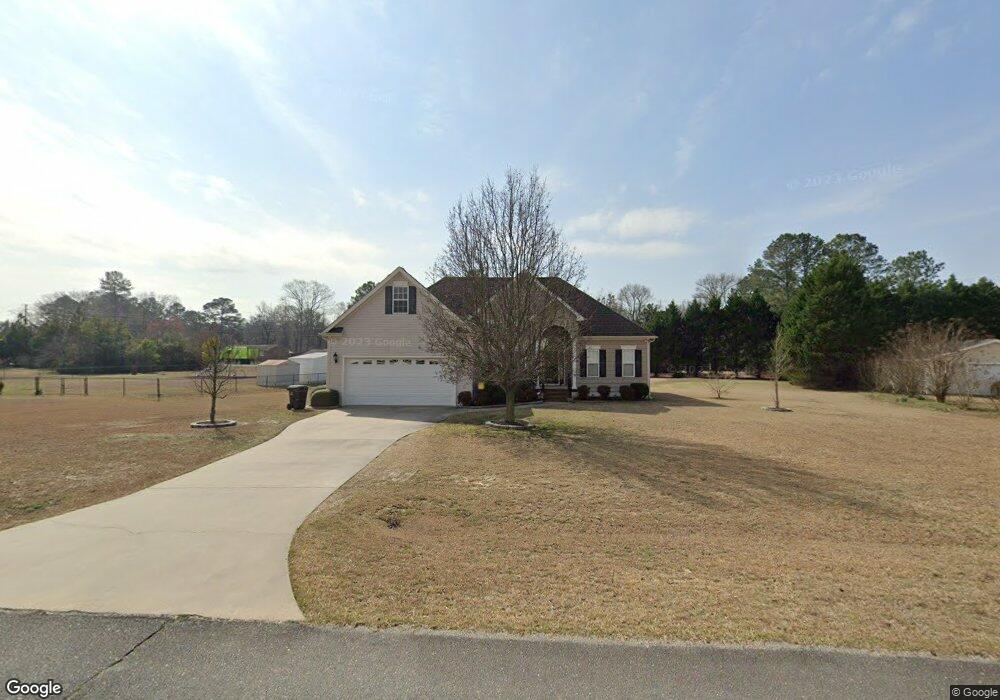
202 Mossburg Dr Goldsboro, NC 27530
Estimated Value: $315,021 - $348,000
3
Beds
3
Baths
2,027
Sq Ft
$161/Sq Ft
Est. Value
About This Home
This home is located at 202 Mossburg Dr, Goldsboro, NC 27530 and is currently estimated at $326,005, approximately $160 per square foot. 202 Mossburg Dr is a home located in Wayne County with nearby schools including Northwest Elementary School, Norwayne Middle School, and Charles B. Aycock High School.
Ownership History
Date
Name
Owned For
Owner Type
Purchase Details
Closed on
Jun 1, 2003
Current Estimated Value
Purchase Details
Closed on
Dec 1, 2002
Create a Home Valuation Report for This Property
The Home Valuation Report is an in-depth analysis detailing your home's value as well as a comparison with similar homes in the area
Home Values in the Area
Average Home Value in this Area
Purchase History
| Date | Buyer | Sale Price | Title Company |
|---|---|---|---|
| -- | $170,000 | -- | |
| -- | $15,000 | -- |
Source: Public Records
Tax History Compared to Growth
Tax History
| Year | Tax Paid | Tax Assessment Tax Assessment Total Assessment is a certain percentage of the fair market value that is determined by local assessors to be the total taxable value of land and additions on the property. | Land | Improvement |
|---|---|---|---|---|
| 2025 | $2,216 | $311,220 | $35,000 | $276,220 |
| 2024 | $1,675 | $197,560 | $22,500 | $175,060 |
| 2023 | $1,625 | $197,560 | $22,500 | $175,060 |
| 2022 | $1,625 | $197,560 | $22,500 | $175,060 |
| 2021 | $1,556 | $197,560 | $22,500 | $175,060 |
| 2020 | $1,469 | $197,560 | $22,500 | $175,060 |
| 2018 | $1,550 | $208,730 | $22,500 | $186,230 |
| 2017 | $1,550 | $208,730 | $22,500 | $186,230 |
| 2016 | $1,550 | $208,730 | $22,500 | $186,230 |
| 2015 | $1,553 | $208,730 | $22,500 | $186,230 |
| 2014 | $1,556 | $208,730 | $22,500 | $186,230 |
Source: Public Records
Map
Nearby Homes
- 104 Angel Place
- 600 Morgan Trace Ln
- 0 Buck Swamp Unit 100521598
- 206 Koufax Dr
- 216 Koufax Dr
- 205 Carlyle Cir
- 302 Morgan Trace Ln
- 461 Perkins
- 408 Perkins Rd
- 455 Perkins Rd
- 479 Perkins Rd
- 176 Perkins Rd
- 106 Pony Cir NW
- Lot 14 Pony Dr
- 000 Pony Dr NW
- 220 Creek Ridge Dr
- 000 Farmingdale Dr
- 203 Lane Tree Dr
- 139 Livingston Dr
- 101 Mcwood Place
- 200 Mossburg Dr
- 204 Mossburg Dr
- 203 Mossburg Dr
- 101 Benelli Cir
- 205 Mossburg Dr
- 120 Mossburg Dr
- 797 Buck Swamp Rd
- 807 Buck Swamp Rd
- 821 Buck Swamp Rd
- 103 Benelli Cir
- 208 Mossburg Dr
- 787 Buck Swamp Rd
- 786 Buck Swamp Rd
- 825 Buck Swamp Rd
- 207 Mossburg Dr
- 118 Mossburg Dr
- 105 Benelli Cir
- 117 Mossburg Dr
- 777 Buck Swamp Rd
- 102 Benelli Cir