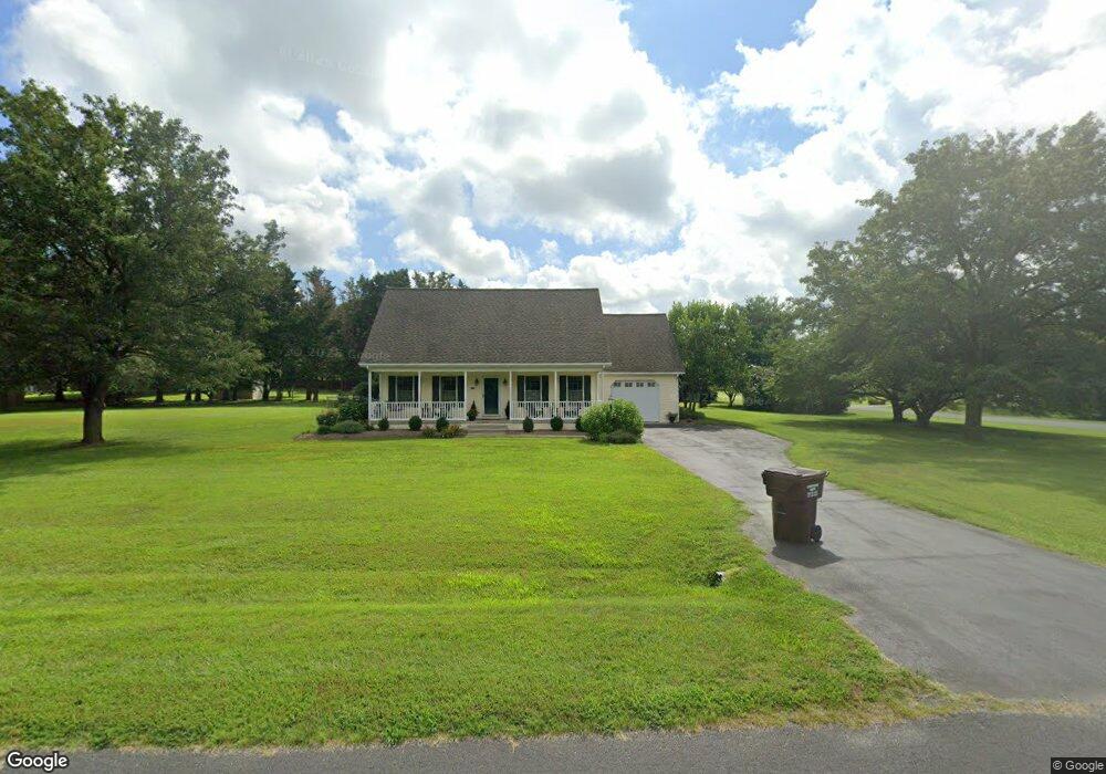
202 Myers Rd Chestertown, MD 21620
Estimated Value: $357,682 - $423,000
--
Bed
2
Baths
1,568
Sq Ft
$257/Sq Ft
Est. Value
About This Home
This home is located at 202 Myers Rd, Chestertown, MD 21620 and is currently estimated at $402,921, approximately $256 per square foot. 202 Myers Rd is a home located in Queen Anne's County with nearby schools including Church Hill Elementary School, Sudlersville Middle School, and Queen Anne's County High School.
Ownership History
Date
Name
Owned For
Owner Type
Purchase Details
Closed on
Jul 10, 2019
Sold by
Robinson Patricia Ann
Bought by
Robinson Patricia Ann and Mills Donna Robinson
Current Estimated Value
Purchase Details
Closed on
Aug 24, 1992
Sold by
Bryden Bruce R and Bryden Helen K
Bought by
Knotts William H and Knotts Joan M
Home Financials for this Owner
Home Financials are based on the most recent Mortgage that was taken out on this home.
Original Mortgage
$100,000
Interest Rate
7.87%
Purchase Details
Closed on
Nov 12, 1987
Sold by
Sheaffer Peter G
Bought by
Bryden Bruce R and Bryden Helen K
Create a Home Valuation Report for This Property
The Home Valuation Report is an in-depth analysis detailing your home's value as well as a comparison with similar homes in the area
Home Values in the Area
Average Home Value in this Area
Purchase History
| Date | Buyer | Sale Price | Title Company |
|---|---|---|---|
| Robinson Patricia Ann | -- | None Available | |
| Knotts William H | $25,000 | -- | |
| Bryden Bruce R | $39,000 | -- |
Source: Public Records
Mortgage History
| Date | Status | Borrower | Loan Amount |
|---|---|---|---|
| Previous Owner | Knotts William H | $100,000 |
Source: Public Records
Tax History Compared to Growth
Tax History
| Year | Tax Paid | Tax Assessment Tax Assessment Total Assessment is a certain percentage of the fair market value that is determined by local assessors to be the total taxable value of land and additions on the property. | Land | Improvement |
|---|---|---|---|---|
| 2025 | $2,440 | $284,100 | $90,600 | $193,500 |
| 2024 | $2,315 | $260,933 | $0 | $0 |
| 2023 | $2,195 | $237,767 | $0 | $0 |
| 2022 | $2,082 | $214,600 | $75,600 | $139,000 |
| 2021 | $2,099 | $212,633 | $0 | $0 |
| 2020 | $2,081 | $210,667 | $0 | $0 |
| 2019 | $2,002 | $208,700 | $75,600 | $133,100 |
| 2018 | $1,991 | $207,600 | $0 | $0 |
| 2017 | $2,030 | $206,500 | $0 | $0 |
| 2016 | -- | $205,400 | $0 | $0 |
| 2015 | $2,206 | $205,400 | $0 | $0 |
| 2014 | $2,206 | $205,400 | $0 | $0 |
Source: Public Records
Map
Nearby Homes
- 216 Blakefield Dr
- 247 Blakefield Dr
- 109 Wilton Rd
- 213 Central Dr
- 222 Dutchess Rd
- 492 Pear Tree Point Rd
- 0 East St
- 121 Primrose Rd
- 26933 Mallard Rd
- 105 High St
- 228 S Water St
- 206 S Water St
- 108 Little Harbor Way
- 101 Birch Run Rd
- 104 Little Harbor Way
- 0 Little Harbor Way Unit 1
- 0 Little Harbor Way Unit 1 MDKE2004992
- 102 Little Harbor Way
- 118 Little Harbor Way Unit 202
- 36 Landing Ln