Estimated Value: $39,000 - $123,000
Studio
--
Bath
--
Sq Ft
43,560
Sq Ft Lot
About This Home
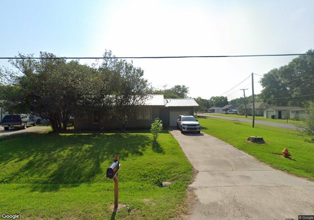
This home is located at 202 N Joseph St, Welsh, LA 70591 and is currently estimated at $70,736. 202 N Joseph St is a home located in Jefferson Davis Parish with nearby schools including Welsh Elementary School, Welsh-Roanoke Junior High School, and Welsh High School.
Ownership History
Date
Name
Owned For
Owner Type
Purchase Details
Closed on
Dec 14, 2022
Sold by
Sonnier Carl James and Sonnier Julie Rose
Bought by
Fontenot Amanda Rae Sonnier
Current Estimated Value
Purchase Details
Closed on
Jun 30, 2008
Sold by
Bihm Rosa and Bhim Belton
Bought by
Sonnier Carl James and Leger Sonnier Julie Rose
Home Financials for this Owner
Home Financials are based on the most recent Mortgage that was taken out on this home.
Original Mortgage
$36,000
Interest Rate
6.05%
Mortgage Type
Purchase Money Mortgage
Create a Home Valuation Report for This Property
The Home Valuation Report is an in-depth analysis detailing your home's value as well as a comparison with similar homes in the area
Home Values in the Area
Average Home Value in this Area
Purchase History
| Date | Buyer | Sale Price | Title Company |
|---|---|---|---|
| Fontenot Amanda Rae Sonnier | $47,000 | -- | |
| Sonnier Carl James | $40,000 | None Available |
Source: Public Records
Mortgage History
| Date | Status | Borrower | Loan Amount |
|---|---|---|---|
| Previous Owner | Sonnier Carl James | $36,000 |
Source: Public Records
Tax History
| Year | Tax Paid | Tax Assessment Tax Assessment Total Assessment is a certain percentage of the fair market value that is determined by local assessors to be the total taxable value of land and additions on the property. | Land | Improvement |
|---|---|---|---|---|
| 2025 | $453 | $5,300 | $700 | $4,600 |
| 2024 | $452 | $5,300 | $700 | $4,600 |
| 2023 | $351 | $4,700 | $700 | $4,000 |
| 2022 | $351 | $4,700 | $700 | $4,000 |
| 2021 | $351 | $4,700 | $700 | $4,000 |
| 2020 | $351 | $4,700 | $700 | $4,000 |
| 2019 | $343 | $4,500 | $700 | $3,800 |
| 2018 | $393 | $4,500 | $700 | $3,800 |
| 2017 | $393 | $4,500 | $700 | $3,800 |
| 2015 | $357 | $4,100 | $700 | $3,400 |
| 2014 | $357 | $4,100 | $700 | $3,400 |
| 2013 | $365 | $4,100 | $700 | $3,400 |
Source: Public Records
Map
Nearby Homes
- 311 Bourgeois St
- 560 Bowers St
- 507 Beaufort St
- 17188 Highway 90 Unit Suite B
- 17180 Highway 90
- 0 Highway 90
- 207 Powers St
- 501 S Polk St
- 0 Grove St Unit SWL25002212
- 0 Grove St Unit SWL25002213
- 0 Grove St Unit SWL25002211
- 0 Grove St Unit SWL25002210
- 0 S Simmons St Unit SWL25002203
- 0 S Simmons St Unit SWL25002209
- 0 S Simmons St Unit SWL25002206
- 0 S Simmons St Unit SWL25002205
- 0 S Simmons St Unit SWL25002208
- 0 S Simmons St Unit SWL25002217
- 0 S Simmons St Unit SWL25002207
- 406 W Hudspeth St
Your Personal Tour Guide
Ask me questions while you tour the home.