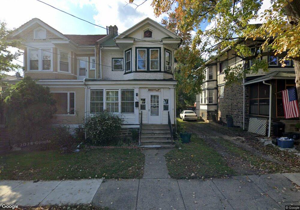
202 N Maple Ave Lansdowne, PA 19050
Estimated Value: $208,000 - $282,000
3
Beds
1
Bath
1,491
Sq Ft
$162/Sq Ft
Est. Value
About This Home
This home is located at 202 N Maple Ave, Lansdowne, PA 19050 and is currently estimated at $241,042, approximately $161 per square foot. 202 N Maple Ave is a home located in Delaware County with nearby schools including East Lansdowne Elementary School, Penn Wood Middle School, and Penn Wood High School - Cypress Street Campus.
Ownership History
Date
Name
Owned For
Owner Type
Purchase Details
Closed on
Oct 27, 2014
Sold by
Brennan James R and Brennan Margaret A
Bought by
Brennan James R and Brennan Margaret A
Current Estimated Value
Home Financials for this Owner
Home Financials are based on the most recent Mortgage that was taken out on this home.
Original Mortgage
$118,000
Interest Rate
4.21%
Mortgage Type
New Conventional
Create a Home Valuation Report for This Property
The Home Valuation Report is an in-depth analysis detailing your home's value as well as a comparison with similar homes in the area
Home Values in the Area
Average Home Value in this Area
Purchase History
| Date | Buyer | Sale Price | Title Company |
|---|---|---|---|
| Brennan James R | -- | None Available |
Source: Public Records
Mortgage History
| Date | Status | Borrower | Loan Amount |
|---|---|---|---|
| Closed | Brennan James R | $118,000 |
Source: Public Records
Tax History
| Year | Tax Paid | Tax Assessment Tax Assessment Total Assessment is a certain percentage of the fair market value that is determined by local assessors to be the total taxable value of land and additions on the property. | Land | Improvement |
|---|---|---|---|---|
| 2025 | $4,469 | $108,540 | $28,910 | $79,630 |
| 2024 | $4,469 | $108,540 | $28,910 | $79,630 |
| 2023 | $4,261 | $108,540 | $28,910 | $79,630 |
| 2022 | $4,177 | $108,540 | $28,910 | $79,630 |
| 2021 | $6,272 | $108,540 | $28,910 | $79,630 |
| 2020 | $3,622 | $55,230 | $17,590 | $37,640 |
| 2019 | $3,561 | $55,230 | $17,590 | $37,640 |
| 2018 | $3,500 | $55,230 | $0 | $0 |
| 2017 | $3,423 | $55,230 | $0 | $0 |
| 2016 | $303 | $55,230 | $0 | $0 |
| 2015 | $303 | $55,230 | $0 | $0 |
| 2014 | $303 | $55,230 | $0 | $0 |
Source: Public Records
Map
Nearby Homes
- 212 N Maple Ave
- 178 N Union Ave
- 210 Wabash Ave
- 217 E Greenwood Ave
- 0 Hirst Ave
- 113 A A000 N Union Ave
- 230 Wynnewood Ave
- 291 N Wycombe Ave
- 243 Coverly Rd
- 247 Coverly Rd
- 81 Hartley Rd
- 86 Houston Rd
- 291 Jackson Ave
- 56 E Stewart Ave
- 147 Lexington Ave
- 91 Lamport Rd
- 7218 Radbourne Rd
- 7303 Sherbrook Blvd
- 109 Lexington Ave
- 7265 Calvin Rd
- 200 N Maple Ave
- 204 N Maple Ave
- 206 N Maple Ave
- 107 Powelton Ave
- 208 N Maple Ave
- 105 Powelton Ave
- 210 N Maple Ave
- 103 Powelton Ave
- 108 Powelton Ave
- 110 Powelton Ave
- 112 Powelton Ave
- 207 Hansell Rd
- 106 Powelton Ave
- 203 N Maple Ave
- 201 N Maple Ave
- 101 Powelton Ave
- 104 Powelton Ave
- 114 Powelton Ave
- 205 N Maple Ave
- 209 Hansell Rd
Your Personal Tour Guide
Ask me questions while you tour the home.