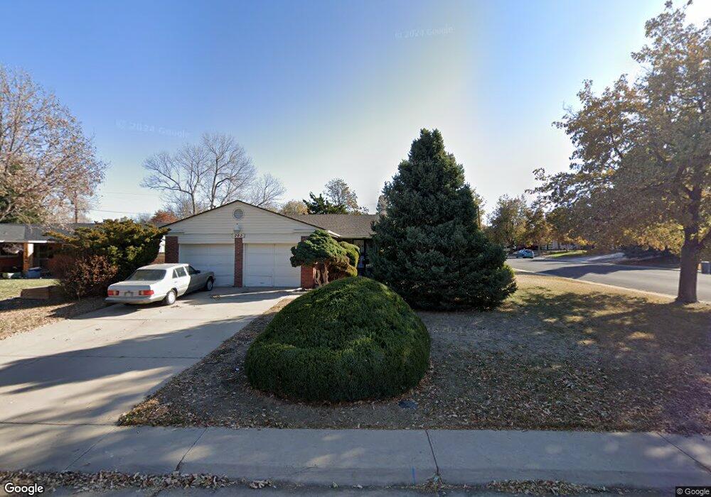
202 Newark St Aurora, CO 80010
Highland Park NeighborhoodEstimated Value: $447,000 - $554,000
3
Beds
4
Baths
1,875
Sq Ft
$269/Sq Ft
Est. Value
About This Home
This home is located at 202 Newark St, Aurora, CO 80010 and is currently estimated at $503,520, approximately $268 per square foot. 202 Newark St is a home located in Arapahoe County with nearby schools including Lansing Elementary Community School, Del Mar Academy, and Aurora Hills Middle School.
Ownership History
Date
Name
Owned For
Owner Type
Purchase Details
Closed on
Jul 21, 1993
Sold by
Nichols Frances J
Bought by
Tapps Mary
Current Estimated Value
Purchase Details
Closed on
Mar 9, 1989
Sold by
Conversion Arapco
Bought by
Nichols Frances J
Purchase Details
Closed on
Jun 1, 1982
Sold by
Conversion Arapco
Bought by
Conversion Arapco
Purchase Details
Closed on
Dec 1, 1978
Sold by
Conversion Arapco
Bought by
Conversion Arapco
Purchase Details
Closed on
Jul 4, 1776
Bought by
Conversion Arapco
Create a Home Valuation Report for This Property
The Home Valuation Report is an in-depth analysis detailing your home's value as well as a comparison with similar homes in the area
Home Values in the Area
Average Home Value in this Area
Purchase History
| Date | Buyer | Sale Price | Title Company |
|---|---|---|---|
| Tapps Mary | -- | -- | |
| Nichols Frances J | -- | -- | |
| Conversion Arapco | -- | -- | |
| Conversion Arapco | -- | -- | |
| Conversion Arapco | -- | -- |
Source: Public Records
Tax History Compared to Growth
Tax History
| Year | Tax Paid | Tax Assessment Tax Assessment Total Assessment is a certain percentage of the fair market value that is determined by local assessors to be the total taxable value of land and additions on the property. | Land | Improvement |
|---|---|---|---|---|
| 2024 | $2,662 | $35,336 | -- | -- |
| 2023 | $2,662 | $35,336 | $0 | $0 |
| 2022 | $2,326 | $30,115 | $0 | $0 |
| 2021 | $2,401 | $30,115 | $0 | $0 |
| 2020 | $2,487 | $31,032 | $0 | $0 |
| 2019 | $2,473 | $31,032 | $0 | $0 |
| 2018 | $1,814 | $24,358 | $0 | $0 |
| 2017 | $1,515 | $23,666 | $0 | $0 |
| 2016 | $1,994 | $21,229 | $0 | $0 |
| 2015 | $1,925 | $21,229 | $0 | $0 |
| 2014 | $1,485 | $15,769 | $0 | $0 |
| 2013 | -- | $17,220 | $0 | $0 |
Source: Public Records
Map
Nearby Homes
- 223 Nome St
- 11413 E Ellsworth Place
- 62 Newark St Unit C
- 363 Lima St
- 11718 E Canal Dr
- 64 Nome Way Unit A
- 11036 & 11038 E 4th Way
- 56 S Nome St
- 11576 E Bayaud Dr
- 11918 E 1st Place
- 100 S Moline St
- 539 Newark St
- 105 S Nome St
- 87 S Nome St
- 11906 E Canal Dr
- 128 S Moline St
- 126 S Nome St
- 11620 E Bayaud Dr
- 531 Nome St
- 12054 E 3rd Ave
- 212 Newark St
- 11685 E 2nd Ave
- 213 Nome St
- 222 Newark St
- 116 E 2nd Ave
- 11612 E 2nd Ave
- 11595 E 2nd Ave
- 11672 E 2nd Ave
- 211 Newark St
- 11590 E 2nd Ave
- 221 Newark St
- 11692 E 2nd Ave
- 11692 E 2nd Ave Unit 11692 E 2nd Ave
- 232 Newark St
- 11580 E 2nd Ave
- 231 Newark St
- 11714 E 2nd Ave
- 11545 E 2nd Ave
- 11531 E 1st Ave
- 204 Nome St